Saturday, August 15, 2009

Lochranza - Arran - Scotland - etc....


Scenes around Loch Ranza

[Kyle]First, let’s define some terms. Loch Ranza is the loch called Ranza, Lochranza is the little village next to Loch Ranza. The Scots do this a lot with place names so expect more. Apparently Ranza means ‘red’ in the Viking language and referred not to the loch but the colour of the pretty little rowan trees with bunches of red berries that populate the area. Loch Ranza is also the place where Queen Elizabeth II spent the first night of her honeymoon aboard the Royal Yacht Brittania.

By late morning the day after we arrived in Loch Ranza in the much less posh Footprint, the weather had cleared and the Day Star was out and shining. Maryanne and I rowed ashore to have a look around. During our walk, we found a sign that read Distillery: 1 and a 1/4 miles. Off we went.

The Arran Distillery is not old or historic in any way. Even though the island has a long history of (mostly illegal) whisky making, the Arran distillery has only been around since 1994. I have t-shirts older than that. Nevertheless, the distillery was very nice and the tour was well done and informative. The whisky was gorgeous. Maryanne and I had been worried that it would resemble the Islay variety we had on Sanda since it is from the same general region but Arran did a much better job, I think. Whisky over here is very expensive as it is mostly (nearly 80%) tax. We bought a sampler mini pack of our favorites and a bottle of their really nice cream liqueur. Perhaps if we find ourselves in a French supermarché someday (reputedly the cheapest place to buy whisky), we can load up on proper amounts.

[Maryanne]Notably, the Arran distillery does not dry the malted barley over peat smoked fires, nor does it add any peat aromas during its processing - this means that Arran whisky does not have the distinctive peaty taste typical of the Islands. Their explanation? Arran is Scotland in miniature and it can pick the taste of the region it's master distillers like best. It was good.

[Kyle]After the distillery, we headed up into the mountains on the three mile trail up Gleann Easan Biorach (pronounced: Thpthpthchackackack) toward Loch na Davie and were rewarded with stunning views of the glen. As we went further and further up the glen, the path became noticeably mushier. All the recent rain had turned much of the path into a little brook. Maryanne had on her distillery tour wellies (see Whiskey and Wildlife, July 2009). I was wearing sandals. Once we both realized that trying to keep our feet dry was pointless, we had a nice time splashing our way up the path. A couple of times, each of us mis-stepped and, squelch!, one or both feet would sink to the knee in sticky mud. With the one of us (Maryanne) pulling it usually took all of our strength to pull the other one (me) out without losing the shoe. Maryanne had one particularly upsetting moment when she sunk deep enough for the goo to flow over the top and into her boot. Eeew! Still, the scenery was very Scottish and breathtaking. That walk really made me feel like we’re in Scotland.


The trails for this hike seem to be wet, soggy streams; thank goodness it was not raining!

On the way back, we bought a few provisions and had a look at the ruin of Lochranza Castle, which has a commanding view of the Loch. On the way out of there, Maryanne spotted the most adorable little baby seal. He was only about two feet long and kept making cute little sleepy faces. Aawww!


This seal just can't stay awake

Moving On to Arran

[Kyle]The night after the loafing in Sanda was great. The water was flat calm and the boats just floated over their anchors without pulling. I woke up in the middle of the night to see the moon streaming through the window surrounded by a halo of thin cirrus – the weather was on its way. By the morning, the clouds had thickened into a solid gray mass. Occasional gusts would whip around the island and send us skittering to the end of our rode, where we stopped with a lurch as the line stretched. The gust would leave and the water would flatten and we would float around aimlessly for a while before the next one. By the time it was time for us to leave, the wind was howling constantly and it was raining hard. One by one, we watched one wet, miserable crew after another pull up anchor, and then it was our turn.

While we were still in the lee of Sanda, we put up only the mainsail with two reefs in and then turned north. Once out of the lee of the island, even with practically no sail up, we flew North up Kilbrannan Sound. The wind and waves increased by the minute and soon we were surfing down big waves while being pushed by winds of almost 40 knots. The pelting rain brought the visibility to near zero. The wind was from almost directly behind us, which is about the only point of sail in which we have no protection from our cockpit enclosure. We keep the back panels rolled up while sailing so that we have access to the sail control lines and the deck. It wasn’t long before I was completely soaked at the helm. The rain dripping down my neck and running up my sleeves eventually made my raingear about as effective as a pair of jeans and a sweatshirt. At least it wasn’t too cold. I kept thinking about the solo sailor who pulled his anchor right before us and disappeared into the rain. His boat gave him no protection whatsoever from the weather. He had no choice but to sit outside in the full force of the wind and rain. As it was, it didn’t take me too long to think we were all a bit crazy to be out here. The Coast Guard kept issuing gale warnings and dire forecasts. Maryanne, who I forced to stay inside as there was no point in us both being wet, reminded me that it was probably a choice between having good weather on a sailing day or a ‘shore’ day. Footprint is a wind powered boat, after all, and these conditions, while miserable, were not the worst we’ve seen.

As we approached our planned anchorage at Carradale, I could see that it was completely untenable. The winds were double what were forecast and they had also failed to swing so that we would have offshore winds and thus flat seas. The anchorage was a maelstrom of six foot whitecaps. There was no way we were anchoring there, so we just kept going. We had good enough speed at we would be able to make our next destination on the flood.

Looking up into the sound the day before from the top of Sheep Island had made me very excited about sailing between the green mountains on either side of the sound. I was so disappointed that today, the rain and fog completely obscured all of it from view. Nothing could be seen past the raindrops dripping off the brim of my hat except the boat and, beyond it, a featureless gray. Actually, come to think of it, I did see one fishing boat appear and disappear at the limit of visibility.

We sailed around to the protected northern side of Arran and the seas finally calmed. At Loch Ranza, the Lochranza and Catacol Sea Society have installed 12 free visitor moorings in deep water, saving us (Maryanne) from having to go through the kerfuffle of dealing with the whole anchor setup in the pouring rain. The moorings were lacking in pendants, though, so instead of just grabbing a line and cleating it aboard, Maryanne had to hang over the side and thread ours through the eye on top of the ball. The Gemini, like most other sailboats, has a tendency to bear off downwind when stopped. This made it very hard to maintain position at the ball, but Maryanne managed to capture it with both bow lines on the first try. It’s amazing what the motivation to not stay in the rain any longer than necessary can do.

We set up the rain catcher, peeled off our dripping clothes to dry in the cockpit and then hunkered down for the night. The good news is that between the wind and rain, we had full batteries and 30 more liters of water by morning.

No pictures for this blog - heavy rain and low cloud made it totally pointless to even pull out the camera!

Extra Day in Sanda

[Kyle]We had intended to leave Sanda the next morning but one look at the weather forecast changed my mind. Sanda was pretty well protected. Our next intended anchorage at Carradale was not and would have been completely exposed so we decided to spend another day at the anchorage at Sanda.

Maryanne had a good book she was working on. I decided to take advantage of our extra time here by exploring the minor isles of the Sanda group. I set up the dinghy for sailing and set off to the various rocks to the East. Mostly, I just wanted to see what was there since that part of the island was not visible from our hike the day before. It turned out to be a lot of birds and rock. I turned and tacked back towards the main anchorage against a slight current in the strait between Sanda and the next biggest island, uninhabited Sheep Island. Well, not exactly uninhabited. There were lots of Kittiwakes and the shore was strewn with Cormorants and seals. I had about five seals watching me from the water everywhere I went. As I got close to the Sheep Island shore, the ones on land would get all vocal and fidgety. The ones in the water would start splashing around and breaching. Time to tack. I would go until the water was too shallow on the Sanda side and tack back. The poor seals. Because of the current, I was only getting about 100 feet further along the shore with every tack. Just as they thought they were safe, I would turn and come back.

I found a seal free spot on the rocky beach and landed on the island. The island is shaped roughly like a bowler hat, with a flattened dome of a center leading down a very steep slope to a shallow beach. After a bit of scary searching, I managed to find a route up to the top. Once I got up there, I found a pretty impenetrable mass of waist-high plants. As I searched back and forth for a way in, I must have come too close to some kittiwake nests because they started dive-bombing me. A couple of passes came close enough that I could hear the buzzing of the turbulence over their feathers. I never saw a nest and, fortunately, never stepped on an egg. I finally found what looked like goat path leading to the center and followed it in. In the middle of the island was a grassy meadow that was just littered with bird feathers. I walked further North toward a little dip in the grass when I saw a couple of goat heads pop up and look at me. I took another step and they all bolted into the ferns. I couldn’t see goats at all, just fern tops thrashing wildly. I went to the edge of the island and poked my head over the edge. As soon as I did, most of the Cormorants took off toward the sea. The seals regarded me very nervously and then decided not to take chances and headed into the water en masse. I have no idea why a bunch of 300lb seals would be afraid of a human 100 feet away up on a cliff but they were. Maryanne thinks it was probably more in response to the general agitation of the birds than anything else.


Kyle takes a tour of the uninhabited Sheep Island

By the time I scrambled back to the dinghy, almost all of several dozen seals had taken to the water. Once the ungainly creatures were in the water and were fast and graceful again, their fear turned into curiosity…or something else. They were all poking their heads out of the water in what I swear looked like disapproval. I felt like a guy who rooted for the wrong team in a bar and was being surrounded. The wind was completely gone so I stowed the sailing rig and rowed back to Footprint. About five of them followed me, apparently just to make sure I left, until I was among the other boats of the anchorage. Even though it was calm and beautiful, Maryanne and I spent the rest of the day preparing for the night’s predicted blow. We also did a bit of loafing as well.

Sanda Island


Hiking around Sanda


[Kyle]When we got up in the morning, all of the other boats were in the process of pulling up anchor. By the time the coffee was ready, we were the only boat left. We decided to go ashore and properly explore the little 1 mile long island.

First, a little about the island; Sanda , just two miles off Kintyre, has been occupied by Vikings, fisherman, farmers and shepherds. Robert the Bruce used the island as a lookout post. More recently, the island was uninhabited except for a lighthouse keeper and owned by a series of people, most notably the bassist from Cream. Dennis, the current owner, bought the island in order to escape the rat race. He has since restored most of the buildings, some of which he rents out as holiday cottages. He also built an award winning pub by bringing supplies over from the mainland with over 100 trips on his own boat. He now runs the island with his daughter and one Summer employee, dividing his time between herding sheep and, as people of a certain hair color are wont to do, complaining about the government full-time. I’m not sure what the deal is with the sheep. He says the price he can get for the wool by the time he’s taken it to the mainland isn’t worth shearing them. He’s constantly trying to herd them from one area of the island to another. Perhaps it’s to keep from overgrazing certain areas. I think mostly, it gives him something to do and thus complain about.

Not being in a city mood, our first hike was over to the other side of the island to the lighthouse. We had not seen it (or anything else) from the sea so had no idea what to expect. As we came over the hill, we were stunned. It lies atop a giant rock on one side of a natural archway and comes with its own helipad for access.

Sanda Lighthouse

From there we climbed in intermittent rain showers to the island’s highest point; Trig Point. Our chart says the elevation up there is only 122 meters (403 feet). I don’t believe it! That climb was long and steep. We were rewarded with stunning views of the great glacial valley that bisects the island as well as both Kintyre and the Northern Irish coast we had become so familiar with.

Back down at the shore, we had a stroll along the beach as far as we could go. At one point, we encountered a small cave with two adorable little birdies in a nest. We also found a couple of sheep carcasses that had obviously come a little too close to the cliffs.

It was kind of cool having the whole island to ourselves. Dennis came up to us as we walked back to the dinghy muttering under his breath about his sheep. As his entire economy is based on tourism (mostly yachts, although he does have a boat he can collect people with if they book a cottage), we decided we should have dinner at the pub. We asked him when he opened. His answer was, “Whenever you get there.” Sure enough, the employee outran us and had the pub open as we got there.

We spent the afternoon in the pub doing pub stuff. We started with some nice hot tea and passed the time playing darts and dominoes while the other three people on the island read and worked on the computer. After a while, some people from a boat that had been across the dock from us on Rathlin came in and we had a nice conversation. I must admit to some prejudice here. On the boat were a middle aged couple and their grown son. I had assumed the boat was theirs but it turned out to belong to the son. He had just really liked boats so he bought one and was busy learning to sail it. He was really keen and we had a good time trading stories, some of which I didn’t get because he had a wee thick Scottish accent. Once it got late enough, we had nice veggie lasagnas and topped it off by sharing a whisky sampler.

Between lessons from Maryanne when we first met, who was in the Whiskey Society at the University of St. Andrews and all of the distillery tours, I feel like I’m pretty up on whisky, but it’s always good to get an idea of what the local whiskies are like. We had four varieties from the four key Scottish regions: Highland, Lowland, Campbeltown and Islay. The sampler confirmed what they say about whiskey; that if you don’t like it, you haven’t found the right one. The Campbeltown and Lowland whiskies were nice, but we both really liked the Highland. It was yum, yum, yummy. The Islay, on the other hand, tasted like charcoal lighter fluid that had been strained through an old sock. Had that been the first whisky I had ever tasted, I surely would have had to been held down for more. Luckily, it wasn’t. Just for good measure and to keep the economy going, we also added in a t-shirt for Maryanne. Now we’re broke and Dennis is rich, but we’d hate for this little gem to not be here.


Sanda Free Range Chickens

[Maryanne]We were advised before we arrived to make sure we picked up some Sanda eggs. Free range chickens feeding on seaweed apparently make for an especially yummy egg and we weren't going to miss a chance to check them out. Apparently we are not the only ones: Princess Anne has even stopped off for eggs while cruising the Scottish Islands.

Scottish whisky has distinct flavours that can (broadly) be divided by the region it came from, traditionally the Island (Islay) whiskeys are very peat flavoured since the malted barley is dried over peat fires and picks up the smoke aromas. I prefer a more butterscotch flavour - but each whisky is different and you just have to try them all to be sure :-).

Next Country: Scotland

[Kyle]The morning we left Rathlin Island, Northern Ireland for Scotland, the weather had turned back from warm and summery to thick, low clouds. Once we got out of the harbor, it started to drizzle and then rain. The visibility got worse and the wind died down to almost nothing. We put up the mainsail and the screacher to give them a good rinse. The current pushed us around the south side of Rathlin and then filled in from the north. As we were headed east, we turned a little to the north away from the South wind to maintain our course. As we got further into deep water, the current rose from 3 to 4, then 4.5 knots. The wind started to die off. Soon, we were headed 70 degrees to our intended course. Soon after that, we were enshrouded in rain and fog and being hopelessly swept toward Wales. The current would reverse in several hours but then we would be fighting both it and the wind to keep from being swept completely north of the Clyde. On came the engine. Oh, well. We needed the full set of electrics on for the fog anyway; radar, foghorn and lights. Fortunately, there was no traffic to worry about while crossing the shipping lanes. The radar only showed the areas of heavy rain that kept overtaking us.

When we finally arrived on the Scottish side, we could hardly see it. All that was visible through the fog and rain was mountainside with all of the contrast bled out. We found our anchorage on the north side of Sanda Island and found a spot tucked sufficiently behind the point to protect us from the next day’s forecast winds. Within ten minutes of our arrival, 3 more boats showed up out if the fog and anchored. We had all apparently planned to arrive right at high tide. Going ashore in the rain had little appeal so we took a much needed nap. (We had been up yucking it up with another boat a little late the night before). We were awakened by the sun streaming through the window. There were patches of blue sky!

We had planned to just stay in for the night and go ashore the next day but then we watched all of the other boats go ashore. Feeling conspicuous in our absence, we decided we should go as well. We went to the pub for a drink and to introduce ourselves. Having a boat flying an American flag around here is a great ice breaker. Usually, the first question we get asked is, ‘Did you actually sail that little boat here?’ When we answer ‘yes’, we suddenly become minor celebrities. We spent most of the evening chatting to three friends on another boat: two retired high-speed ferry captains and a schoolteacher from Northern Ireland. Before we knew it, it was dark and time for us to all head back to our respective boats and leave the Island to its three residents so they could get some sleep.

Sanda Island, Population 3! taken from nearby Sheep Island

Monday, August 10, 2009

Rathlin Island

[Maryanne]We've had 3 whole days at Rathlin Island, and we've spent those fully exploring - each day setting out in a different direction. Each evening our legs have been stiff so we know the exercise has been good for us; we found free wifi, the marina/dock is inexpensive and they have HOT SHOWERS; and it's only rained once we are home for the evening... Life is feeling good.


One of the many tall ships we spotted on our way to Rathlin Island, presumably part of the Tall Ships race, and Footprint again at a dock - what luxury

[Kyle]From Portballintrae, we left for Rathlin Island, just a couple of miles off the northeast corner of Northern Ireland. Not being in any particular hurry and since it was yet another nice day (finally?), we reefed each sail and headed for the island in light winds. I typically plan passages to have following current and have become spoiled at seeing 8 or 9 knots over the bottom with 3 or 4 through the water. (Typical sailing speeds are 6 or 7ish.) . We had a lovely couple of hours crossing the sound with nice views on both sides and the added bonus of seeing several Tall Ships along the way. We know the leg of the race from Halifax to Belfast was supposed to be wrapping up around then. We weren’t sure if they were coming or going or just sailing around but they certainly added charm to an already lovely day.

We got to the little anchorage in Church Bay on Rathlin and after a couple attempts at anchoring in the small stones of the anchorage, we resigned ourselves to tying up on the public float like everyone else did, which should have been our first clue about the anchorage. It turns out the dock is only £12.50 per day and comes with showers, so that’s not too bad.

As it was a Saturday, The little harbour was filled with weekenders from both Northern Ireland and Scotland who were all frolicking around in the water as if it were warm. Almost all had thick wetsuits on. We took a gorgeous hike first along a deserted road and then well marked trail to the southern tip of the island. The trail alternated between sheep pastures and stunning cliff views with Antrim in the background. We ended up at a lighthouse and a bay populated by a pretty large colony of seals, which were adorable, of course.


Adorable Gray Seals, just hanging out and relaxing


Scenes From the South arm of the Island

We got back to the boat and in the middle of dinner, I saw a Customs boat go by. Our big, red sore thumb of a courtesy flag had them hovering for a bit. Knowing what was coming, I went out and welcomed them aboard. The three of them were very nice. For the first time since arriving on this side of the Atlantic, we received a proper clearing in and inspection. They spent maybe an hour on board, actually copied information from our passports and boat papers and asked the specifics of our cruise, noting dates and ports of call. One of the guys even went around swabbing for drug and explosive residue. In spite of the depth of the examination, they were very courteous and we felt no sense of invasiveness. I think we were mostly glad to actually see Customs face to face and know that we’ve now been through the official process. The only discomfort we had was because it was smack in the middle of dinner so the galley was a huge mess and there were dirty dishes all over the table. They didn’t seem to care but we felt conspicuous in our apparent pigginess.

Western Rathlin Island

Scenes from the West End of the Island

Our next morning, we headed out to the end of the other arm of boomerang shaped Rathlin, the western end. The road passed over the high middle of the island through rolling hills covered by purple heather speckled with little yellow flowers. In the distance, Rathlin Sound and the Antrim coast were visible. At the far end of the island, about four steep up and down miles from Church Bay, is the West Light and the RSPB (Royal Society for the Protection of Birds) sanctuary.

West Light from the sea


West Light its Cliffs full of Seabirds


West Light is unusual in that it is reputed to be the only ‘upside down’ lighthouse in the world, that is, with the lens at the base of the tower. It is also supposed to be one of the very few all-red lighthouses. Supplies for the light were pulled by horse and cart up a long ramp to the top of the cliffs and then across to the lighthouse site. The concrete was mixed on site and poured and set by hand directly into the cliff face. The light was built with the lens on the bottom because low clouds (high fog) often obscured the top of the tower, which was still necessary as it housed the long pendulum mechanism that drove the light. Many lighthouses have red sectors to warn of hazard areas. Apparently, it was decided to make West Light all-red both because of the seriousness of the adjacent hazard and to distinguish it from other nearby lights.

At the lighthouse site was also the viewing point for the RSPB sanctuary, which was home to colonies of Kittiwakes, Guillemots, Fulmars and the adorable Puffins. The site was really well done. RSPB had volunteers on hand to point things out and answer questions. They also had binoculars (nice ones!) to lend and scopes set up for people to use. We did manage to see Puffins out at sea acclimatizing their young to the environment, but they were pretty far off. We could see them well through our binoculars but they were a bit too far out for the camera.

We had our picnic lunch and then walked home under a sky that seemed constantly like it was two minutes from raining, which, fortunately it didn’t do until two minutes after we got home.

Monday

Having done the two long trails on Rathlin, we decided to have an easy day and do the final ‘easy’ trail across the narrow part of the island to the east side; the elbow of the island (the harbour is tucked in the inner elbow). ‘Easy’ was a bit of a misnomer because, to get to the other side, the path goes steeply up then steeply down. Maryanne also discovered yet another trail that we just had to do as well if we wanted the whole set.

The main focus of our first particular path was the East Light, The one that lit up our cabin in Murlough Bay. It sits high atop a cliff with a sweeping view of the Mull of Kintyre in Scotland and the entire east coast of Rathlin. Also in the immediate area of the lighthouse was the cave where Robert the Bruce lived for a year while exiled from Scotland in the 14th century. I found a very steep path leading down to the beach but was unable to locate anything more than a couple of indentations in the rock, nothing that would offer enough protection to live. The area did have a nice view toward Scotland. I could imagine that looking out and seeing it every day must have helped strengthen his resolve to return. The legend has it that he watched a spider build six failed webs before succeeding on the seventh and so he decided there and then that he would be at least as determined as that spider to succeed.

I had a horrible steep climb back up to the lighthouse where Maryanne and I then had a picnic lunch. We sat on the grass and leaned against the wall and looked out at the fields full of flowers and the sea. Little Swifts darted back and forth, playing in the wind. The sun was shining. It was almost bordering on hot. We kept looking out at various places on Rathlin and Antrim where we have been and reminiscing about them.

We got done with our lunch and took the trail to the disused coast guard lookout point further up the coast. Before ship to shore radiotelephony, lookouts used to search for boats and then report the sightings to Lloyd’s of London. Guglielmo Marconi made the first wireless transmission for Lloyd’s between Rathlin island and Torr Head in Antrim. The lookout post has a commanding view of the entire waterway between Rathlin and Kintyre and the scenery is just breathtaking.

My favourite parts of the day’s walks were the vast rolling fields of bright purple heather that we crossed. Each clump had little complimentary yellow flowers amidst the purple and green. It was magnificent.
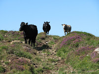

Monday, Rush hour on the trail, and general scenery

Saturday, August 08, 2009

Antrim Coastal Path

[Kyle]We finally got out and had a proper walk. The weather was beautiful and for the first time since being in Ireland, I wore shorts and a t-shirt all day!


Coastal Walk

We headed out from the boat to the top of the farthest hill that we could see. The trail took us via the Bushmill Steam Railway route for the first couple of miles to the Giant’s Causeway. From there, we joined the trail that runs along the top of the cliffs. We followed that for two or three more miles. Adding to our other visits, we have managed to see the Causeway from about every conceivable perspective. As usual, I would get to one point and then decide that I just had to continue on to the next one. Every time, we were rewarded with spectacular views of Green Arizona. In a few places, it was possible to lie down on the ground and stick our heads over the edges of the cliffs and see straight down. Wow!

We encountered one young guy who managed to be persuaded by his friend to stand on a pinnacle about two feet around that could only be reached by making a short hop from a patch of slippery grass. Maryanne tried to persuade me to stand on it for a picture but once I got a closer look at it, I thought the better of it. That hop could only be done by someone with nerves of steel on a no wind day. I hate to think of what would have happened if the guy had overshot.

Crazy location for a pose, and looking down on the Giants Causeway from waaaay up there


Friday, August 07, 2009

Portballintrae And Bushmills


PortBallintrae Village and Harbour

[Kyle]My original plan had been to stay in the Skerries a couple of days and explore the islands but they were too rocky to allow for a safe landing in the dinghy, plus the seals didn’t have wifi. We decided to move the boat over to the much better protected but not as pretty little harbour at Portballintrae. There were no other boats in the harbour (suspicious) so we anchored Footprint right in the middle. We found wifi we could pay for and then went ashore for a look around the town.

There was no town. Portballintrae does have a couple of businesses but is basically just a cluster of uncharacteristically large houses nestled up against the beach. We walked about a mile out of town one way then decided to turn back and see if ‘town’ was the other way. After two or three more miles, we had changed towns altogether and ended up in Bushmills. Well, since we were already here, we decided we just had to do the distillery tour. I think we’re getting to the point where we are not getting anything out of a tour of the mechanics of the distilling process but there is a sample included. For our sample, we chose the 12 year old single malt and the 1608 Reserve (to commemorate their 400th anniversary). Both were nice. I liked the 1608. It tasted more like a Scottish whisky, Maryanne preferred the 12 year old.


Bushmills Town and Kyle sampling at the distillery

We had a pleasant walk back through the town along the Bush River. Bushmills is definitely a Loyalist town. Northern Ireland does this Crips and Bloods thing with some of their towns. Towns are decorated in red, white and blue or green, white and orange, depending on which side they are on. I’m sure they think of it as a pride thing, but to me, it just seems to scream ‘if you’re not on our side, you’re not welcome here’. It’s a lot like the Confederate flag in the Southern U.S.

Anywho, we walked back into Portballintrae along part of the long footpath that stretches for miles along this coast. This took us along the river and through fields until it eventually wound through dunes to the beach. We managed to get back to Footprint just minutes before it started raining in earnest.