Wednesday, May 07, 2014

Officialdom in Hilo

[Kyle]We would really have liked to sleep in, but we had to get up after only eleven hours of sleep to go clear Customs and deal with various other administration related to our arrival.


Leaving the dinghy at the beach, so much quieter than the weekend.

We rowed to the now deserted beach at the park and pulled our dinghy up into a smoother spot than the day before. It was a short walk past warehouses and big oil tanks, then we were at the Customs office. The officer there was really nice. He was unconcerned about our lack of a zarpe from Ecuador. He understood tsunami warnings, although Hawai’i didn’t get one that day. We chatted for a bit and he even helped by giving directions and recommending a few places to go.

Next was the harbormaster’s office in Radio Bay. It turns out we didn’t need to see them since we weren’t moored there, but they were also very nice and called up the correct guy for us. He was in town at the government offices. That was a little inconvenient, but we lucked out and left at just the right time to catch a bus there.


On our wanderings we came across the tiny but very active fish market, and loved this ice dispenser we found down the street... Any one for ice?

Both he and the bus driver were very nice, extremely helpful. (I’m detecting a theme, here!) The paperwork for our temporary mooring permit seems very convoluted, just so we could anchor, but he did his part with good cheer and chatted away with us at the same time.


Beautiful trees and gardens are everywhere

We decided to walk back home through many of the parks that replaced the neighborhoods that were wiped out in the tsunamis. They were all very beautiful. We both decided we were really taken with the Banyan trees. Each giant tree is an enormous labyrinth of tiny, intertwining trunks. They look like paradises for little birds and lizards. I don’t know how parents keep their kids from climbing all over them or playing hide-and-seek in them.

We still couldn’t find a convenient pizza place, but honestly after that long trip, what we were really craving were fresh vegetables. An all-you-can-eat salad bar at a restaurant near the dinghy filled that bill nicely.

Begonia was in need of a proper tidying and we were way behind on emails and work memos (and the blog!). It was time for a day (or two) on the boat catching up.

Setting foot on land - in Hilo, Hawaii

[Kyle]We had really been hoping to make it into Hilo in time for the big Lei Day festival, so we did just the bare minimum aboard Begonia to give us more time ashore. Since we had internet now, Maryanne decided to check on the particulars just before we left. Although our Lonely Planet guide says the Lei Day festival is the first Sunday in May. Lei Day actually moves around a lot, and is different for different islands. Sunday Lei Day was in Honolulu this year. Hilo’s ended four days ago!

All of the information we had said to take the dinghy to the beach in a nearby park. When we got there, it was full of people out enjoying their Sunday. We couldn’t see any other dinghies and it felt a little weird to be pushing past little kids playing in the sand to land the only dinghy in sight.

We had wanted to get that pizza we had missed out on in the Galápagos, but there didn’t seem to be anywhere very close. A friend of mine, who lives here and commutes to Houston, had recommended a Mexican restaurant in town, mostly based on the tropical fruit margaritas, so the walk there and back became the new focus of our day.


This is exactly what we were expecting - just beautiful

Since it was our first time ashore, we ended up taking a very zig-zaggy path to the restaurant a mile and a half away. The route followed the shore through some very pretty public parks before finally depositing us in downtown Hilo with its strangely Wild West architecture.

The food was pretty good, especially considering we were pretty far from Mexico. The Prickly Pear Margaritas were some of the best non-alcoholic tropical fruit margaritas we’ve had.


A nice stroll through the gardens towards a promised cocktail

Maryanne spotted a grocery store and convinced me to stop in “for a few bits”. We walked out with a modest bag of food that slowly gained mass on the way home. I vetoed any more detours of any kind on the way home. By the time we got back to the dinghy, the bag of food weighed more than the three of us combined (me, Maryanne and the dinghy). It was like the bag had a couple of car batteries in it. How can that be? We only bought rice cakes, marshmallows, bubble wrap and a festive Styrofoam snowman for Cinco de Mayo! (??)


The area of town we are in is famed for its Banyan trees, they are amazing

One thing we did notice along the walk back home were what seemed like a lot of monuments and memorials commemorating the tsunamis of 1946 and 1960, which each wiped out huge swaths of the town. Well that was a little disconcerting.


Exploring the heart and history of Hilo

We were pretty tired from the nearly twenty-four-hour day and all of the jobs earlier, so our hearts were just not in it for heavy tourism. We tiptoed our way back through the picnicking families to our dinghy and headed back to Begonia.

Ah, it felt good to be home. It really did. It was nice to be able to sit together in the cockpit and chat freely and watch the sun go down without having to worry about the sails or keeping the log or worrying about getting to bed by a certain time so I am rested enough to relieve Maryanne after she has been up all night.

Monday, May 05, 2014

Details, Details... Where to find the Pictures (and more)

[Maryanne]For some time now we've been posting to the blog from way out at sea using our satellite phone. When we do this, we don't add too many details, or pictures, and we can't see any of the comments until we return to the lands of decent internet.

Finally we are catching up. Rather than confuse the time-line I'm adding posts in their rightful position earlier in the blog. So for new or revised blog posts (added or updated after the fact) - you can go and check out the following

As an aside for those of you who follow our blog regularly - you don't have to keep checking-in to see if there is an update, you can sign up for an email notification every time there is a new post: see the "Follow by Email" section on the right hand menu bar.

Made it to Hawaii!

Sent on arrival!

[Maryanne]For those of you following our blog, a quick note: we made it! Arrived yesterday and will clear customs today (although we did get permission to go ashore yesterday and enjoyed a walk on solid land and some food that someone else got to both cook and wash-up).

The passage from Panama to Hawaii via Galapagos has been a little too eventful, what with cutting short our time in Las Perlas islands due to weather and Kyle's work, striking a whale, a tsunami alert in Galapagos, losing a rudder, and averting a fire aboard; enough adventure for anyone really, and I know that many of you that follow along have your own adventures (both wanted and not) too.

We are safe and well, and happy to be here in Hawaii. Will post proper updates with pictures once we are settled in.

Thanks for the great friendship and support of all those who watch over us and follow along.

Updated after the fact

The next morning, another ship popped up. It turned out to be the last we would see for the rest of the journey. It was the CS Onsan. Our conversation started informally at 4:40 am:

CS Onsan: “Hello, hello.”

Me: “Hello.”

CS Onsan, a couple of minutes later: “Hello”

Me: “Hello”

CS Onsan: “Are you the boat seven miles off my starboard bow?”

Me: “I must be. We must be the only two boats way out here. This is the sailing catamaran Begonia”

CS Onsan: “Where are you going?”

Me: “We’re going to Hawai’i. We are 26 days out of the Galápagos”

CS Onsan: “That is a long time. Are you a sailing vessel?” (Referring to our running lights. He would have only seen a sole green light).

Me: “Yes we are. Where are you headed?”

CS Onsan: “We are on our way to Chile. We left from Russia. The passage is about 30 days. You are only the second boat we have seen.”

Me: “Russia!? That is a very long way. My AIS says you’re going 12.3 knots. That must make your trip about 9,000 miles.”

CS Onsan: “Yes, 9,000 miles, but we are not on a sailing boat. I think you are having more of an adventure.”

Me: “That is almost certainly true, but you don’t want any adventure on a big ship!”

CS Onsan: “Yes, yes. I suppose that is true! Pleasant voyage to you.”

Me: “And you too, sir. Good night!”

CS Onsan: “Good Night”

The next few days were more of the usual: Tailwinds and strangely uncomfortable cross-seas. This trip was starting to get tedious.

Maryanne continued to amaze with culinary variety. She made chilis and Thai curries and even managed homemade cheesecake! Yummy!

On about day 30, the seas started coming from the same direction as the wind and the ride improved significantly. We gybed the jib and were now on a dead downwind, wing-on-wing point of sail for Hilo.

We would go back and forth between having the sails all on one side and having them one on each side as the wind shifted slightly this way and that. After coming on watch at midnight on day 32, I gybed the jib back to wing-on-wing (one sail left, one right) and was rebuffed with a croak. A Brown Booby was perched on a spreader and didn’t like the sail flapping nearby and scaring her. She held her ground, though, and rode with us through the whole night watch. Every time I would shine a light up there, she was wagging her tail and preening her feathers. It was calm enough by then that even up there, she has a pretty smooth ride. I got used to hearing her toenails clicking on the aluminum as she tried to balance herself every time there was a little more motion than usual.

A dawn gybe sent her fluttering away. She tried to return, but couldn’t find a clear approach. The wind was such that I couldn’t keep the jib from filling and collapsing. Eventually, I just gave up, pulled down both sails and hoisted the spinnaker.

Suddenly, we were flying toward Hawai’i and using hardly any rudder in the process to boot. The spinnaker stayed up all day and night without giving us any of the usual trouble.

Day 34, 1:19a.m.: Land Ho! I spotted the light of a radio tower above Hilo at 43 miles. After that, the city’s lights slowly revealed themselves, intermittently disappearing as rain showers blotted them out.


First views of Hawaii

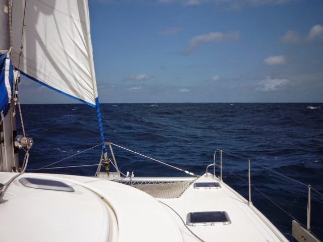
Around sunrise, we got close enough to the Big Island to feel its effect on the trade winds. The wind slowed and then shifted ahead. Maryanne was up by then, so she stowed the spinnaker while I hoisted the other sails. The wind then moved further and further forward until we had to bend our course north of the harbor entrance until we were paralleling the shore. Then it died and it was time for the engines.


We decided against Radio Bay which was very quiet and only had one boat other than the Coast Guard cutter, but there was no doubt we were in Hawaii!

Typically, Customs clearance is done in Radio Bay. Once I had cell phone service, I called up the Customs guy. He knew we were coming. He was just about to leave for the day, so he took down some basic information over the phone and cleared us to go ashore. We could do the actual paperwork the next morning. This meant we could anchor out instead of paying the fees to tie to the wall at the commercial dock overnight. Radio Bay has water, though, which we would need more of before we left Hilo, so we pulled in anyway to refill our tanks. Now we wouldn’t have to pull up our anchor mid stay just to get water. While I was filling the tanks, Maryanne stole away enough time for a nice, long shower.

We left Radio Bay and motored the short distance to Reed’s Bay, just outside the commercial area of the harbor, where we dropped anchor amidst a dozen other boats, many of which were clearly locally owned. We made it!

Friday, April 25, 2014

Sailing to Hawaii - Day 25

Sent from sea

Weather: [More of the same, mostly overcast and windy enough to be chilly]

Sailing conditions: [More of the same, mostly sailing with double reefed main *and* jib, seas are 'mixed' making for a wild ride aboard]

Food: [I did some baking yesterday and made both chocolate cake and cornbread... it wasn't easy with all this rolling around but somehow it came out OK. The jelly/jello I made wasn't so lucky and managed to empty itself inside the depths of my fridge... Not my brightest of moves I guess - sigh.

Breakfast: Cereal, Lunch: Totillas with spicy lentil spread, Dinner: Stew with cornbread]

General Comments: [We've not seen any wildlife for days, it could well be all around us but with the seas so rough it is unlikely we will see much apart from the occasional bird, and the odd flying fish that lands on the boat after a great escape from some other larger fish (or possibly from Begonia itself). Our remaining rudder continues to function well for which we love it greatly.]

Progress: so far we've made [3362]nm on this passage and have [1059]nm to go. Last 24 hours we made [191]nm through the water and [169]nm from our 6am position yesterday (direct point-to-point).

Updates after the fact...


Kyle filling out the log, and then reading to me while I cook at sea. From this comfy location we can both still keep an eye on everything while sharing a little bit of time together each day

On day 23, we passed an interesting milestone; we found ourselves in a patch of ocean at least 1,000 nautical miles from the nearest land. It turns out there are only three regions in the world where this state exists. All of them are in the eastern Pacific. The smallest is a region west of the Galápagos, the largest is way down off the tip of South America, and we were in the medium one, between North America and Hawai’i. It is possible to sail around the entire world without passing through one of these regions. We spent 44 hours and 56 minutes in this one before we closed on less than 1,000 miles from Hawai’i, reaching a maximum distance of 1,160 nautical miles in the middle. I made a point of going on deck and having a good look around right at this point. I’d like to report that it was really dramatic, but the sea was indistinguishable from any other place sufficiently offshore to be out of sight of land. When I was younger, I would have assumed that it would have been really scary being way out here in the (really) deep end, so far from the edge of the pool. Now, as a more experienced sailor, I realize that it’s the boat that’s the edge of the pool. Shore, more often than not, represents danger from rocks and shoals and Italian beaches. This place had a comforting solitude borne from its lack of all that. Swimming out here all alone, with no boat in sight, THAT would be scary.

Right after we left the 1,000-mile region, I saw our first boat in 11 days. It was heading the other way and it’s AIS tag said it was going to Chile. They never answered their radio and they only got close enough for me to see the faint outline of the top of the ship, way out on the horizon.


A smouldering fuse gives us cause for alarm (averted), and we continue to enjoy the sunsets aboard

We also had a scare that was fortunately minor. Maryanne and I both simultaneously smelled burning. We started investigating and I found a bad fuse in our solar panel circuit. Instead of overheating and opening the circuit, the fuse melted in such a way as to not lose continuity. It then just heated up until the whole rubber fuse case was smoldering. It’s likely that if it burned further, it would have interrupted the circuit and thus removed the source of heat, but it was scary nonetheless. I was able to fix it quickly by rewiring it with our electrical spares. Now we have yet another thing we check regularly. No problems noted.

Monday, April 21, 2014

Sailing to Hawaii - Day 21

Sent from sea

Weather: [Overcast, cooler, windy; we remain well wrapped up at night]

Sailing conditions: [Good speed, we spend most of the time with 2 reefs in both sails - uncomfortable seas and boat speeds between 7-10kt all day - some great distances, but not so great on the comfort level aboard. ]

Food: [Breakfast: Parfait, Lunch: Tortillas with spicy lentil spread, Dinner: Pasta]

General Comments: [Remaining rudder remains fully functional (we are hugely relieved and hopeful it will remain so). Sailing at night (for my watch at least) is now moonless, and it is tough. It is hard to see anything ahead except the dark, we rely on any ships being lit or showing up on the chartplotter somehow, and we rely on the wildlife keeping out of our way (hopefully the whales have that memo too). We haven't seen any ship since the Royal Polaris, nor have we seen a plane. It feels very remote.]

Progress: so far we've made [2620]nm on this passage and have [1708]nm to go. Last 24 hours we made [184]nm through the water and [151]nm from our 6am position yesterday (direct point-to-point).

Updates after the fact

At the beginning of my next watch, I was surprised to see a clear sky full of stars. The Milky Way, several star clusters and even a few nebulae were clearly visible to the naked eye. What surprised me was not that it was clear enough to see all of those things so far out into the ocean, but rather that they weren’t being washed out by the light of the full moon. There’s usually not a whole lot to do at night alone on a watch, so the brilliant night sky commands a lot of attention. Watching it carefully, I could see our progression over the curve of the earth’s surface manifesting itself as a slow change in the night sky. It scrolled over us as we headed west. Jupiter, Mars and Saturn were all where I expected them, but mostly I was expecting Begonia’s decks to be bathed in bright moonlight that I could practically read by.

I looked straight up and saw the moon’s disk, but instead of being bright white, it was a deep, dark red. An eclipse! I was so excited! I hadn’t even checked for an eclipse.

The deep red was the entire moon only being lit by sunlight passing through the earth’s atmosphere at the terminator – the line between night and day. From the moon it would have been possible to see all of the earth’s sunrises and sunsets at once. For the next hour and a half, I got to watch the earth’s shadow slowly leave the face of the moon, which turned yellow, then white, and then bathed Begonia’s decks in light I could practically read by.


For some reason we are suddenly 'catching' these bigger flying fish as they fling themselves on the boat at night (for most of the passage we've had tiny ones around 1 or 2" on deck

Things were pretty routine over the next few days. We had wonderful tailwinds, but for some reason were being hit with a big swell from the north right on our starboard beam. Begonia rolled erratically back and forth uncomfortably in the sloppy seas. Every now and then, an errant wave would crash into the hull like a boulder on a beach and explode into a wall of spray and drenching the person at the helm. They seemed to have the exact same period as the time it takes to get completely dry after being soaked by a wave. It was very frustrating.


The sea state has been very variable for this whole trip

On day 17, Maryanne was doing her daily rig walk around (I do one in the morning). To make it easier for her to stay upright, I gradually turned Begonia into the wind and slowed to a stop, easing the motion considerably. Well’ I overdid it and the sails backed. There are two ways to handle this: The Quick Way is to run around the deck and redo everything about both sails. The Lazy Way is to turn the wheel hard to leeward, and then wait for the boat to turn 270° back around to the original heading. The Lazy Way is preferred, but can only be done in light winds and relatively calm seas. The seas weren’t calm, but I tried it anyway. I repeatedly got almost around before a wave would slap us back the other way to where we started. It probably didn’t help that we only had half the rudder authority. I persevered though, intent that laziness would prevail! It took thirty minutes, some of it going backwards, but eventually I found a wave that helped us and we were soon back on our way.

Except something was wrong. Begonia was not getting back up to speed and the rudder felt like mush. Uh, oh!

I tried this and that, but the problem persisted. My leading theory was that the remaining rudder blade was somehow spinning on the shaft, giving us only partial deflection. It also would mean the rudder was just about to fail.

I decided to jump in and have a look. As soon as my mask hit the water, I saw the problem: The feathering prop’s blades had been spun into the reverse position when Begonia was going backwards using the Lazy Way. Unlike forward pitch, when the blades are in reverse, they won’t feather by themselves. This meant we were dragging three big, flat blades through the water. This made for a lot of drag as well as bathing the rudder in the turbulence, reducing its effectiveness. The rudder was just fine. Whew! I spun the prop into feather by hand, checked the other one (still feathered) and for the first time saw the patch of ocean where our port rudder used to be. Yep, it was definitely gone.

Tuesday, April 15, 2014

Sailing to Hawaii - Day 15 - Grocery delivery at sea

Sent from Sea

Weather: [Sunny, Humid.. Pretty miserable inside the boat but fine if we are outside in the breeze.]

Sailing conditions: [Great sailing for the last day, seas are still a bit bouncy but much easier, mostly close hauled but still need plenty of sail tending as winds swing about.]

Food: [Breakfast: Parfait, Lunch: Chocolate cake!, Dinner: Thai Curry]

General Comments: [What a day. Since leaving Galapagos, and then losing one of the rudders we've been a bit down (about so many lost plans) and anxious (about how the other rudder will fair/survive the journey ahead). Yesterday we both lightened up - it was a very happy day aboard. We got to sail really close by to Clipperton Island, and the timing was perfect, it was daylight and we were both up as it was around morning/breakfast time. When we initially set off we'd expected to be no where near the island. The island looks like a fairy tail desert island, beautiful beaches, pounding waves of amazing white and turquoise, and smatterings of palm trees. We were also led about by too many dolphins to count. As we approached we saw a 2nd boat (Royal Polaris) already at the island (we saw them on the AIS). We attempted to hail them on the radio but got no reply. As we got closer we were surprised to see it looked like some kind of large motor boat from a distance, we'd expected a cruising sail boat this far out from land (over 600nm). The birds (boobies) also entertained us by diving and flying close by but were impossible to photograph (oh, our 'good' camera has broken too).

We decided to take the time to sail around the island a bit more rather than just sail by - it was just too magical (unfortunately there is no safe way to land). Eventually this other boat hailed us on the radio and we had a nice chat about the dolphins and the island. They were a large sport fishing boat based in San Diego and made regular trips to the island with paying passengers. Just before signing off they asked if we had a Satellite phone aboard; apparently their long range radio and their sat phone were not working, and they asked if we'd notify their office that all was well. We *were* low on minutes but figured this was important so we made the call and confirmed that the message was received. They got on with their fishing and we got on with enjoying the dolphins, the birds and the island. An hour or so later, as we turned to leave, Royal Polaris called us again on the radio... they thanked us again for the sat. phone call and asked if there was anything We needed. Thinking as quickly as I could I suggested if they had any eggs or onions to spare that would be very welcome! Next thing we know we have a giant boat approaching us with passengers and crew to deliver grocery supplies to Begonia. Along with a tray of eggs and a huge bag of onions they also gave us some apples and oranges. Wow, I was so happy I was practically dancing on the boat. Kyle was grinning too, knowing I had been rationing my onions in dishes and was down to just one more for perhaps another 3 weeks at sea. As we left the island, Kyle went to sleep and I baked a cake in celebration of my new supply of provisions. Life is good.]

Progress: so far we've made [1566]nm on this passage and have [2589]nm to go. Last 24 hours we made [140]nm through the water [135]nm direct from start to end point.

Additional updates after the fact

On day 13 it rained and was cloudy most of the day. Once it cleared, we had partly cloudy skies and consistent winds for the next 3,000 miles.

It was kind of a shame, we could have had full sail, or possibly a single reef in the jib, and spent most of the trip sailing 10 or 11 knots. I’d imagined making the whole passage in as little as 22 days. We were too concerned for the remaining rudder to be willing to risk a big rudder at such high speeds, so we spent most of the time with reduce sail, holding back the boat. If the rudder deflection got above 10° or the speed started creeping into the 9kt level, we’d take in another reef and slow down.

We had more than enough water and food aboard, there was no need to push too hard and make things any worse.


The days continue to pass at sea.

On day 14, it was clear that our course would pass nearby to Clipperton Island. We had noticed it before, during the planning stage, lying near the great circle route between Panamá and Hawaii. It intrigued me, but I assumed the trade winds would allow us nowhere near it on the southern route we’d expected to take. On our new more northerly route, we would pass within 30 miles of it. I knew that it was uninhabited and that it had no safe anchorage or landing point for us, so we planned to sail by leaving it over the horizon. To get the best wind angle, and hedging against a forecast direction change we had been slowly drifting north of our great circle course. Our closest approach to Clipperton would now be less than 10 miles, and it would be in daylight. Maryanne persuaded me we HAD to take a look and we made the slight course adjustment..


Our first sign of land came from the air, with small groups of maybe half a dozen Brown and Nazca Boobies (birds) that had accompanied us from the Galápagos turned into flocks of 20, then 50. Shortly behind them were a few sentinel dolphins, joined later by bigger and bigger pods. By the time we spotted the island, only four miles out, we felt like the center of an aquatic motorcade. We alternated time at the bows with our heads on a swivel, not knowing if to look at the cavorting dolphins, the acrobatics of the birds, or the palm tree covered island. All were impressive in their own way.

Clipperton is an atoll, in the shape of a diamond ring. There is a circle of white sand surrounding a central lagoon. To one side is a giant outcrop of rock covered in white guano. The sandy beach was scattered with coconut palms and was completely deserted. Everywhere along the island, turquoise breakers crashed along the blinding white sand. It was a desert island postcard.

We so desperately wanted to drop anchor and take a walk along that beach for a few hours, but the swells striking the NE side of the island were wrapping around all the way to the opposite side and making large breakers around the entire perimeter. On a calm-ish day it would be possible to leave someone on the boat while the others dinghy or snorkel ashore, but we were not that motivated (nor did we have any legal permission to occupy a French owned island in such a way).

Our AIS (shipping traffic display system) picked up another boat loitering on the opposite side of the island. We could see it’s name (The Royal Polaris) but were not able to spot it using binoculars yet. I tried several times to hail them on the VHF but got no reply. Later when I was on the trampoline, watching the dolphins and birds they called us. Maryanne had a brief exchange with them about our respective voyages – they were a fishing charter out of San Diego, milling around Clipperton for a week.

He then asked Maryanne if she would be willing to do him a favor. His single sideband radio and his satellite phone were not working correctly. He asked if we had the ability to contact his office and let them know that everything is okay and that they’ll most likely be out of contact for another week. This would save them worrying about him and his passengers. Maryanne made a one-minute call on our satellite phone and called him back on the VHF to let him know that she got through to a woman named Rhonda. Rhonda had been very efficient at taking such a rapid message (thanks Rhonda!), and was presumably happy to hear the news.

We didn’t have the best charts of the island, so we hugged the shore as closely as we could while keeping the depth at about 100 meters. Oh, the deserted, blinding white beach looked so tempting.

We went almost completely around the island until we had curved around as far into the trade winds as we could sail. We tacked through the eye of the wind, and then bore off for Hawai’i. We were both so glad that we had made the detour.

A couple of minutes later, Royal Polaris called us to thank us again, and asked if there was anything we needed.

“Well, as a matter of fact,” Maryanne said, “We could use some eggs and onions if you have any extra aboard.” We had meant to pick up some of these in the Galápagos, but, uh, never got the chance.

“Yeah, I think we could do that.” He replied. “We’ll be right over.”

Whoo hoo! I pulled all of the sails down. Royal Polaris approached, its decks lined with possibly 100's of fishing rods and a few over-tanned men who looked like they had been out of the softening influence of women for a while (there was also at least one female fisherman out there with the pack. The Captain gingerly maneuvered his bow over our decks and Maryanne was handed several well-wrapped packages with a long fishing net. One was a WHOLE FLAT of eggs, one had about fifteen onions, and there was a bonus bag of apples and oranges. It was basically the same few things we were going to pick up in Isabela, only three times the quantity. AND it was delivered right to our boat! We seemed to be a highlight for the paying guests aboard too, as they busily snapped their photos of us, we did the same of them.


A welcome delivery of supplies - thank you Royal Polaris

You should have seen Maryanne’s face. Wait a minute, you have! It’s the same exact face the woman gets on those pre-Christmas jewelry ads when she opens the tiny box. By the way, I’ve given Maryanne jewelry and she did not make that face then, but give her fifteen onions and she won’t stop smiling and squeaking with joy all day. I took a nap and when I came back on for my afternoon watch, she greeted me with a chocolate cake freshly made with her new eggs. She was still smiling.

Thursday, April 10, 2014

Sailing to Hawaii - day 10 - Lost a Rudder!

Sent from sea

Weather: [Sunny, nice]

Sailing conditions: [seas are much bigger (3m waves) and choppier, and the ride is 'fun', walking around the boat definitely requires 2 hands]

Food: [Breakfast: Cereal, Lunch: Cheese and crackers, Dinner: Pasta]
Re: our lack of provisioning in Galapagos. We deliberately did all our provisioning in Panama and have food enough aboard to feed us for much longer than we need to reach Hawaii. All we lost by not shopping in Galapagos was some fresh eggs, bread, and veggies - but we can manage just fine without them - we have plenty of tinned veggies, and I can make bread aboard. Please don't worry about us - there is no need.

General Comments: [Kyle had an amazing sight yesterday where immediately ahead of him a huge school of fish leapt from the water, followed closely by about 40 dolphins attempting to catch them. The dolphins act in a team effort to catch and heard the fish, with the dolphins coordinating a leap out of the water themselves.. very cool.

We finally hit the trade winds proper and started to make some good speeds. All seemed well, and we were both happy to have the boat moving properly again.

The big news from yesterday is however, that at about 6pm last night we lost a rudder. Kyle had noticed the steering was a little stiffer than normal, and suddenly we were requiring more turn of the rudder to hold course. Since we are a catamaran, we have 2 rudders, and the other is (at least for now) steering the boat just fine. It is not ideal that we have over 3000nm remaining, and that 'spare' rudder will be tested to the full. We really don't see an alternative to ploughing on. If we head for anywhere else the sailing will be shorter in distance, but just as long in time and more upwind and work/wear on the remaining rudder so on we go, with fingers and everything else crossed.]

Progress: so far we've made [826]nm on this passage and have [3321]nm to go. Last 24 hours we made [193]nm through the water [168]nm over the ground.

Updated after the fact


Pleasant sailing conditions, and Kyle at work on the log and chart plotting

On day nine of our passage, I was sailing along in fairly calm seas when the sea ahead from 30° either side of the bows exploded into white spray. It looked like a depth charge had gone off. A split second later about 50 dolphins leapt out of the water in perfect unison. They all leapt the same height, pointing the same direction and they returned to the water in synchrony. Wow! The Rockettes of the dolphin world. They were fishing and such maneuvers are used to coral, confuse and stun their prey. I cannot think of how such a thing could happen spontaneously if these were not intelligent creatures. They must have someone in the group yelling out the equivalent of “3, 2, 1, NOW”.

Over the next half our or so they continued to do the same with little side groups of about a dozen at a time, occasionally in parallel with Begonia. Amazing.

I hand steer a lot, this is partially since I’m sat at the helm anyway, and partially so I can maintain a feel for the boat (it also saves on battery power to disengage the autopilot). I seem to alternate between phases of thinking the steering is too stiff, and thinking it too loose, causing me to go into states of alternating worry about whether something has ceased or become disconnected. Usually it is nothing, just varying forces on the boat through the water. After the dolphin show, however, it really did fell that it was taking twice as much force to turn the wheel. I turned upwind and slowly coasted to a stop. The steering worked, and at low speeds the wheel felt fine. I decided I was being paranoid again.

A little while later I engaged the autopilot for a minute or two while I stepped away from the helm to adjust a sail. When I turned it off again, the steering felt fine. Yep, Paranoid, that’s me!

I engaged the autopilot again to keep Maryanne company while she made dinner (we traditionally pick a book to read to each other at such times), at this point I noticed something curious: the autopilot seemed to be using twice as much rudder turn/deflection as when I’d been hand steering. This gave me a bad feeling.

Kids, let’s recall the Lift Equation from the first week of flying school: L = CLqS.

Stay with me here, L is the lift, CL is the coefficient of lift, which is approximately equal to surface deflection. q is effectively the force of the moving water and S is the surface area (of the rudder in our case). Therefore if the autopilot was trying to produce twice as much force for a given speed the total control surface must therefore be half. Either we’d lost a rudder or one was disconnected from the steering mechanism.

We stopped Begonia again and tried shining a light on the rudders, but everything is blue down there, including our rudder paint, but we thought we saw them both. As I was climbing into bed later I heard a new noise, a dull clang. I spun around in bed and put my hand on top of the rudder post which is just beyond the foot well. The post was there, and attached to the steering linkage properly, but the rudder was gone. I told Maryanne, who started wondering if it was possibly really this or that, I convinced her to just climb into bed and feel the rudder shaft. It was obvious; our rudders are blade type formed onto a 7ft stainless steel rod that is supported through the hull with two widely spaced bearings. It is a pretty stout arrangement with little play. Feeling the top of the post, now it could be persuaded to lift and raise, we could tell the post had broken above the lower bearing. The clanging I heard was the remaining post banging around lose in the tube.

Well, crap! The good news was that Begonia was steering fine on the remaining rudder. If I hadn’t been ‘that guy’ and we didn’t sleep in that particular berth, we may not have even noticed.

The bad news is that we were a long way from anywhere. Our nearest inhabited land was still the Galapagos (800nm behind), but they have no facilities for hauling out and repairing boats of this type. Mexico was a 1000nm up wind and into heavy seas. If we continued to Hawaii it should be a relatively easy downwind ride, but it was a long way: still 3400nm away (600nm further than our Atlantic passage from Bermuda to Ireland).

We were not sure what caused the rudder post to sever like this. Perhaps an unseen materials defect, hidden corrosion, or just plane cumulative fatigue. This boat had crossed the Atlantic three times before we got hold of it, our concern was the remaining rudder which was also original. While the maximum possible load on it would be unchanged, the cyclic loads would double and there were going to be a lot of cycles in 3400nm. Another tough decision! If the second rudder failed we figured we’d be able to jury-rig a system of emergency steering, but it would neither be fun or terribly efficient.

{Maryanne: Back in Panama, while we were hauled out for bottom paint and general servicing we met another Fountaine-Pajot owner who had mentioned he had lost a rudder in this way. He said he hadn’t even noticed it was lost until he went for a swim one day and saw it was missing; the boat had steered fine without it. The boat yard also said that this was the most common problem that Fountain Pajot boats seem to have. They see several each year arrive without a rudder and needing hauling out for repair/replacement. This persuaded us to check on our rudders carefully and they seemed a little pitted, but otherwise fine. Without a penetrating dye test (which we didn’t have time for before our canal transit) we could never be sure. We figured with the age of the boat we’d consider replacing them as a precaution once we were next in mainland USA, we'd even gone as far as to price the rudders and learned that there was a two month lead time to have them made. All this was now flooding back to us. Would the remaining rudder survive the following 3400nm? It is an impossible thing to estimate. We didn’t have any great options. We had to just hope so.}

We decided to continue on to Hawaii and worked out a crude system for steering the boat using mostly sail trim for use if we did lose the remaining rudder. We could only sail about four different directions with such a method, but by alternating the length of each leg, we should be able to get close enough to the Islands to get us within motoring range when the engines can effectively steer the boat. For the meantime, we would consider every extra mile with our remaining rudder a gift.

We had reached the southern limit of the northern trade winds. The wind direction was consistent but the strength was still variable.

Monday, April 07, 2014

Sailing to Hawaii - Day 7

Sent from sea

Weather: [Sunny, with clouds]

Sailing conditions: [Mostly downwind sailing, the Spinnaker has been up for over 24 hours now. The seas are becoming a little more mixed and choppy, but still a fairly gentle ride]

Food: [Breakfast: Parfait, Lunch: (home made) bread and jam, Dinner: Fishcakes and rice. Yes, I made bread yesterday (using the pressure cooker as a dutch oven).. not too bad]

General Comments: [Brown Noddies are regular visitors. No birds so far seen to land on the boat, just to circle us and catch any flying fish we disturb. The other day We had a school of 5 tuna at the bow sitting in the shade of the spinnaker. I got excited and put out a fishing line, when Kyle was on watch he promptly took the line in and hid it away (such a softy!). We *think* we are about 40nm short of the trade winds - when we find it, we'll turn more west for Hawaii. Yesterday was our first *good* day of sailing distance wise, and much appreciated. The sea water temperature is climbing and is currently a balmy 37 celcius (96 Fahrenheit). At night (if it wasn't for the clouds) we should be able to see the (North) pole star again, and for now we still see the Southern cross.]

Progress: so far we've made [455]nm on this passage and have [3658]nm to go. Last 24 hours we made [124]nm through the water [119]nm over the ground.

Updated after the fact

By morning on day two, we were south-west of Isabela and headed quickly NNW. What little wind there was in the area was sped up as it funneled around the edges of the island. When we reached the lee we coasted to a stop in the dead patch behind.

The traditional sailing route between the Galapagos and Hawaii heads South-West until reaching the southern trade winds, then crosses the Intertropical Convergence Zone (ITZ) at the equator at about 115°W where it is narrower. From there the northern trade winds are picked up for the passage to Hawaii. In our case, both sets of trade winds were positioned 300 miles south of their usual position. This made it just barely shorter for us to make a run to the North. This strategy would also put us at a more comfortable angle once we reached the trades, and would get us out of the ITZ for good.

It was a clear warm day and we could see the rim of the Sierra Negra volcano sharply from 40 miles out. We knew we had made the right decision for us, but it was hard to look back at the island and not feel cheated, we had missed out terribly. There is so much to see and we barely scratched the surface.


Local fishermen can be many miles out at sea in these small open boats, and sunsets continue to add color to our passage

On day three, we were only 30 miles farther than we had been before. We could still see the volcanoes of Isabela, and also a new Island Fernandina. More melancholy! Just at the end of her night watch Maryanne finally started picking up some speed as she sailed out of Isabela’s wind shadow. Almost as soon as she did, it was gone again. She did some investigation and found herself trailing a fishing line, two floats and maybe two dozen hooks. She tried alone for half and hour before she finally admitted defeat and woke me up for help. I tried all the same stuff she tried and had the same predictable result. Reluctantly I realized that I’d have to go into the water to free us. Well this was another first. Swimming in 10,000 ft of water in the middle of the night (in an area famed for sharks). It does wake you up, but I still prefer the slower process of savoring a pot of coffee.

We knew that the headlamps worked underwater from my plunge in Contadora, so I donned one of those along with mask, snorkel and fins and went in. I looked around but there was not much to see. My light disappeared into a blue void of scattered light. Close up there were a few plankton looking like larger versions of the critters seen in a drop of water through a microscope; no giant sets of teeth came booming out of the deep.

The fishing line had caught in the little gap between the port rudder and the hull. Checking that there were no hooks to snag, I pulled it clear. As soon as I let go of it, it sprang out of sight. I REALLY wish those guys would not use floating line.

A couple of hours later at 1:39am on day four, we crossed the equator for a second time. We had been in the southern hemisphere for almost 11 days. Four hours later I spotted a line of black floats ahead (really, black ones, what are they thinking!). I turned 90° to avoid them and sailed along the line. Once I was sure I was clear, I turned back on course and immediately snagged a line suspended between two slimy black floats that were just breaking the surface. This time I didn’t even try starting with the boat hook – on with the fins, and in I went. These fishermen are a real menace. We do our best to avoid the lines, and if we snag them to free rather than cut them, but they don’t make our job any easier!

Maryanne caught yet another that night; my night swim was practically a tradition now. At least this time I had chance to go back to bed for a while afterwards.


Fish are hanging out tantalizingly close to us, but Kyle is not keen to catch any. With no fresh bread aboard I had to go ahead and make some!

The next few days, heading towards the trade winds were calm and slow. Maryanne got lucky and was visited almost every watch by a pod of dolphins trying to make the best of our meager bow waves. Once, she even had a school of Bluefin tuna jockeying for shade at the bow.

Tuesday, April 01, 2014

Pacific Tsunami Alert

Sent from sea

At around 6:30pm on the 1st April - Kyle and I were dining in a pizza restaurant when the owner(?) rushed into the store, took in the sign and closed up the shutters.. We were at an outside table and were advised that the islands are under tsunami warning and the restaurant was closed. We were not asked to clear our check so we knew this was no April fools joke.

We scrambled to return to the boat (an adventure for later, with a hero called Bruce from Australia involved), and by the time we were back at Begonia the Port Captain was declaring a forced evacuation of all boats. We were advised to head SOUTH 20nm into deep water.

We are currently South of the island, and in approximately 2000m (plenty safe for any tsunami wave, and continue to head further south to comply.

Regardless of if the tsunami now hits Galapagos and does any damage, Begonia will now continue on to Hawaii. Luckily we collected our passports today. It makes no sense to return to the Island if they are impacted. Even if they are spared, and life is normal in Galapagos, we will be unable to partake in any of the events we had planned after a forced night at sea.

Nobody yet knows if a Tsunami will hit the Galapagos and we understand many other pacific countries are also under alert. We wish everyone well, and hope you keep safe. We are CONFIDENT that we and begonia are currently in safe water.

Too many adventures!

We hope all the Pacific nations remain safe and this is simply a cautious warning and not anything that will materialize into any damage or destruction.

Please rest assured that Begonia feels safe and we are out at sea in sufficient depth for there to be no concerns for our safety... Maybe we can get pizza in Hawaii!

Update after the fact


At the time we had no idea this would be our last Galápgos sunset for a while.

After the hike to the volcano, we’d reached the stage where all we wanted was a shower (or at least a swim), but we knew we needed dinner, and weren’t in the mood to deal with it on the boat. After a quick trip to the beach to enjoy the sunset we found a place selling pizza and decided that sounded perfect.

We selected a table by the sidewalk and ordered two big Pilseners, when our waiter returned with the beers and to take our food order, he said the pizza oven had only just been turned on so any order would be delayed by the time taken to heat the oven. We were seated and comfortable with cold beer, so were in no hurry. He brought us out a large bowl of popcorn to keep us from starving while we waited. Another couple took up seats two tables down, bringing the total clientele to four.

As we were waiting the town church’s bell started clanging going on for 30 seconds or so. That seemed odd. It wasn’t Sunday, it wasn’t on the hour or anything, the sun had set a while ago and as far as we knew it wasn’t a holiday. The one note bell sounded like an oversized cowbell so it was unlikely someone was playing it just for the sound (maybe someone just got married?). It went off again for another 15 seconds. Most people who took notice just shrugged their shoulders and continued with what they were doing.

A couple of minutes later a little round woman of early grandmother age came running across the street in a trot that didn’t seem to increase her speed so much as cause every square inch of her to vibrate wildly with what appeared to be terminal resonance. She was fanning her face ineffectually with her hands. At this point, nobody seemed to take much notice of her because to be honest the lines in her face looked like they had been formed by doing this several times a day for decades. We and the other table exchanged shrugs while the wait staff seemed to ignore her. A couple of the restaurant staff got a look that said “OH no, here she comes again! What’s bothering her now?”. A couple of them dove for the back room.

She jiggled by us, gasping for breath and muttering in high speed Spanish too fast for me to understand, some of it sounded like “Dios mio! Dios mio! Arriba, arriba. Dios mio! Dios mio! Dios mio! Tsunami, Dios mio …”.

We looked to the folks at the other table… “Did she just say tsunami?”.

Her staff (or family?) clustered around her and even they had to tell her to slow down so they could understand her. She repeated her distress. We still weren’t sure that it was just a phrase in Spanish that sounded like tsunami. “I think she did say tsunami” the guy at the next table said.

By this time the staff were still basically ignoring her, so were really unsure what was going on. Maryanne grabbed a guy walking by and asked if he could help. “We think she keeps saying tsunami, can you ask for us what is going on?”.

He made his way through to her, calmed her down and asked her what was going on. He listened for a little while and then returned to us. The two tables gathered around him. “There has been a magnitude 8 earthquake in Chile, it’s very bad, the government of Ecuador is preparing to make an announcement in the next few minutes ordering an evacuation of all low lying areas in the Galápagos. You should all go back to your hotels”.

Oh… Shit.

Grandma came outside, grabbed the Pizza sign from the side walk, and took it inside starting to close the shutters behind her. Eventually her staff decided they needed to act too, and started to shut off the lights.

So… no pizza then!

We were not even asked to settle up for our beers, we left them half full, grabbed our stuff and started for the dock. If there was to be a tsunami, we had to get Begonia into deeper water. Apparently we had 3 hours before the tsunami would arrive, plenty of time. As we trotted ourselves towards the docks, other locals came out to us to ask if we’d heard the news, ready to fill us in, again telling us to go to our hotel.

As we passed by the laundry, it was still open, and I collected my clothes to haul back to the boat. The woman inside took me to a shelf with piles of completed laundry and I picked ours out. There was some confusion over payment, I eventually convinced her I’d paid a guy the day before, this turned out to be her father and she was OK once we’d said that. She seemed too calm, and I realized she hadn’t heard about the tsunami. I tried to tell her but could not make myself understood.

“Huevos Rancheros, por favor?”.

No, that’s not it!

“Escargót le télévision”. Damn!

A woman from the adjoining store saved me; she came in an turned on the TV (Let there be light!). A very serious weatherman was standing in front of a map with a bunch of concentric circles. I left them to it and Maryanne and I resumed our push for the dock.

The streets were starting to fill with people, almost all of who were headed north to higher ground. The normally sedate first gear only traffic was no zipping by kicking up plumes of dust. We were too heavily laden to be running, but we were walking as fast as we could make our legs move.

Maryanne wondered allowed why we hadn’t heard anything on our hand held VHF. I pulled it off my belt clip. It was on, and tuned to the local cruisers frequency.

She looked at me “maybe nobody knows yet”. She grabbed the radio and hit the transmit button. “All stations, all stations, all stations… This is Begonia, we are ashore in town and have just received news of a pending tsunami warning for the Galapagos islands. This has been confirmed by several sources. Estimated time of arrival in Isabela is 9:30pm, the town is already beginning to evacuate, please make necessary preparations”.

{Maryanne: Another cruisers' blog (Lil' Explorers) reports me as panicked. Now while I wasn't happy about the news, I certainly wasn't panicking, I was simply trying to talk on the radio while also trying to keep up with Kyle who was rushing ahead back to the dinghy dock, imagine running on a treadmill when making a phone call.. I guess that can sound like panicking!}

That woke everybody up! The radio crackled to life with disbelieving “Did she say tsunami?”, "what do you think?".

There was a pause, one of the boats with television or an internet connection came on an repeated the information with the addition that the tsunami warning had now been officially issued and that evacuations were being ordered. Our stomachs were in our throats. If we couldn’t get back to Begonia, and if the tsunami arrived, we would lose Begonia and all we owned. We were worried we’d not be able to get to Begonia and have to abandon her and hitch a ride into the hills. Please, not again!

We were somewhat relieved to find a few water taxi skippers still at the dock. We started calling out “Water taxi” seeking a ride. We were given looks of acknowledgement, but they were all on their phones in that initial confused state where they were trying to make sense of the arriving news. One of them saw the VHF radio in Maryanne’s hand, grabbed it and called the Port Captain. Their response was they’d just heard and were deciding what to do. I knew every second that passed would decrease our chance of getting to Begonia. I went up and down the line pleading “Por Favor!”. Most seemed to want to help, but were waiting to see what the Port Captain said before they committed. I don’t blame them, they had their own homes and families to worry about. Taking us to Begonia would cost them at least 20 minutes.

One of the drivers spotted a dinghy leaving the dock and encouraged us to wave him down for a ride. We did this, and although his dinghy was full to the brim with jerry cans and jumble, he kindly said he’d be happy to take us if we didn’t mind riding on top of everything. No of course not, what are you kidding? “Oh, I might get a diesel stain on my shorts… never mind”. We sped off into the anchorage. The skipper’s name was Bruce (he was Australian on a catamaran in the harbor – we can’t remember the boat name.) Bruce, we can’t thank you enough!

Back at Begonia, we chucked our laundry ahead of us and jumped aboard. We have never been underway so quickly. I got the engine started while Maryanne unlocked the boat. Then she went to pull up the anchor while I got the lights and instruments on. We were underway in three minutes. Our position at the harbor entrance was now a benefit to us. In spite of being ashore when we found out, we were the third boat out of Puerto Villamil.

The Port Captain began making lengthy announcements that JC would then follow-up with the English version “All vessels in Puerto Villamil are ordered to evacuate immediately and proceed to sea to a point at least 20 nautical miles south and a depth of at least 1000meters. Tsunami expected to arrive from the south-south-east at 9:30pm with a height of 2 meters.”

Two meters would probably be 5cm out at sea at 1000 m depth, barely a ripple. By the time that ripple reached the beaches it could be as high as 4-5 meters. Most of Puerto Villamil is only a meter or two above sea level. What they had going for them was it was low tide, so the water was already 3.5 meters below the high tide line.

The departure was surreal. Puerto Villamil has the feeling of being a remote outpost of an already remote place. The harbor is tricky and almost nobody goes out at night. It is a very quite place.

Now there were suddenly two dozen boats in the same square mile, fleeing into the moonless night under both engine and all the sail they could carry. It looked like race week in New York harbor.

We were lucky that the Galápagos is very steep. We figured we’d make it to at least 14 miles out when the tsunami passed us, and we’ve have plenty of depth below us (over 3000m), but the consensus of the fleet was to follow the instructions of the Port Captain and get as close to 20 miles out as we could. Our AIS showed targets streaming out to sea from all of the islands.

Most boats planned to spend the night out and return in the morning (with the daylight). Once boat was already cleared and ready to leave for the Marquesas, so he decided to just keep on going. We did the same, we figured we’d be in no shape for our planned snorkeling trip in the morning, and that would only leave us with one day, and to do what? We were not even sure that there would be a town to return to. We didn’t get our passports stamped (or our clearance zarpe), but at least we had our passports. US customs doesn’t usually require a zarpe, and if they asked we presumed they’d understand about the evacuation.

So now we were on our way to Hawaii, over 4000 miles distant. Most of the other boats stopped at 20 miles. We and the Marquesas-headed boat were on similar but slowly diverging courses. Once we were clear of the boundary of the marine park around Isabela, we turned NNW and they receded over the horizon and out of VHF range. Maryanne tried looking for news on the ham radio, but the emergency frequencies were full of traffic seeking emergency traffic only. The last we heard from Isabela was a week and static-y announcement from the Port Captain at 1:30am. While the announcement was in Spanish, we were pretty sure it was cancelling the tsunami alert but was still not allowing boats to return. We took the fact that it could transmit at all from their low-lying office as a good sign. The rest we’d have to find out in Hawaii. [Maryanne]Although we were lucky enough to have our laundry and passports, we were hoping that before we left Puerto Villamil we'd have also purchased a selection of fresh provisions. We'd already established that there was not much to select from, but that it would be better than nothing. Many fresh produce is prohibited from import into the country so we had deliberately eaten up our eggs, and veggies before arriving. This sudden change of plan left us without chance to restock. While we had plenty of food aboard, the menus would be a little less exciting for a while without that provisioning. At least we were safe and well.

Sierra Negra Volcano Caldera

[Kyle]As we were finishing off our beers after collecting our passports, a man came in from the street walked over to our table and started showing us photos of smiling people climbing and spelunking in lava tunnels. He then gave us his card: he did tours, would we like one? As a matter of fact we would. Maryanne explained in Spanish that we were busy snorkeling tomorrow, but we would like to see the Sierra Negra volcano on Thursday if possible… “Si, no problem”. Brilliant! We made plans to meet with him on Thursday. As he was leaving, Maryanne asked “Unless you have something this afternoon?”. He smiled, “no, no es possible hoy”. OK, no problems.

Five minutes later he returned and said we COULD go today, a driver would pick us up in 20 minutes. Brilliant.

Indeed 20 minutes later a guy in a five seat pickup truck swung by. We paid our bill at the restaurant and climbed aboard the truck. We stopped off at a backpackers’ hostel and picked up four more people: three girls and a guy who seemed to be oh… 20. I slid over, one of the girls joined us on the back seat but acknowledged our presence with the exact minimum effort possible.

We were soon out of town and speeding across the imposing cracked and rippled landscape. The girl next to me immediately fell asleep (stuff like that is boring!). The truck left the lava and headed up the lush sides of Sierra Negra. After a few miles the driver stopped in the middle of the road, our guide climbed out of the truck bed and opened our doors. We were standing around having a look at the place (it was just nowhere on a road), and noticed our guide was GONE. He was spotted almost at the next crest of the hilly road and receding fast. We each gave chase, but it was a struggle to keep up, much less close the gap. I’m in reasonably good shape (what with the running and all) but I was at my limits just trying to keep sight of him. The others fell behind, spaced out and in our own private hell, each trying to keep sight of the person ahead. I could just barely see the guide, Maryanne could barely see me, and so on. A couple of times I saw our guide resting, but he took off as soon as he glimpsed me (with no regard for the other stragglers)! Eventually we decided to cease to keep up this crazy pace and encourage him to keep on waiting on us.


Follow that guy - where is he? On the lush hike there were at least occasional views of the land below (but no real time to appreciate them)

Maryanne caught up to me, she had grazed her arm on a barbed wire fence and was bleeding through her white cotton shirt. It wasn’t serious, and Maryanne was able to clean it with supplies from her backpack, but the small amount of blood made a huge mess that looked serious. We caught up to our guide, he looked at us as we panted heavily, looked at Maryanne’s arm, and without comment or expression took off again. We figured me MUST have a first aid kit in his pack, and he would at least offer a band aid, but he just kept steaming up the hill.

Some of the others started to catch up with us, the poor things. They had been led to believe there would be almost no walking, that the truck would take them practically to the top! Just running? Ha! Two of them were wearing flip flops, and this was NOT flip-flop terrain. They turned out to be students volunteering on the islands collecting data for scientists. Some of which involved shovels.

Every few weeks they would get a few days off from their volunteering, and they would use that to explore a different Galápagos island.

Our climb got steeper still, we stepped through a gap in the trees, and … WHOA!


We were standing on the edge of a giant caldera, it was immense (7.2 x 9.3 km). It looked like a mini version of Ngorongoro Crater, but rather than herds of wilder beast, this caldera floor was covered with a flat cooled layer of lava that looked like cracked custard (it certainly didn’t look like a comfortable walking surface) Some areas were still smoldering. This lava was from the October 2005 eruption, and so far not a hint of life had taken hold on its surface. We all stood there transfixed by it, that march was actually worth it! We all silently agreed that our guide could now live, at least until we got back to the truck.

It was during our blissful awe of the caldera that our guide started taking photos of us. Oh, I knew what this was – he was going to put them on his web site as examples of happy customers. I did my best not to smile (well, maybe a little one sneaked out).


The trip down was much the same as the one up, only with more falling. We could not see where we were putting our feet in the dense growth.

Back at the truck, we all piled in exhausted, without saying anything. All right, we’ll get into town first, and then we’ll tell him! By the time we pulled up to the backpackers hotel, where we all got out, I think we’d all decided that life was too short and Ecuadorian jails were probably not fun. Fine! We’ll let you go, but we are not coming back!

As we reluctantly paid our fee (that seemed to be double everyone elses’, and we knew that the traditional tour walks the full caldera rim (this one was abbreviated due to the lateness)), our guide suggested that since we had now seen Sierra Negra, we could go spelunking on Thursday instead. Great! “What are we doing?”. Fine, we’ll go back, but only once. That will teach him. We've spent so much time, money and effort just to get here, it seems crazy to worry about a few dollars now.

{Maryanne: Aside from the WOW of the view, the rapid pace, and the barbed wire incident, it seems that Kyle has a completely different memory of events than I do... We'll go with his version.}