Thursday, September 29, 2016

New Hatch Glass!

[Kyle]On our last week in Jack London Square, it really would have been nice to be able to sit back and enjoy a last dose of the place before we left. There were too many jobs left to do, so it ended up being a pretty busy week.

The main task we wanted to complete was replacing the plexiglass on all of our hatches. They were all pretty badly crazed from spending years in the sun, so they were all pretty hard to see through. We had initially fantasized about replacing all of our hatches, but once we priced that up, we decided to go for the much more economical and less invasive hatch refurbishment.

The work was broken down into basically three steps:

The first was to get the hatches apart so that we could even access the lenses. The covers are connected to the frames with a friction hinge. All of our old hinges were so worn and stiff that they had to be pounded out in pieces using equal parts hammering and swearing. It took me a whole day to free the first one. Experience got the last one off in an hour. I can still swear a LOT in an hour.


We have 11 hatches overall - 5 small and 6 large ones

Step two was getting the old lenses out. Like our big wrap-around windows, the only way to do this was to cut and pry them out. Luckily, we had all of the tools we had used for the job on the big windows, so that wasn't too hard. The real pain was removing every speck of the old silicone from the frames. We would cut as much off as we could with razor blades. The rest had to be laboriously removed with wire brushes. Our six big hatches took about three hours each, the five little ones were each about an hour.

Once those were all off, we had eleven big holes in the boat that would have to be plugged before we could leave Begonia unattended or before it rained. Caulking and putting the new ones in only took a few hours. We let everything set overnight and in the morning, we removed the tape and the protective covering.

It was AMAZING! Afterwards, when I would look at one of them, I kept thinking I forgot one. Nope, it was just clean.

In the middle of all of the work, we had guests and visitors, who were trying to get in one last visit before we sailed off of the planet. It was nice to have an excuse to pause the work for a bit.

Thursday, September 22, 2016

Oregon and Washington Road Trip

[Kyle]We gave ourselves a whole day to rest before hitting the road again; this time driving North to spend a week in Oregon, starting with a night in a hotel in Portland. {Maryanne: The reality of that 'rest' day was laundry and repacking, but sure, you can call it rest!}.

My original plan was to spend three days camping, hiking some of my favorite trails in the Columbia River Gorge. Three relatively easy days at near sea level sounded pretty good. When we got there however, the skies were looking gloomy (as is usual for Portland). Our first day's forecast originally had been calling for drizzle most of the day, evolving into 'light' and then 'medium' rain all day. The following two days were forecast to be clear and nice, so I figured if we could just get through the first one we'd be home free.

The rain started in earnest just as we parked the car at the trail head (about 8am). It was hard to raise the motivation to put on rain gear, don our heavy packs, and go out in it. After a pause we finally managed, and not surprisingly found we had the whole trail to ourselves. We walked about a mile on flat ground before turning up hill on the Oneonta Trail towards the Larch Mountain summit. The rain didn't lessen, nor even show signs of lessening. It was cold and we were constantly going back and forth between the choice of opening the rain gear (for ventilation) making us wet and cold, and keeping it cinched up (which made us clammy and hot) - both poor choices. We persisted for another couple of miles looking out at a drippy world through the tunnel of our rain hoods, with the only sound we could hear being the beating of rain upon them (the hoods).


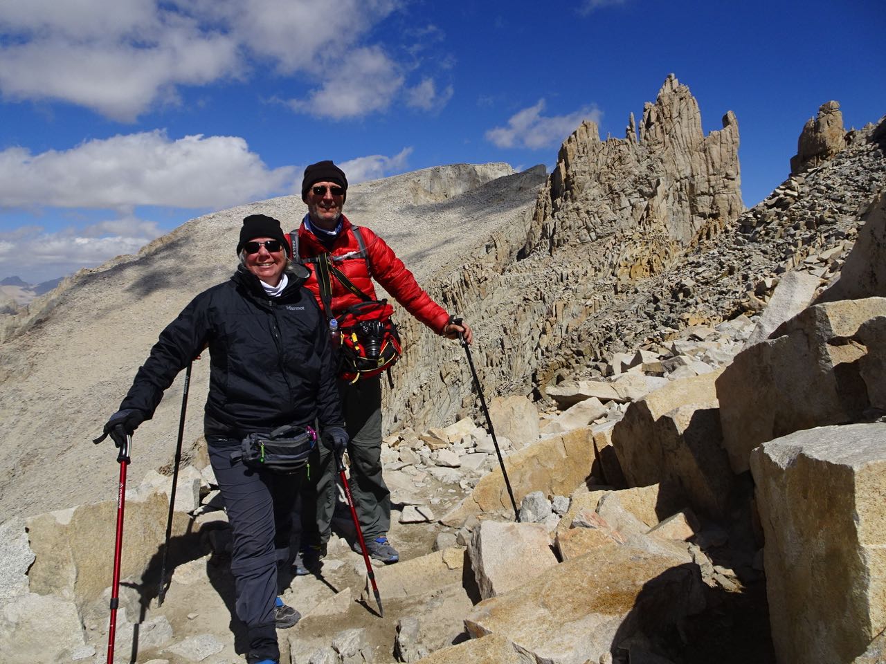
The only pictures we managed to get before the rain started in earnest!

We got to Triple Falls, which was nice enough, but we didn't feel like sitting and enjoying the view; we were hoping to get camped and be inside a dry(ish) tent as soon as possible. After another mile or so Maryanne finally admitted that she just didn't have it in her and she wanted to turn and go back. By this point the return journey was longer than the distance to the camp site, and it seemed more sensible to me to continue on (another two miles in the heavy rain seemed preferable to four in the rain). Maryanne's argument was that four miles to a dry warm car beat a cold, wet tent at whatever distance. I wanted to keep trying so we reluctantly agreed to separate - she would go to the car and find a hotel, I'd continue and hope for a sheltered camping spot and a break in the rain.

As I continued to climb, my heart became heavy with worry about her descending alone. Neither of us had a phone signal, so I could not check up on her (nor she, me). I decided to continue up the canyon to the hilltop where I'd originally planned to camp in the hopes I'd be able to receive a signal there. Once I got there I received a text asking me to keep her posted about my progress whenever I found a chance. It was not going well. It was raining even harder and I knew I had little hope of erecting a dry tent, nor climbing into a dry sleeping bag.

{Maryanne: It turns out I did fall on the way down, not at any of the mudslides nor the slippery rock falls, but at the concrete steps (with a hand rail) just at the entrance to the parking lot - I now had a giant bruise on my butt and another on my back - go figure!}

I had just enough daylight left for two options: One was to descend to where she was via another (more direct) trail, the other was to take the shorter up hill route to the top of Larch Mountain (1,400 more feet of climbing) where there happened to be a road. I asked her if she wouldn't mind picking me up in the car, and she agreed. I arrived an hour and a half later (just after she did); I was pretty exhausted. I had just carried the same loaded pack that we'd used on the High Sierra Trail (HST) up 4,000 vertical feet without hardly any rest. That was more vertical gain than any on day on the HST. I was actually so cold and stiff and sore that Maryanne had to peel my pack off me as I couldn't remove it myself. It was good to know that I would not have to spend a miserable, wet, sleepless night in the woods after all.

As we drove back to Portland with the heat on full, we managed to snag a room in the hotel we'd stayed in the previous night (it was not a great hotel, but it was warm and dry).

Time for Plan C!

The Next day - Sunday

Since we were so sore from the day before, we decided any serious hiking was off the table, so we spent our extra day exploring downtown Portland.


Portlandia, and the Chinese Gardens were just some of the sites we visited

The Following day - Monday

I got it in my head that I wanted to actually finish the second half of our original three day backpacking route. We agreed on a plan to have Maryanne drop me off at the top of Larch Mountain, this time with no pack (I should have done it the other way). She would drive down to the end of the trail at Multnomah falls and hike up until she met me; we would then finish the trail together.

I started to encounter people going up the trail at about the half way point; every time I saw someone new I kept thinking it must be Maryanne, but she kept not appearing. I started to get a little nervous when I knew I was close the finish and I still hadn't seen her, she should have had plenty of time to get this far. I finally got a signal on my phone just as I reached the top of the falls, and started the switchbacks down to the parking lot. She WAS on her way up and would intercept me soon. {Maryanne: While we had a greed to meet at the top of the falls, I figured he'd be a while about getting there, and I stopped at all the cute tourist stops and viewpoints on the way to snap pictures and soak up the sun. Oops!}


Some of the scenic spots Maryanne stopped at along the way

Once she met up with me, we turned back up hill to make sure she got to see some of the best nearby sites on the trail. Unlike two days before, the weather was mild and sunny, and the lower trail was packed with people going in both directions.


Multnomah and other falls along the trail

We still had some daylight left, so we decided to take a side trip to the nearby Bonneville Dam visitor center. A brochure by the exit about Columbia Gorge wineries peaked Maryanne's interest and we decided we had time to pick one to visit (not too far in the 'wrong' direction). She did some quick research and decided we'd be visiting the Marchesi Vineyards & Winery near Hood River; what a lovely find. The wines are very good, and the service and setting was just perfect. Between glasses we were able to fuss over the vineyard's resident cats and play 'get the stick' with their inexhaustible dogs.


Marchesi Vineyards & Winery

The Following day - Tuesday

Today's plan had us venturing into Washington State for a hike to Ape Canyon on Mount St. Helens. The trail is also used for mountain biking which means most of it has been smoothed, and consists of slopes gentler than we'd been recently seeing. That, not carrying heavy packs, and being at lower altitude, made it seem practically effortless to climb the 5.5 miles to the canyon. The trail is a bit inappropriately named. It doesn't follow the canyon, but instead goes along a ridge to the canyon viewpoint, where you can look down into the steep, narrow depths; at its narrowest point the canyon is only 8' wide, and it didn't look to us like there was any trail down.


Views from the Ape Canyon trail

Alongside the ridge was a large valley in which ash and debris had flowed during the 1980 eruption. It is still barren today, 36 years later.

We weren't too tired once we returned to the car, so we decided to visit Ape Cave on the drive back. Ape Cave is a lava tube over a mile long with an entrance at each end. Most people do a loop (half above ground and half through the cave). We started walking above ground to the upper (further) entrance, electing to walk back through the cave.

The cave part of the walk started out mildly. Formed by an underground river of lava that had long since cooled, the cave that remained was formed into an approximate size and shape of a subway tunnel with a flat lava floor bottom. This made for easy walking. Before long, we encountered our first obstacle: a boulder field formed by a collapsed ceiling.


Ape Cave - a magical mystery tour

In order to traverse it, we had to climb over the large and often unstable boulders, up into the ceiling cavity, and then traverse to the other side and descend back into the original tube. We had 100' or so of easy walking and came upon yet another, and then another. At a couple of places as the tube wound its way left and right, the cave narrowed to the width of a doorway before expanding again into a two lane highway sized chamber. At one of the pinch points (just over half way) the cave not only make a sharp bend, but also a slide-like descent. To get down, it was necessary to turn and lower ourselves using hand holds as best we could, but which were not sufficient to reach the bottom - we had to just let go and slide/drop the last couple of feet until our feet (hopefully) hit the floor - that was unnerving. There were yet more boulder fields after that. Initially we found the cave fascinating and impressive, then a little challenging, and eventually downright frightening. It was hard to really understand how far along we were, nor what challenges awaited us - was it safer/easier to proceed or to turn around? We were both greatly relieved when we eventually saw the stairs for the exit. We had been expecting some hint of daylight, but the stairs take a convoluted route to the surface and it was already mostly dark by then. After that, we decided we'd 'done' Ape Cave, and we never needed to return again.

The Following day - Wednesday

From Portland we were on our way to spend a day with my Dad in Coos Bay on the Southern Oregon coast. Since Portland isn't 'too' far from there, we decided we had enough extra daylight to take the long way, and detour to Crater Lake National Park. Unfortunately the main road through the park is under construction/repair, so it took a little longer than we expected, but it was well worth the detour.


Crater Lake National Park

We spent the next day or so catching up with Dad before making the long drive back to Begonia for some rest and relaxation... Just kidding... to start the many jobs outstanding before we could actually start cruising again!!

{Maryanne: Since the whole point of the trip to Oregon was to see Kyle's Dad, I'm embarrassed to discover that (yet again) we took no photos! I guess there was just too much talking to think of it! Doh!}

Tuesday, September 13, 2016

High Sierra Trail – Day 9 (Tuesday) – Maryanne’s 50th Birthday

[Kyle]I had been promising Maryanne ever since we came up with the idea for our hike that it would be all downhill on her birthday. In the planning phase, it looked like it would be easy; 2.8 miles with a 1,600 foot drop. We had run out of food the night before and we carried just a small amount of water, so our packs were each as light as they have been the whole hike. Still, we were tired and sore and we hadn't had any breakfast, so it was still longer than we would have liked at that point.


It was easier to appreciate Lone Pine Lake in the morning

As we descended into the forest, dirt and decaying leaf litter finally started to fill the gaps in the boulders with soil, gradually turning into a nice, dirt path. We met several day hikers starting their climb and really felt for them. That trail is relentless all of the way to the top. Even the only downhill bit between Trail Crest and the junction with the summit trail is so steep as to be hard on the knees. I know we had just walked over 70 miles across the Sierras with heavy packs, but I could not imagine trying to do what they were doing.


A short hike down, still with splendid views

We stepped off of the trail onto our first pavement in nine days, the parking lot at Whitney Portal. We were amongst day hikers and people who had just driven up there to escape the heat at lower altitudes. Nobody knew what we had done. There was no welcome and no fanfare. We were just a couple of smelly hikers with dusty packs.

We limped to the Portal Store for breakfast. We had been told they have giant pancakes. It turns out we had just missed breakfast - lunch only. So much for that craving. We settled for burgers (mine was veggie) which are also legendary amongst hikers dreaming of their first real meal in civilization. They were okay. It was nice to have real food, but I wouldn't have driven up from town for one.

We finished up and headed to the spot the woman in the store told us was the best place to stand for hitchhiking. No sooner had we stuck out our thumbs than a woman in an SUV behind us backed up and asked if we needed a ride. She was literally the first person we saw. Great!

We piled our stuff in, got into the truck, drove 100 feet and then sat for half an hour while we waited for uphill traffic to pass through a one way construction zone. Our driver, Sherry, immediately made us look at each other and feel like we hadn't done anything.

She had started the climb from Whitney Portal at midnight, climbed (basically run) 6,200 vertical feet to the top, and returned the SAME day, a distance of over 20 miles. We found out she did stuff like that all of the time. She's the kind of person that would roll into town, find out there's a marathon tomorrow, and sign up, even though she just did one on Monday.

She was really nice and the descent to Lone Pine, way down at 3,900 feet, was too short. She dropped us in the middle of town (between the two buildings). We walked to the nearest motel with a vacancy sign and checked in. The proprietress was kind enough NOT to act like we were two homeless people. I made a point of returning with some minor request after showering and shaving so that she could see that we were at least adjacent to being fine, respectable citizens.

We went for a walk through the town buoyed by both the thick air and by not having to carry our accommodation with us. We perused a few menus and ended up at a Mexican restaurant that looked nice. We made a point of ordering everything on the menu that looked good.

Afterwards, we stopped at the grocery store for a bottle of wine to take to our room. Maryanne enjoyed a nice, hot birthday soak and I lay on the bed luxuriating in it's giant, soft, flatness.

{Maryanne}Of course, we still had to get home, and that involved more buses and yet another rental car; but it was a relaxed and happy journey as we'd DONE IT!!

Monday, September 12, 2016

High Sierra Trail – Day 8 (Monday) - Mount Whitney

[Kyle]We slept reasonably well for two people who were at 12,000 feet and who knew they would have to get up in the pre-dawn darkness. Around 3:30, the leader of one of the groups that try to make it to the summit for sunrise stopped near our tent for what had to be the loudest, longest snack break ever. I know our tent, with all of its reflective stitching, would have been perfectly visible in the light of their lamps. They seemed to think the tent was uninhabited - perhaps we got an earlier start than they did. I was at that point on the very edge of sleep where hoping they would finish soon and go away was outweighing my desire to wake up enough to yell at them.

A few minutes after they left, I realized I wasn't going back to sleep after all, so I started the slow process of going from my nice, warm, comfortable bag out into the freezing cold to start packing up.

Maryanne is usually pretty resistant when she realizes the way things are going. It was our coldest, darkest morning yet, so it wasn't until I was dressed and was making too much noise packing up my sleeping pad and bag that she poked her head out and made a face that told me she didn't feel she was quite ready for what was about to come.

Once she's awake, though, Maryanne gets up to full speed faster than I do, so she started making breakfast by the light of her head lamp while I continued packing.


An early start made for some special views

She's generally a slower hiker than I am and we had a long day ahead, so I let her set off while I cleaned up and packed up the rest of the gear that goes in my pack. When I was breaking down the tent, I noted that both the outside and the inside of the rain fly was covered in frost.

I got underway about an hour after she did. I tried my best to pace myself and not burn all of my energy trying to catch up with her. I was starting to worry I had allowed her too much time and she would have to wait for me at our agreed rendezvous point at the junction where the summit trail intersects with the trail going over and down the east side. If she stopped exercising, she would stop producing heat and would get cold fast. I finally spotted her above me at the second to last switchback. We got to the junction together.


It was a great relief to make it to the junction
Somehow we thought the hard work was done; it wasn't!

At the trail junction, we removed our heavy packs and pared down to a light day pack, which I carried. Even though we were at 13,500 feet, losing the weight of the big packs made us positively buoyant. We took big steps and zipped up the start of the trail.

It didn't last very long. Soon we came upon Mt. Muir. The trail there turned into a narrow jumble of boulders and the jagged remains of when the trail was dynamited out of the granite cliff face. There was ice on many of them as well as some snow and we had to be careful in order to keep from slipping. At one point, I was standing in front of Maryanne taking a picture of the view. She took a step back toward the cliff wall trying to give me more room. When she did, she slipped and slid toward me. Realizing she was about to kick me off of the cliff, she crumpled into a ball during her fall and landed at my feet without even touching me. I was completely oblivious to all of this until I heard her fall, so I was surprised to turn around to find her worried about me. She was the one that had just fallen. I had been fine the whole time.


The altitude and path made for slow progress - but at least spectacular views during the regular rests

The trail got so bad that Maryanne was starting to make noises about turning back. We were so close. We had already made it above 14,000 feet!

Since the junction, the trail had become a lot more crowded with day hikers who had ascended from Whitney Portal on the east side. We always had three or four other hikers in view each direction. One of the next people to pass us was John, the Ranger I met in Crabtree Meadows. We asked him about it and he said the condition of the trail would improve soon. We pressed on.

By the time we got to about 14,300 feet, the altitude was making us feel like we had the big packs on again. We came around a bend and could finally see the hut at the summit. That helped a lot.

There were about a dozen or so hikers scrambling around on the boulders at the summit taking pictures and generally congratulating each other. A few others were sat in the lee of the hut trying to escape the biting wind. It was 18F/-8C.


We made it!

We signed the book at the hut and then found a protected spot on a ledge out of the wind just on the other side of the boulder marking the summit. It had a USGS marker upon which the elevation was marked as 14,508 feet. We were at the top of the highest mountain in the 48 contiguous states.

We sat for a while enjoying the view and eating a lunch of trail mix and frozen granola bars. We knew we shouldn't be up there too long, so when we finished up, we climbed back up over the summit and headed down. Ah, that is so much easier than up.

We retraced our steps back to our packs, trying our best not to look too fresh for the poor people trudging their way to the top. Several people were milling around either dropping or picking up packs. Some were just resting. One spot, where I had almost left my pack, there was another where a very fearless marmot was brazenly chewing his way toward some sweet-smelling morsel inside. Several of us tried shooing him away, but you had to practically make contact to get him to back off. He knew he could wait us out. Eventually another hiker just dug into the guy's pack to retrieve the marmot's prize for him so he'd stop trying to chew his way to it.


And down again to our packs

I stuffed the day bag into my pack and we shouldered them once again. Oof! Not again! As one last kick in the teeth, we had to climb with them another 200 feet before we could start the long descent down the other side. That last 200 feet of elevation was a real killer. Not only was it way up there to begin with, that part of the trail was made of big, steep steps that were like taking stairs four at a time.

We were SO relieved when we finally passed through the pass at Trail Crest and started descending the switchbacks on the other side. The rocky trail was still pretty tough on the legs. It was made up of a jumble of small boulders with faces canted every which way EXCEPT horizontal. It was like traversing miles of earthquake rubble.

We lowered ourselves thousands of times onto rocks that were each just a broken ankle waiting to happen before we finally spotted a bit of flat dirt trail heading away from the slope below. Oh, I've never ached to walk on a normal surface so much in my life.


The descent seemed endless, and not so much easier either!

It wasn't long after we got there that it ended again and returned to ankle-breakers. We did that for a few more miles. It was awful. Each steep step was just big enough that we could lower ourselves almost all of the way on the uphill leg before we would have to drop and try to absorb the impact using our calf muscles. We saw several people going the other way and couldn't imagine the misery they must be suffering. Many were going too slow to be able to make it to the next campground by dark.


Camping at lone pine lake - a touch too windy to fully appreciate

By the time we made it to our campground at Lone Pine Lake, we both felt pretty much like we had sprained everything. There were a few guys there who seemed to be wrapping up a day of fishing. When they left, we had the whole little lake to ourselves. It was a really beautiful spot, but we could hardly move and the cold wind we had at the summit had continued down to us. We made a hasty dinner and retreated to the warmth of our bags and tent.