Showing posts with label USA-OR. Show all posts

Thursday, September 22, 2016

Oregon and Washington Road Trip

[Kyle]We gave ourselves a whole day to rest before hitting the road again; this time driving North to spend a week in Oregon, starting with a night in a hotel in Portland. {Maryanne: The reality of that 'rest' day was laundry and repacking, but sure, you can call it rest!}.

My original plan was to spend three days camping, hiking some of my favorite trails in the Columbia River Gorge. Three relatively easy days at near sea level sounded pretty good. When we got there however, the skies were looking gloomy (as is usual for Portland). Our first day's forecast originally had been calling for drizzle most of the day, evolving into 'light' and then 'medium' rain all day. The following two days were forecast to be clear and nice, so I figured if we could just get through the first one we'd be home free.

The rain started in earnest just as we parked the car at the trail head (about 8am). It was hard to raise the motivation to put on rain gear, don our heavy packs, and go out in it. After a pause we finally managed, and not surprisingly found we had the whole trail to ourselves. We walked about a mile on flat ground before turning up hill on the Oneonta Trail towards the Larch Mountain summit. The rain didn't lessen, nor even show signs of lessening. It was cold and we were constantly going back and forth between the choice of opening the rain gear (for ventilation) making us wet and cold, and keeping it cinched up (which made us clammy and hot) - both poor choices. We persisted for another couple of miles looking out at a drippy world through the tunnel of our rain hoods, with the only sound we could hear being the beating of rain upon them (the hoods).


The only pictures we managed to get before the rain started in earnest!

We got to Triple Falls, which was nice enough, but we didn't feel like sitting and enjoying the view; we were hoping to get camped and be inside a dry(ish) tent as soon as possible. After another mile or so Maryanne finally admitted that she just didn't have it in her and she wanted to turn and go back. By this point the return journey was longer than the distance to the camp site, and it seemed more sensible to me to continue on (another two miles in the heavy rain seemed preferable to four in the rain). Maryanne's argument was that four miles to a dry warm car beat a cold, wet tent at whatever distance. I wanted to keep trying so we reluctantly agreed to separate - she would go to the car and find a hotel, I'd continue and hope for a sheltered camping spot and a break in the rain.

As I continued to climb, my heart became heavy with worry about her descending alone. Neither of us had a phone signal, so I could not check up on her (nor she, me). I decided to continue up the canyon to the hilltop where I'd originally planned to camp in the hopes I'd be able to receive a signal there. Once I got there I received a text asking me to keep her posted about my progress whenever I found a chance. It was not going well. It was raining even harder and I knew I had little hope of erecting a dry tent, nor climbing into a dry sleeping bag.

{Maryanne: It turns out I did fall on the way down, not at any of the mudslides nor the slippery rock falls, but at the concrete steps (with a hand rail) just at the entrance to the parking lot - I now had a giant bruise on my butt and another on my back - go figure!}

I had just enough daylight left for two options: One was to descend to where she was via another (more direct) trail, the other was to take the shorter up hill route to the top of Larch Mountain (1,400 more feet of climbing) where there happened to be a road. I asked her if she wouldn't mind picking me up in the car, and she agreed. I arrived an hour and a half later (just after she did); I was pretty exhausted. I had just carried the same loaded pack that we'd used on the High Sierra Trail (HST) up 4,000 vertical feet without hardly any rest. That was more vertical gain than any on day on the HST. I was actually so cold and stiff and sore that Maryanne had to peel my pack off me as I couldn't remove it myself. It was good to know that I would not have to spend a miserable, wet, sleepless night in the woods after all.

As we drove back to Portland with the heat on full, we managed to snag a room in the hotel we'd stayed in the previous night (it was not a great hotel, but it was warm and dry).

Time for Plan C!

The Next day - Sunday

Since we were so sore from the day before, we decided any serious hiking was off the table, so we spent our extra day exploring downtown Portland.


Portlandia, and the Chinese Gardens were just some of the sites we visited

The Following day - Monday

I got it in my head that I wanted to actually finish the second half of our original three day backpacking route. We agreed on a plan to have Maryanne drop me off at the top of Larch Mountain, this time with no pack (I should have done it the other way). She would drive down to the end of the trail at Multnomah falls and hike up until she met me; we would then finish the trail together.

I started to encounter people going up the trail at about the half way point; every time I saw someone new I kept thinking it must be Maryanne, but she kept not appearing. I started to get a little nervous when I knew I was close the finish and I still hadn't seen her, she should have had plenty of time to get this far. I finally got a signal on my phone just as I reached the top of the falls, and started the switchbacks down to the parking lot. She WAS on her way up and would intercept me soon. {Maryanne: While we had a greed to meet at the top of the falls, I figured he'd be a while about getting there, and I stopped at all the cute tourist stops and viewpoints on the way to snap pictures and soak up the sun. Oops!}


Some of the scenic spots Maryanne stopped at along the way

Once she met up with me, we turned back up hill to make sure she got to see some of the best nearby sites on the trail. Unlike two days before, the weather was mild and sunny, and the lower trail was packed with people going in both directions.


Multnomah and other falls along the trail

We still had some daylight left, so we decided to take a side trip to the nearby Bonneville Dam visitor center. A brochure by the exit about Columbia Gorge wineries peaked Maryanne's interest and we decided we had time to pick one to visit (not too far in the 'wrong' direction). She did some quick research and decided we'd be visiting the Marchesi Vineyards & Winery near Hood River; what a lovely find. The wines are very good, and the service and setting was just perfect. Between glasses we were able to fuss over the vineyard's resident cats and play 'get the stick' with their inexhaustible dogs.


Marchesi Vineyards & Winery

The Following day - Tuesday

Today's plan had us venturing into Washington State for a hike to Ape Canyon on Mount St. Helens. The trail is also used for mountain biking which means most of it has been smoothed, and consists of slopes gentler than we'd been recently seeing. That, not carrying heavy packs, and being at lower altitude, made it seem practically effortless to climb the 5.5 miles to the canyon. The trail is a bit inappropriately named. It doesn't follow the canyon, but instead goes along a ridge to the canyon viewpoint, where you can look down into the steep, narrow depths; at its narrowest point the canyon is only 8' wide, and it didn't look to us like there was any trail down.


Views from the Ape Canyon trail

Alongside the ridge was a large valley in which ash and debris had flowed during the 1980 eruption. It is still barren today, 36 years later.

We weren't too tired once we returned to the car, so we decided to visit Ape Cave on the drive back. Ape Cave is a lava tube over a mile long with an entrance at each end. Most people do a loop (half above ground and half through the cave). We started walking above ground to the upper (further) entrance, electing to walk back through the cave.

The cave part of the walk started out mildly. Formed by an underground river of lava that had long since cooled, the cave that remained was formed into an approximate size and shape of a subway tunnel with a flat lava floor bottom. This made for easy walking. Before long, we encountered our first obstacle: a boulder field formed by a collapsed ceiling.


Ape Cave - a magical mystery tour

In order to traverse it, we had to climb over the large and often unstable boulders, up into the ceiling cavity, and then traverse to the other side and descend back into the original tube. We had 100' or so of easy walking and came upon yet another, and then another. At a couple of places as the tube wound its way left and right, the cave narrowed to the width of a doorway before expanding again into a two lane highway sized chamber. At one of the pinch points (just over half way) the cave not only make a sharp bend, but also a slide-like descent. To get down, it was necessary to turn and lower ourselves using hand holds as best we could, but which were not sufficient to reach the bottom - we had to just let go and slide/drop the last couple of feet until our feet (hopefully) hit the floor - that was unnerving. There were yet more boulder fields after that. Initially we found the cave fascinating and impressive, then a little challenging, and eventually downright frightening. It was hard to really understand how far along we were, nor what challenges awaited us - was it safer/easier to proceed or to turn around? We were both greatly relieved when we eventually saw the stairs for the exit. We had been expecting some hint of daylight, but the stairs take a convoluted route to the surface and it was already mostly dark by then. After that, we decided we'd 'done' Ape Cave, and we never needed to return again.

The Following day - Wednesday

From Portland we were on our way to spend a day with my Dad in Coos Bay on the Southern Oregon coast. Since Portland isn't 'too' far from there, we decided we had enough extra daylight to take the long way, and detour to Crater Lake National Park. Unfortunately the main road through the park is under construction/repair, so it took a little longer than we expected, but it was well worth the detour.


Crater Lake National Park

We spent the next day or so catching up with Dad before making the long drive back to Begonia for some rest and relaxation... Just kidding... to start the many jobs outstanding before we could actually start cruising again!!

{Maryanne: Since the whole point of the trip to Oregon was to see Kyle's Dad, I'm embarrassed to discover that (yet again) we took no photos! I guess there was just too much talking to think of it! Doh!}

Wednesday, August 20, 2014

Passage to Eureka (California, here we come!)

[Kyle]The best time to cross the Chetco River bar at Brookings was in the afternoon. We had a guilt-free lie-in and then headed to the fish shop for a lunch of fresh-caught fish and chips before departing.


Leaving Brookings

The sea was pretty calm at the bar and the swell didn’t start building until we were a couple of miles away. We hoisted sail, turned south and picked up speed. Eureka was only ninety miles away and we had twenty-five hours before we could cross the bar into Humboldt Bay, so we were in no real hurry.

We ticked off the miles and then gradually reduced sail more and more as the night wore on to keep from arriving early. By the time Maryanne came on watch at sunrise, we had slowed down to three knots. I handed Begonia over to her and went below to get a few hours sleep. A few minutes later, before I had fallen asleep, she popped her head in, “We’ve got no sails up!”

Yep. We had been under bare poles for a couple of hours. The wind was strong and almost dead astern, so it was a real luxury to pull everything down. I no longer had to deal with moving flapping, temperamental sails from side to side with every minor shift in wind direction and the fear of a crash jibe was gone. All Maryanne had to do was stay awake and steer, at least until the wind died down.

When I took over a few hours later, she had unrolled about half of the jib to keep us moving. We were now both awake for the rest of the leg to the Humboldt Bay bar.

Maryanne was making breakfast while I was outside at the helm. Up ahead about two miles away, I spotted a big plume of steam. It was a blast from one of the members of a small pod of humpback whales. I was cautiously excited. Maryanne was distinctly more nervous. She has been on edge around whales since the collision.

This pod circled around us in the course of their feeding, but never got closer than a mile. They were very active, though, and we got to see several breeches. It is an impressive thing to see the teardrop shape of one of these massive animals come clear out of the water, pirouette slowly with the long flippers waving like a dancer’s arms and then crash back into the sea in an explosion of white water.

They left us when we sailed into shallower water near the coast. We were right at the right time to enter Humboldt Bay at an hour before slack water. As we approached, a Coast Guard cutter was leaving. They do this a couple of times a day to check bar conditions.

As we passed them, they started to circle back toward us. I got that feeling you get when you see a cop going the other way in your rear-view mirror suddenly hit the brakes. Perhaps they were just turning around now that they’ve seen the bar. Nope. They called us and asked how long it’s been since we’ve been boarded.

“By the U.S. Coast Guard? Several years”, I responded.

Our number was up. They told us they would meet us once we crossed the bar and launched a rib (rigid inflatable boat) to give chase.

Once inside, they came alongside and two men boarded us. They were both polite and efficient and conducted their inspection as we continued up the bay with the rib following us. Maryanne gave the tour and answered questions while I navigated.

They seemed to be actually impressed by Begonia’s compliment of safety gear. They told us we had better flares than they did. When one of the guys asked to see our fire extinguisher, Maryanne showed him all five. He stopped her before she could get out the fire blankets. Later, when the other guy asked if we had PFDs (life jackets), the first guy pointed out that we were wearing them and added, “I’m sure they’ve got lots more below.”

We do, as a matter of fact.

They bid us good day and left us with a form with all of the right boxes ticked that we could show to the next Coast Guard boarding party to encourage them to move along.

We proceeded up the river to the marina run by the city of Eureka. We found an empty space and were about to tie up when a fisherman in an old boat who appeared to be on the phone to the harbormaster ran us off.

“You need to go to the Flumpta Megulain dock, up the river.”

“I’m sorry, the what?”

The Osaiah Gesubub gas dock, up the river.”

“Where is it?

“It’s the Omega Hartunian dock, half mile up the river.”

Oh, of course. Half mile. That, we can work with. We’ll figure out what the hell the rest of that was on the way.

We tied up to a likely candidate near the town center. It looked good from the river, but once we were tied up, we noticed that we were under the constant watch of a few unsavory looking people who looked like they may have been in prison when we left Coos Bay.

We were just finishing up out arrival checklist and resigning ourselves to cowering inside our barricaded boat for the evening when the harbormaster called us to tell us we were at the wrong dock. We were supposed to be two docks further along (at the Bonnie Gool Dock).

We untied and headed up the river to a park on the edge of town. We pulled up to a dock covered with teenagers fishing. We approached slowly enough to let them get their lines out of the water, but they still only moved off reluctantly, leaving us a dock covered with bait, fish guts and bird droppings. This didn’t feel like much of a better deal than the last spot.

The kids seemed more concerned about fishing than about Begonia, so we felt a little safer leaving her unattended while we had a walk around town to get our bearings.

It didn’t start off well. Our initial path into town took us past a couple of homeless shelters and motels that rent by the hour. What had happened to Eureka since the last time I had seen it? I remembered it being so much nicer.

After a few more blocks, it started getting that way. Overgrown railroad tracks and crumbling buildings gave way to galleries, bistros, microbreweries and bookshops. We debated popping into one place or another for dinner or at least a drink, but we were too worn out from the adjustment from our sea routine to our land routine, so we just decided to go home and call it a night, ready to explore properly after a good night's rest.

Exploring Brookings (doesn’t take too long…)

[Kyle]For our first whole day in Brookings we set off in the general direction of town to see what’s around. With nothing in particular in mind we figured we’d simply enjoy the scenery along the way.

Many years ago I would occasionally fly freight into Brookings, so I had a passing familiarity with the place. It seems in the years since, the town hasn’t held up as well as I’d remembered. Don’t get me wrong, Brookings is a nice enough place, but I just remember it as being quaint and rustic back then, but to fair I was half asleep all the time.


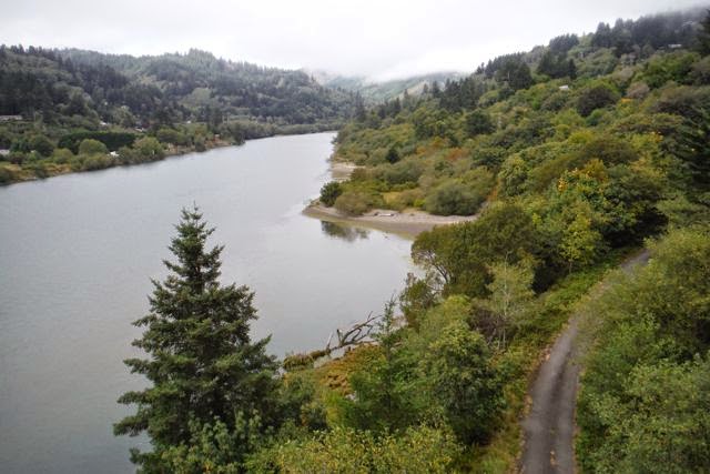
Views from the 101 over Chetco River, Brookings

We started our exploration by making the uphill climb from the marina to cross the road bridge that takes US route 101 across the Chetco River. The marina was on the opposite side from town so the bridge couldn’t be avoided but the elevation provided spectacular views of the river valley and harbor. By the time we reached the other side of the bridge, and into town proper we were feeling a little puckish and stopped into the first coffee shop we saw where I had a delicious mocha and a giant and generous bowl of tortilla soup. Maryanne was given a cup of hot water for tea and a single slice of thin white bread toasted and cut in half. The poor woman looked quite the waif at my soup as she gnawed on the corners of her dry toast. {Maryanne: with our stove functioning down to just a single ring I can’t have toast aboard Begonia, so I’d really built up a craving for it. This was a really poor example of it that I could have done without, and it cost me almost as much as Kyle’s delicious soup. They didn’t even give me a knife for the butter! Sigh}

Back in the fresh air newly caffeinated and stuffed (at least one of us!), we spotted a brown tourist road sign directing us to Chetco Point and decided to amble in that direction. The route took us on back roads past industrial areas, non-descript apartment buildings and the generic edge of town stores. On about the 4th section of the route the signs vanished, and we were clearly not at any scenic outlook. We poked around a little and eventually found a gate chained shut with a sign saying the path to Chetco Point was closed (Sigh, again). By now our feet were feeling abused from the effort of walking after so long at sea, and Maryanne was not amused at so much effort for no reward. Back to the main road! Apart from the sea mist this part of Brookings was indistinguishable from any other American town. There was a big four-lane highway with few accommodations for pedestrians to either walk along or cross; either side lined with dated and dusty chain stores and strip malls. We kept passing places that seemed like they might have something or other we might ‘need’ for the boat, and we ended up spending more time that I would have cared to in hardware, electrical and grocery stores.


Harris Beach State Park

At the other edge of town we spotted a sign for a bicycle path that split away from the road headed into trees and a picturesque trail (finally!). Suddenly we were back in the nice part of Oregon, walking through woodland filled with the scent of pine and sea air. As an added bonus the trail was lined with loaded blackberry bushes and we were able to graze as we went along (giving us plenty of opportunity to rest our feet). A mile or so later we emerged from the trail into Harris Beach State Park perfectly swathed in a mist giving a dramatic sense to the already spectacular beach scene. We walked the trails and climbed the rocks and were amazed to see families playing in the surf of the frigid waters wearing swimsuits on such a cold and foggy day. We kept our distance from the ocean, remaining sensibly dry.


Grazing while hiking... Blackberry season!

Realizing we’d gone as far as our abused feet could be expected to take us, we retraced our route along the bike path and this time encountered several groups of people picking blackberries. Maryanne’s favorite was a group of young siblings with loaded sand-castle buckets, one of which had failed to commit the perfect crime; his bucket was empty but his face was covered with the stains from those blackberries that didn’t make his mouth in the rush to eat them without his industrious sisters noticing.

Back in the strip mall zone, we passed the distance by ducking into one shop after another and purchasing those things we hadn’t wanted to carry any further than necessary. Knowing we are most likely back to living at the dock, we purchased a toaster so Maryanne can again have all the toast she wants (provided we are plugged into shore power), and we picked up some bagels, good bread, and English muffins to test it out! We finally made it back to Begonia loaded down with new purchases, declining any further excursions, we turned to Netflix for entertainment as our beleaguered feet got a well deserved rest.

After a good night’s sleep we set off to explore the marina side of the bridge (the unincorporated town of Harbor), but on closer inspection couldn’t identify anything of any interest so we decided to head back across the bridge for one of the parks we’d ignored earlier. On route through the harbor buildings we came across the chamber of commerce’s tourist information office and excitedly went in to seek guidance on how to fill our day. They started off by explaining all the great things there were to do provided you had a car (after we’d explained we were on foot after arriving by boat). Maryanne enquired about any buses? (Nope!), how about a rental car? (Nope!). Harris Beach (not the best, they assured us) was the only local thing. A second attendant arrived and was equally stumped as to what anyone would do in Brookings if they didn’t have a car to get out of it! Maryanne pushed: any museums? “Ah, yes, there are lots of galleries, you can go to such and such café, or the tattoo parlor they both have galleries you can view”. Hmmmm. So we decided to ignore them and stick to our plan to visit the nearby park (Azalea Park).

We’d seen signs from the road pointing to the Park, and indicating hiking trails. Unfortunately the hiking trails were at a second park (15miles further away), Azalea park was a couple of baseball fields and a small amphitheater and giant kids play area all set in beautiful woodland but easily walked in 10 minutes. We stretched out tour to 20 minutes with another meal of freshly picked blackberries and set off to return via what looked like a small café near the entrance ‘Capella by the sea’. As we got closer to this interesting building we could see the front doors wide open and what looked like pews within. This steep A frame building with all glass ends was beautiful but looked like a church rather than the hoped for café. It sat atop a ridge and surrounded by redwood trees. Once inside we learned that it was designed as a place for contemplation, built by a famous movie producer in memory of his wife who he missed dearly after she passed away. We’d stumbled on the Taj Mahal of Brookings. Inside were two people. One making use of the amazing setting engaged in quiet meditation/contemplation; the other, a volunteer, desperate to engage in excited conversation, instantly breaking the peaceful spell. Karen, the volunteer docent, was indeed an amazing person. She’d hiked around the Middle and Far East in her 20’s (having her children as she went), and been active in the wooden boat scene of the pacific North West, living aboard in Washington state for a while. The other lady quietly slipped out as Karen chatted away. After conversing for a while, we took our leave and went in search of a quiet road along the river valley (and more blackberries). As we left the park we notice that other woman, the one we’d seen enjoying the quiet of the Capella, enjoying the sunshine sat on the grass.


The Capella-By-the-Sea at Brookings Azelea Park

Our new trail took us to a few dead ends and eventually we acknowledged that our feet deserved a break and we made our way back home, rewarding ourselves with a Zola’s pizza and a Slug-and-Stone ice cream on the way – both were excellent. We also picked up some local smoked salmon and smoked halibut for future dining in, it would be a crime to leave Oregon without any salmon!


Zola's may look like a dive from the outside, but it is not to be missed!

The following morning, before departing Brookings, Maryanne dragged me back to the nearby seafood store for a meal of fish and chips to sustain us on the passage on to California.

Tuesday, August 12, 2014

Still in Oregon

[Kyle]We left Coos Bay three days after arriving from Hawai’i. The coastal wind that had abandoned us on arrival was now back with a vengeance. The Coast Guard had issued a small craft advisory for the area and the Coos River bar was closed to craft smaller than thirty feet. Fortunately, both were based on a forecast that so far had failed to materialize. We crossed in a little chop, but nothing very serious. The forecast wind of eighteen knots, gusting to thirty, was in reality about five. It wasn’t until we were five miles out that we had enough wind to shut down the engines. Fog had started at the breakwater, so there was no coastal scenery to enjoy.

It cleared up further out and we made good progress in hazy sunshine to Cape Blanco, about fifty miles south, before the wind started dying. We were heading for Brookings, just north of the Oregon/California border. The harbor there is on the Chetco River, which also has a bar that requires careful timing to cross safely.

We motored through the rest of the night on one engine to make it to the Chetco on the flood. After the wind died, fog moved in that became increasingly thick as we neared the coast. In the early hours of the morning, I spotted several geysers of spray. They turned out to be Humpback Whales slowly heading the other direction. After they passed, one of them reversed direction and swam alongside about ten feet away. It was longer than we were. Our one engine was running at high rpm and this whale seemed to barely move in order to keep pace. An eye surfaced and looked straight at us. We did our best to appear friendly and non-threatening. They moved off without making hardly a ripple.


A shot of the cliffs as we are leaving Coos Bay, and I guess I'll just have to get used to their being plenty of whales out in the ocean!

Closer in, we dodged several fishing boats that we only saw on radar and didn’t even see land until we were about to cross the breakwater. The calm seas meant the bar was flat and entering the harbor was like anywhere else.


A little bird hops a ride into the harbor from out at sea. Luckily the narrow entrance to Brookings was perfectly calm

We tied up to the transient dock in the small boat basin and went over to the harbormaster’s office only to find them closed for lunch, so we headed back to Begonia to finish up the checklist as a way of killing time until they returned.

When we checked in, they assigned us to their other transient dock, the one used for commercial fishing. Begonia went from being conspicuously large amidst twenty-foot runabouts to being conspicuously small next to hundred-foot commercial fishing boats whose retracted stabilizer poles were higher than our mast.

There was just enough day left to set out in search of a meal out. We had walked by a pizza place when we checked in, which made that the dominant craving. The place we saw looked a bit rough (grubby), with only basic tables and unfinished walls visible through the windows, so we decided to head a little further afield to “the other one”. A quick check of the map on the phone to figure out where exactly to go turned up a bunch of reviews. Both seemed to have a following, but Zola’s - the dodgy place, seemed to be clearly better. We decided to give them a second look.

It was marvellous. The décor was basic – most of the walls not actually unfinished, but were covered with drawings made by patrons on the brown paper table covers, but the food was deeelicious! They had an amazing selection of beers and wines as well and the staff couldn’t have been nicer. None of this was apparent from outside the building and we felt a little guilty for underestimating them. We will definitely be going back before we leave town.

Coos Bay

[Maryanne]Coos Bay is an area that Kyle has spent time in on and off for many years. His grandparents and later his father lived there so there were many summer holidays and visits to this spectacularly beautiful area of the world. His father still lives there so we were very glad to have made it with Begonia.

[Kyle]Since I hadn’t seen my dad in a while, we spent most of our time in Coos Bay with him at his house, catching up. We were so busy chatting and hanging out that we totally forgot to take any pictures of me with my dad (or even of him) and that is a terrible shame! He has trouble getting around, so unfortunately he didn’t get to enjoy a tour of the boat. He was kind enough to lend us his car, so we were able to get some fresh groceries and sneak in a couple of quick trips to some of the area’s scenic area, particularly Oregon Dunes National Recreation Area and Cape Arago park.

A colorful local character Maryanne bumped into on the docks called Misty Bob very kindly provided our initial ride to Dad’s house. Bob was a weather-beaten commercial fisherman with a boat that looked as old and well used as the harbor itself. He’ll talk your ear off with one hair-raising story after another if you let him (which we did). One of them was his harrowing tale of riding out the 2011 tsunami aboard in Crescent City, California (See Video).


Begonia safe and sound at the local dock, and Misty Bob tells us a story


Oregon Dunes National Recreation Area


The beautiful and wild Oregon coast