Wednesday, April 24, 2019

Figure Eight-igator Statistical Roundup

[Kyle]We did it! We were sailing fast on a starboard tack across the entrance to Opua Harbor toward the town of Russell when we finally crossed our outbound track. We have now completed a clockwise circumnavigation of North Island and a counterclockwise circumnavigation of Stewart Island and that one in the middle.


Our track (with a few gaps - we clearly didn't sail over land!)
Track sourced from Cruisers Sat

Here’s the numbers:

We left Russell 156 days and 3,230 nautical miles ago. Of that, our North Island loop took 97 days and 1,550 nautical miles. Our South/Stewart Island loop took 59 days and 1,680 nautical miles.

We have made a total of 60 stops in New Zealand. 34 so far on the North Island, 21 on South Island and 5 at Stewart Island. Of these, we had 15 stops where we did not leave the boat, mostly because of bad weather and my sore back. We had 5 more stops where we left the boat to explore by dinghy/kayak, but didn’t land, mostly because the terrain wouldn’t allow it, but occasionally because there was no way to get inland past "Private Property" signs.


The moment we crossed our incoming track - New Zealand Circumnavigation complete!

Our longest stops were in Dunedin (11days), Norsand Boatyard (10 days) and Napier (6 days). We had 17 stops that were only for one night. The shortest was at Whangaruru on the way between the Bay of Islands and Whangarei in November. Our shortest shore excursion was at Barrier Island, where we climbed the hill behind the beach, realized my back was killing me and then limped home. Our longest time ashore was the 2 ½ day trip off the boat to drive the Southern Scenic Route on South Island.

Our longest sails without stopping were Onetahuti Bay in Abel-Tasman to Milford Sound (462 miles, 3 days), Ship Cove in Marlborough Sound to Ahipara Bay, North Island (397 miles, 3 days) and Napier to Wellington (230 miles, 2 days). Of the 156 days total, 78 of those days were sailing on at least some part of the day.

The longest we spent aboard without leaving the boat was 7 days between Ship Cove, Marlborough Sound and Maitai Bay, North island. Second and third were six-day ties. One in December in the Hauraki Gulf because of my back, the other between Lake Cove in Fiordland and Adventure Cove in Stewart Island. That one was because of weather.

And, finally, the coldest water that we recorded was 8.3°C (47°F) at 46°30’S on the passage between Stewart Island and Dunedin, South Island. We were in the deep ocean far from the coast, which generally had 13°C (55°F) water. The warmest was 29.7°C (85.5°F) at Town Basin marina, Whangarei, North Island. They are at 35°43’S. Mostly, the water at the northern end of North Island is about 21°C (70°F).

So there you have it, one more thing to tick off of the list of random goals. We have been surprised to find that very few people attempt such a trip, even the Kiwis, so I think there’s going to be plenty to talk about at the Opua Boat Club when someone asks, “What did you do all Summer?”


New Zealand Memories - in no particular order

Tuesday, April 23, 2019

Return to the Bay of Islands

[Kyle]It was still raining in the morning when we left Motukawanui. I raised the mainsail and sheets of trapped water came pouring down on me. The wind was only strong enough to keep the sails filled about two thirds of the time during each wave-induced roll. That made us pretty slow, but at least we were moving forward and heading in almost the right direction. The forecast had been for direct headwinds, but they were actually off to one side, so we only needed three long tacks and three short ones to get to Tikitiki Island off Howe Point, at the northern entrance of the Bay of Islands. As the day went on, the wind picked up slowly until it was just below our reefing limit for full sail. Once we got to Tikitiki, we let out the sails and had a fast downwind reach the rest of the way.

After spending months seeing at most a handful of other boats, suddenly they were everywhere. It was Easter weekend, which in New Zealand seems to be a four-day holiday, and the weather was brilliant sunshine. It seemed everybody was out on their boats for the last hurrah of the season. It was like Chesapeake Bay on Labor Day weekend. It was time to dust off our knowledge of the Right of Way rules, not just the one about “Always give way to lighthouses”.

We were on port tack. Another boat was coming up on our port bow. They were on a starboard tack. We had to give way. We wanted to go starboard, but there was another boat there on port tack who was downwind of us. We had to give way to them as well. What to do?

Easy! Point to Old Glory flying proudly from astern and barge right through. They’ll be expecting that! {Kidding!}

After a few more miles of racing every other sailboat going our general direction, we finally wove our way through a few fishing boats and dropped our anchor right in the middle of the Te Pahi Islands. Te Pahi is a group of four islets, each surrounded by rocky outcrops, all lying within a larger bay. Our route into the Bay of Islands had paralleled our arrival route from Tonga five months before, but so far has not crossed it. Even though we can see many of the places we left in November from where we are, we still haven’t officially circumnavigated the North Island. Soon, though. We could almost cross the gap with the dinghy now.

After a night’s sleep, we inflated the kayak and paddled over to adjacent Rangihoua Bay to a trailhead we saw on one of our maps. It turned out to be the Marsden Memorial Walk. The walk meanders through the hills adjacent the bay and has many signboards telling the story of New Zealand’s first missionary settlement, led by Samuel Marsden. For the most part, it seemed like a peaceful transition, although there was some mention of a few neighboring Maori tribes who were a little hostile to both the Europeans and the tribes they favored.

After the one-way Memorial Walk, we used our map to find an alternative route back, which took us past the Pa mound of the old Maori settlement. (A Pa is a fortified village) The view from up there was amazing! The whole Bay of Islands could be seen from on top, as well as the adjacent valleys in the other direction. It was a very picturesque and eminently defensible position.

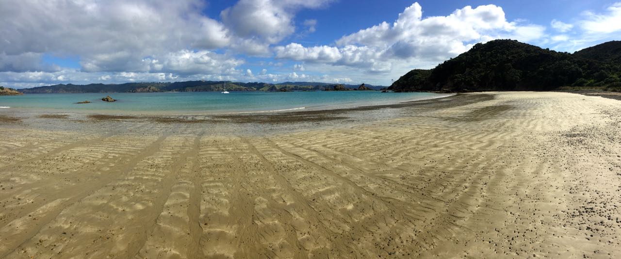
From the Pa, we scrambled down to the beach along a trail that seemed to vanish a little more with each step. It seems few people do the whole loop.

We got back in the kayak and returned to Begonia to drop Maryanne off. She had a million little scratches on her legs from the gorse we had to occasionally push through on our walk. Once her legs hit the salt water while launching the kayak, she decided she was too distracted by the stinging to enjoy any more time out.

I went back out and did a big circuit of the Te Pahi group, stopping at the end to land and scramble up the islet nearest to Begonia. I had got it into my head that I wanted to get a photo of the boat from the top.


Exploring Te Pahi Islands & Rangihoua Heritage Park

There was no trail up there, per se, but I managed to claw my way up through the high grasses and skirt the patches of gorse. The grass was so thick that I couldn’t actually see below my knees. I kept finding mini mounds or holes to trip me up and ended up stumbling my way up and down more than gracefully climbing.

When I got back to Begonia, I was pretty much done for the day and ready to start winding down. We were planning on spending one more night at Te Pahi and then moving across the Kerikeri inlet to Moturoa Island in the morning. The forecast was for rain all day the next day, so we decided to move now, so we could hide inside during the rain and not go out and get wet.

It did rain hard all night, but we were surprised to wake to blue skies and sunshine! The rain had apparently not stopped for the day, but it looked like we would have a few hours before the next wave arrived. We decided to get out the kayak and have a paddle around the islets near our new anchorage.


Around Moturoa Island - among other things we found concrete gannets!

Moturoa has pretty different geology than Te Pahi. The hills here seem to be frozen pyroclastic flows that have since been worn by erosion into big, rounded boulders. They are fascinating to kayak around because of the way even the smallest swell magnifies, reflects off of them and then churns through the gaps.

We played around, ducking in and out of them until the wind picked up and it started getting genuinely rough. Maybe that rain is finally on the way. We hadn’t avoided getting wet, but at least we weren’t paddling around a floating bathtub yet. Time to get back.

{Maryanne: While exploring we were amazed to hear a colony of gannets (and it isn't even nesting season?). As we got closer we found a solar planel, loud speaker and some concrete(?) gannets - presumably part of a plan to attract them to the areas that have been cleared of predators hence making nesting safe. Every time the noise started up, I couldn't help but chuckle.}

Saturday, April 20, 2019

Motukawanui Island (Cavalli Group)

[Kyle]Continuing along the coast of the North Island, we made our next stop at Motukawanui Island in the Cavalli group. It was a little further than we had been going lately, which has mostly been barely far enough to warm up the engines before we’re there already. This time, we shut ‘em down and got to do some actual sailing. We had medium-ish headwinds, so the tacking helped to double our time on the water to three hours.

We anchored at Wai’iti Bay (called Waiiti Bay for short) on the southwestern side. We were the only boat there.

We looked at the forecast and decided today looked better than tomorrow, so we blew-up the kayak (again) and headed for the beach. We had spotted the DOC trailhead sign when anchoring and just had to see where it went. Just as we started climbing up from the beach, a small local fishing boat arrived and anchored and started unloading for what looked like a night at the hidden DOC hut in the trees.


Our trail traversed the length of the island as well as taking a spur to the highest point for a view. It was well maintained and started off moderately enough, but then began to arc into ever-increasing steepness that had us both panting like steam engines. I thought the sign at the trailhead said this was supposed to be classified as “Easy”. It then descended into and out of a couple of steep valleys before steeply descending to the beach on the other side of the island. By the time we made it to the water, we must have climbed and descended three times the island’s maximum height. It was pretty, though. Unlike a lot of heavily wooded trails, the trail on Motukawanui spends the bulk of its distance meandering along high ridges, with sweeping views of the valleys and the sea below. After the double dose of a round trip, we were pretty worn out from three and a half hours of hill walking.

I think I’ve finally figured out the trail classification system in New Zealand: Easy: Trails with average angles between 10° and 30°. Moderate: 30° to 50° Intermediate: 50°to 70° Difficult: 70° to 90°

Trails with an average angle less than 10° are considered the same as sitting in your car and as such do not qualify to be classified as trails, regardless of length.

The good news is we completed all of the trails on the island in only 210 minutes, versus the 215 we got by totaling up all of the estimates on the trail signs. That means we’re 2% fitter than the geezer they used to calibrate them. {Maryanne: At least this is what we're telling ourselves!}

Anyway, It’s a great trail that provides brilliant views along with a respectable amount of vigorous exercise in fresh, clean air. We recommend it highly.


Back on our side of the island, we stopped at the DOC hut to say hi to the people from the fishing boat. It was a couple from just down the road in Kerikeri. He came to the island several times a year in the boat he called his “little tinnie” and had decided to finally show it to his “new” girlfriend of nine months. He was a fount of information, like a friendly amateur ranger, and told us all about the history of the island and the current conservation efforts as a kiwi habitat. He said they had finally reached the happy milestone where they actually had to start taking them off of Motukawanui to keep the population from depleting the island’s resources. They were also exchanging unpaired kiwis with other populations to try to keep the gene pool as diverse as possible.

Night was about to fall, so we bid them farewell and paddled back to Begonia. We made it just before an evening of rain gave everything a good rinse.