Saturday, April 24, 2021

Port Hacking

[Kyle]After sleeping in, we departed Jervis Bay in the late afternoon for the overnight sail to Port Hacking, at the southern limits of Sydney's suburbs. The beginning of the sail was magnificent. We slid past the cliffs of Point Perpendicular just as the sun went behind. I was even able to spot Fishos' Cave from way down at sea level.

As with our last sail, Maryanne woke me a few minutes early because the wind was starting to climb and get gusty. As soon as I was dressed, we reefed everything way down in preparation for my watch. In the next few hours, a cold front blew through with rain, thirty-five knot gusts and, of course, cold. Multiple wave trains were smashing against each other from different directions, which turned the whole sea into an awful, choppy mess. I was annoyed at this, but mainly concerned that Maryanne was having trouble sleeping through the commotion.
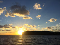
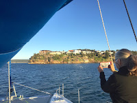
Beecroft Peninsula HeadsPort Hacking, NSWPort Hacking, NSWPort Hacking, NSW
Departing Jervis Bay around Sunset, and arriving in Port Hacking which has suburbs of Sydney on the North side, and peaceful national park on the South Side

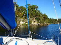
We arrived at Port Hacking just as the sun came up. The wind was blowing so hard that we could only make about two and a half knots against it with one engine. The current was also ebbing, which slowed us down even more. It took us a while, but we finally made it all of the way into the protected cove at the end of Southwest Arm. There, our wind meter read four knots and the sea was a mirror. Finally! Good to be here.

While I had a nap, Maryanne inflated the kayak, which we both set off in as soon as I stirred. Southwest Arm has a very long section that is only knee deep (at high tide), which was perfect for exploring in the kayak. Along the way we met a local (Glenn) in a small, shallow-draft, houseboat who gave us the skinny on his 'secret' waterfall.

We paddled as far upriver as we could, then we left the kayak on a rock ledge and followed a trail along the river to Winifred Falls. There wasn't much flow, but the water hopping down from one sandstone ledge to the next made for some very peaceful scenery. We then went to Glenn's secret spot, hidden away behind a host of trees at the head of the nearby tributary of Saddle Gully. It looked like the perfect little basin for a midday swim in a freshwater basin and with a waterfall to boot. We were looking forward to that one, but the day was waning, so we stopped by Glenn's boat for a quick chat and to thank him and then headed home, glad to have found such a serene spot so close to the city.


Exploring SW Arm

Our plans for a midday freshwater swim in Glenn's secret arm were foiled by the moon. The first high tide of the day was right at sunrise. That's when everything is at its coldest: water, air, rocks. No, thanks. The next was after dark, so that was out for much the same reason. The day's midday low tide was even lower than the previous day. Just to be sure, I took the kayak up the river for an exploratory paddle. No sooner had I rounded the first corner than the little keel fin was parting the sea grass. I stuck my flat hand in until my fingers touched bottom. They hit before my wrist got wet. So much for that idea.

While I was gone, Maryanne had been exchanging messages with a local woman named Daniela who had seen us, from her waterfront home, entering Port Hacking the day before and noticed that we weren't one of the usual local crowd. After a bit of sleuthing, she found our tracker and sent Maryanne a welcome and an invite to come over to her house for tea and to share some of our experiences. They had an available mooring ball right off their property and a dock for tying up our dinghy. Since the weekend was approaching, our little corner of paradise in Southwest Arm was starting to get a little crowded, so it was a good opportunity to meet new friends and leave some room for the weekenders.

We timed our arrival so that it coincided with her husband Bob's finishing his week's work. Pretty quickly, we all determined that wine made more sense than tea, beveragewise. They were great and easy company to get along with, so soon we were accepting an offer to join them and their two daughters for dinner. The TV was on; not the electric one, the picture window one.


We were well looked after by Daniela and her lovely family

Down at water level, the weekend boating crowd was busy having drag races and trying to flip their boats over. Bob says this happens every Friday night after four o'clock when the marine police go home. We were glad we weren't aboard, being tormented by their wakes. As night fell, we could see Begonia's anchor light, just about one floor down. The family was full of questions for us about our unusual lifestyle and I think we did a pretty good job of convincing them that if we can do it, anyone with their obvious intellect should be able to make a much better job of it. At the end of the night it was nice to be able to get home with only half a dozen oar strokes. The wakes were gone. We slept well.

We had an early wake up in the morning, provided free of charge by all of the fishoes in a mad hurry to get to their favorite spots. They needed to get started on their hours-long routine of sitting there with a beer in one hand. We dropped our mooring shortly after, waving goodbye to our new found friends, and headed just across the bay to Jibbon Beach, where we planned to go ashore and do a short loop hike that included some aboriginal art.


Aboriginal rock art/engraving - hard to really see, but of great cultural significance

We did see the art, which was very old and eroded and thus very subtle, but it was there. It was mostly outlines of various animals carved into the soft sandstone. In our way, we didn't just stop there. We soon were hiking the bigger loop that took us around most of the peninsula. Then, as an extra bonus, we took the trail to The Balconies, an area of the coast that is sculpted out of the multicolored layers of sandstone making up the cliffs. The area is just beautiful and provides an almost endless assortment of smooth shapes to admire which change when viewed from each new angle.


Coastal trails (Royal National Park)

When we were done, even though we were getting a bit tired, we detoured through the nearby town of Bundeena, which had a nice selection of restaurants and cafés to choose from. Even though I was hungry, I surprised myself by passing them up, opting instead for an ice cream bar from the grocery store to keep me going until I could get home to Maryanne's cooking. We made it just at sunset, when a large contingent of boats that had come for the event were just leaving again.


[Maryanne] Thinking of sailing to Port Hacking yourself? The Cruising section of the Royal Motor Yacht Club (RMYC) of Port Hacking publishes a free (downloadable) cruising guide to the area full of lots of great tips. Of course most of the South coast of Port Hacking is the lovely Royal National Park (useful to have the annual NSW NP pass).

It’s a gem of a place - easy to enter and lots of free mooring balls (see NSW Courtesy Mooring map); there are city locations and peaceful anchorages surrounded by National Park to visit.

Note: There are overhead cables at Burraneer Point reported (on Navionics) as 12m clearance - but are long replaced and now actually 24m (so shouldn’t be an issue for most cruising boats). Some parts have very windy narrow navigation ways that seem to come way too close to rocks (all is well if you follow the navigation markers). Depending on your keel depth you will need to pay attention to the tide height before entering some of the channels.

Tuesday, April 20, 2021

Jervis Bay

[Kyle]Honestly, I don't know why I even bother to check forecasts anymore. Our trip from Batemans to Jervis Bay was supposed to be a light wind, all spinnaker one. It started off okay. We dropped the pendant for our mooring ball at 2:20am in no wind at all. After an hour or so, we finally had enough to deploy the spinnaker and shut down the engine, I enjoyed it for a bit, but I was flagging from the early start, so I handed it over to Maryanne while I got in a short nap.

Maryanne woke me up before she had planned. The wind was building and she was worried it would soon be too much for the spinnaker. We wrestled it down, stowed it in its bag and switched to the jib. It was a good thing we did. The wind stayed strong the rest of the way, even requiring a reef or two at times to keep everything civil.


We picked up a visitor for the passage to Jervis Bay

We arrived at Jervis well before we had originally thought, which gave us plenty of time to find just the right spot to set our anchor. We ended up on the southern end of Long Beach in a patch of sand just big and deep enough for Begonia. {Maryanne: We arrived at the Beecroft Peninsula Side of Jervis Bay. This is mostly set aside as a military weapons range, and with strict rules about when you can (and cannot) go ashore; We triple checked before leaving the boat!}

In the morning, we set off to trek to the lighthouse at Point Perpendicular. On the main road, we stuck out our thumbs and were relieved to immediately get a ride from a group of English expats in a pair of cars. That saved us the boring, dusty part of the walk. The lighthouse is very pretty and blinding white, with the foundation painted bright blue. To me, it looked like a giant chess piece.


The old Point Perpendicular Light/Lighthouse

We then took the trail down to the Outer Tubes, where the military had a WWII gun emplacement. It is a prime fishing spot – one of only a handful in the world where marlin and big tuna can be landed from shore, The spot was so full of people fishing that we passed on going all of the way to the rusty gun ruins and instead contented ourselves with views of the impressive scenery.


The cliffs at the end of the Outer (torpedo) Tube trail

From there, we walked a kilometer or so back along the main 'road' to a trail with viewpoints to the north that we could see on our map app. There was no signage whatsoever when we got there, but we did find a trail that seemed to be going in about the right direction, so we continued on.


The trail popped out at some lovely cliff views

After a while, we emerged from the bush at the top of the 80 meter cliff face to spectacular views (One of our guidebooks incorrectly reports these as the highest in Australia - they are not). At this point, the trail became much more rustic; so much so that it was hard to even find it in some places. We backtracked a bit and found it much easier going on the bare rock a few meters back from the cliff edge. In several places, we started spotting anchor points screwed and sometimes concreted into the rock. We assumed climbers used them as belaying points for descending the cliffs.

On the way back along the same trail, seeing the cliffs from a different angle, we spotted what appeared to be a campsite in one of the many caves eroded in the rock face. A good look through the telephoto camera lens revealed it to be a makeshift shack, with a picnic table and windbreaks made from lumber; what a cool place to spend the night for the climbers, we thought.

We met three young guys going the other way and asked them if they knew about it. One of them was local and said he had been looking for it to show his friends. He then told us that it was possible to get to it without ropes. Oh, really‽

We hadn't seen it before, but they were right. The spot was known locally as either the Glass House or Fishos' Cave. It could be accessed via a short descent through a crevice that was not much longer or steeper than a couple of flights of stairs, then via a wide shelf to the entrance. I was initially skeptical, but our new guide bounded down in practically one leap to show me how easy it was. I followed next. Maryanne stayed behind so someone would remain to tell the insurance company.

It was a great spot, if a little too windy. They need to redo the plastic sheeting windbreak they have down there. Since the rock layers comprising the cliffs are flat, the place has a perfectly flat floor that is just the right size for a couple of tents. At the edge, behind an open-framed wall, is a six-person picnic table. Oh, if only we had known, we would have packed a picnic. What a spot!


"Fishos' Cave" aka "The Glass House" was an unexpected find

A local on his way back from the Outer Tubes picked us up for our ride home. He showed us loads of photos of himself holding giant marlin while standing on the rocks there.


Begonia anchored at Long Beach (South), Beecroft Peninsula, Jervis Bay

Since it was still early, we pulled up anchor and headed down the bay to the Hole in the Wall in preparation for our next excursion. The Hole in the Wall lies within the waters of the Jervis Bay Territory (JBT), which was the last of the states and territories within our Australian circumnavigation loop that we have not yet been, so we were keen to go. {Maryanne: Switching to the other side of the Jervis Bay enabled us to visit the Booderee National Park by boat}.

As the Australian Capital Territory lies entirely within New South Wales, the JBT was established as a way for the federal government to have access to a port without being unduly beholden to NSW. When the JBT was formed, the agreement also included a rail corridor between the two territories, but that was never used because by the time the ACT was taking shape, air travel was becoming common enough that the new airport could meet the same need. Thus, the JBT has a military presence, but no merchant shipping port and under 400 full-time residents (over half of which are Aboriginal).

The next nice day, we rowed ashore with a plan of walking a good portion of the JBT's trails. Once again, our map app was both helpful in finding obscure trails and misleading about their quality. Our first hour or two was on a trail worryingly called the Adder Trail; much of it was so overgrown and hard to follow that we were often required to push our way through deep, scratchy undergrowth to follow it. We made a point of making a huge ruckus as we did so, so that any adders within would flee for fear of being trampled. We never saw any, so that was good. {Maryanne: We assumed the trail name was due to an especially large population of the Common Death Adder snake, so we spent most of our time trying to keep an eye on the trail rather than the views. We were very glad to find a more path-like trail for most of our walk}.


Enjoying the sights in Booderee National Park

Further along, the trails ended up being mostly disused fire roads, for which we were very happy. We walked for miles and miles, taking in most of the viewpoints on the peninsula. We arrived back at the dinghy right at sunset on sore legs, ready for an easy day to recover.


Back to the boat by Sunset

[Maryanne]Per Wikipedia "Australia consists of six states (New South Wales, Queensland, South Australia, Tasmania, Victoria, and Western Australia), three internal territories (the Australian Capital Territory, the Jervis Bay Territory, and the Northern Territory), and seven external territories (Ashmore and Cartier Islands, the Australian Antarctic Territory, Christmas Island, the Cocos (Keeling) Islands, the Coral Sea Islands, Heard Island and McDonald Islands, and Norfolk Island)".

With our visit to the Jervis Bay Territory this now means we've visited all the states and Inland territories of Australia. I doubt we'll ever get to all the external territories, but I'm feeling unreasonably smug that we've managed the full set of states and inland territories!