
{Maryanne: Quick warning, Kyle has his statistics hat on and this is a long post...}
[Kyle]A lot of the people we meet think that with all of the sailing we've done, we must have circumnavigated the globe. Its very common; we've never said that, but one sailor in St Helena kept telling others that we’ve done it twice, despite our repeated attempts to clarify and correct. In fact, we had not circumnavigated at all at that point, but we have now!
I think he got it stuck in his head because of the mileage. Maryanne and I have indeed sailed a very long way. As of now, our total sailed together is just over 106,000 nautical miles (83,000 on Begonia). Since the circumference of the earth is 21,600 nautical miles, his assumption would be plausible. Well, now we really have done one, so there’s that.

A Google Map view of our sailing with Footprint (red track) and Begonia (blue track) to date
So why did it take so long? Where did we go wrong? Apparently, it’s because we took a lot of side trips.
Firstly, there are four requirements for a sailing vessel to complete a circumnavigation. Actually, it’s really just three since two of them are the same.
- The first is that you have to cross all 360 degrees of longitude.
- The second is that you must pass over at least one pair of antipodal points (opposite sides of the globe). This is to keep people from sailing to Antarctica, circumnavigating it where the lines of longitude are close together, and then returning and calling it a circumnavigation.
- The third is the extra one, because it stipulates that you must sail at least 21,600 nautical miles. Since any two antipodal points are 10,800 miles apart, it would be impossible to sail from one to the other and back without going at least 21,600 miles, so that one can be considered as being redundant to requirement #2.
- Lastly, you must cross your outbound track at a point prior to the first antipodal point so that there are two separate tracks between the pair. It was this last one that held us up.

A close up of the point our Begonia path actually crosses itself (just south of the Turks and Caicos Islands)
We didn’t know it at the time, but we started our circumnavigation with Begonia on November 29th, 2013, the night after we left the Turks and Caicos Islands for Panama, when we crossed N20° 47’, W073° 08’. It was this point that we would finally return to and cross on March 5th, 2023, 9 years, 95 days and 22 hours later, after logging 79,445.6 miles (during the last few hours of our Ascension Island to Bahamas passage). Both times that we crossed the point, it was exactly 2220 boat time, during Maryanne’s night watch. She crossed it the first time reefed down, going eight knots in a building wind. On our return, she was crawling along at two knots under full sail.
So how long should the circumnavigation have taken? I’m referring of course to a normal cruising one, not one of those non-stop, round the world races. To find out, I dug out our stack of logbooks and started poring through them. I deducted five side voyages that were extraneous to the part of our path that makes up the most direct circumnavigation route. I will explain each in the text later. I left in smaller redoublings of our track, like times that we entered an atoll via a pass, explored a bit, and then exited via the same pass, or times that we entered an area and crisscrossed back and forth before eventually leaving. This extra mileage would be a normal part of a cruising circumnavigation. In fact, it’s pretty much the point of it.
What’s the answer? Not so fast! We’re going through this together. I would suggest a cup of tea and maybe some biscuits, perhaps also a calculator.
When we began the circumnavigation at the aforementioned point, Maryanne and I had already sailed 3,951.9 miles in Begonia, plus 22,639 miles of our total in our previous three boats (all mileage is nautical miles measured through the water/by the speedwheel rather than actual distance between points. Multiply by 1.15 for statute miles and 1.8 for km. Time is elapsed calendar time, not cumulative time underway).

Extra Loop - to Hawaii - Kyle doesn't count that 10,645.9nm
The first deduction starts 3,972.4 miles and 138 days, 21 hours later, west of Clipperton Island in the Pacific, when we broke off for a loop of the northeastern Pacific via Hawaii and the North American west coast. That loop was 10,645.9 miles
We crossed the same spot and rejoined the circumnavigation path three years and 23 hours later, on the way to Hiva Oa in the Marquesas.

Extra Loop - The South Pacific - Kyle doesn't count that 15,829.3nm
Sixty days and 3,285.8 miles later, we reached Tahanea Atoll in the Tuamotus. Our total circumnavigation so far stands at 306 days, 3 hours and 7,258.2 miles. here, we took another break for our loop of the South Pacific. I chose Tahanea because when we returned, we anchored in the same anchorage as the year before. That epic loop had us returning at the exact same hour 357 days later, after sailing 15,829.3 miles.
We then carry on 2,347.7 miles to Neiafu, Tonga over the next 107 days and 6 hours. Our circumnavigation totals are now 306 days, 3 hours and 9,605.9 miles.

Extra loop - New Zealand - Kyle doesn't count that 6,024.3nm
Our third side trip went to New Zealand and back, covering 6,024.3 miles over the next 235 days, 14 hours. This should probably be included in a normal circumnavigation because it is generally desirable to leave the cyclone zone for tropical storm season, but since we did return to the same spot, it is not included in the big running total. Sorry, New Zealand.
From Tonga, we spent the next 167 days, 3 hours sailing 4,200.7 miles to Bundaberg, Australia, bringing the circumnavigation total to 473 days, 6 hours and 13,806.6 miles.
Our departure from our circumnavigation path to circumnavigate Tasmania and return to Bundaberg via Lord Howe Island spanned 144 days, 21 hours, sailing 3,477.2 miles.
After reaching Bundaberg the second time, we then sailed around the rest of Australia and then the length of the east coast between the Whitsundays and Tasmania again before continuing on for our second pass over the ‘Top End’ as they call it. Along the way, we stopped at entirely different anchorages each time. We even bypassed Bundaberg. The first common destination we come to is Darwin. To eliminate most of the squiggles of the second pass, I’ve chosen the initial trip from Bundaberg to Darwin as the most straightforward inclusion in the big circumnavigation. That took 159 days, 5 hours and 2,329.0 miles. Our circumnavigation totals are now 623 days, 11 hours and 16,135.6 miles.

Extra Loops - Most of Australia - Kyle doesn't count that 13,328.4nm (to circumnavigate) and that 3,477.2nm to go around Tasmania and off to Lord Howe Island
The Australian circumnavigation, plus the extra side trips from Darwin to Darwin is our fifth and last big mileage deduction from our total. That trip took a whopping 610 days, 6 hours and covered 13,328.4 miles.
After Darwin, the sail to the Bahamas took 278 days, 1hr, and covered 14,004.9 miles, making the grand totals for our global circumnavigation 910 days, 12 hours and 30,140.5 miles, plus 2472 days, 10 hours and 49,305.1 miles NOT circumnavigating
Some caveats: A direct circumnavigation along our basic route would certainly be longer. Our trip to New Zealand would have been normal to escape tropical storm season in the tropics. That would add eight months and about 3,000 miles, since half of our 6,000-mile detour was to circumnavigate the country’s three main islands. We never met any other international cruisers who did that. The same thing is true in tropical Australia. It would be necessary to add 1,000 to 2,000 miles to escape the cyclone zone and another nine months to realign the ocean crossing times to the best sailing season. This would make realistic no-detour numbers of about three years and 35,000 miles. Also, during that period, we had eleven haulouts, but only one is included in our circumnavigation total. We did the others out of tropical storm zones and seasons, but a direct circumnavigation would require some time for these as well along the route. So there you go.
Wait! I didn’t mean it literally, for now we have a rundown of our:
Antipodal Points!
As I mentioned earlier, we need to cross one set of antipodal points to complete a circumnavigation. We have more. These are listed in the order in which the second point was reached since the exact opposite first point was not known until that time.
- #1 -First point: N11° 48’, W078° 35’ on Dec 4, 2013 at 0300Z during the Turks and Caicos Islands to Panamá leg. Second point: S11° 48’, E101° 25’ on Aug 12, 2022 at 2100Z on the Broome to Cocos (Keeling) leg. Elapsed time between the two: 8 years, 240 days and 15 hours and 67,170.9 miles.
- #2 -First point: N07° 58’, W102° 50’ on Apr 11, 2014 at 1900Z during the Panamá to Hawaii leg. Second point: S07° 58’, E077° 10’ on Sep 12, 2022 at 1500Z on the Cocos (Keeling) to Chagos Archipelago leg. Elapsed time between the two: 8 years, 153 days and 20 hours and 66,686.5 miles.
- #3 -First point: N09° 41’, W113° 03’ on Mar 17, 2017 at 2000Z during the México to Marquesas leg. Second point: S09° 41’, E066° 57’ on Oct 18, 2022 at 0400Z on the Chagos Archipelago to Mayotte leg. Elapsed time between the two: 3 years, 214 days and 8 hours and 55,311.2 miles.
- #4 -First point: S12° 00’, E136° 45’ on July 31st, 2020 at 0000Z during the Gove to Truant Island, Northern Territory leg. Second point: N12° 00’, W053° 15’ on Feb 17th, 2023 at 1930Z on the Ascension Island to Bahamas leg. Elapsed time between the two: 2 years, 202 days and 19.5 hours and 25,371.4 miles.
- #5 -First point: S17° 57’, E122° 12’ on Aug 1, 2022 at 2300Z in Broome, Western Australia. Second point: N17° 57’, W057° 48’ on Feb 24, 2023 at 2100Z on the Ascension Island to Bahamas leg. Elapsed time between the two: 207 days and 22 hours and 12,113.9 miles.
Also, here’s a few others that have one or both points that were not on the direct circumnavigation path:
- #6 -First point: N35° 55’, E023° 24’ on Sep 15, 2011 at 2200Z during the Kimolos to Dyros, Greece leg in Footprint. Second point: S35° 55’, W156° 36’ on Dec 31, 2017 at 2200Z on the New Zealand to Chile leg in Begonia. Elapsed time between the two: 6 years, 108 days and 28,363 miles.
- #7 -First point: N41° 08’, W035° 59’ on June 8, 2009 at 0400Z during the Bermuda to Ireland leg in Footprint. Second point: S41° 08’, E144° 01’ on Jan 18, 2020 at 1300Z on the Sydney to Tasmania leg in Begonia. Elapsed time between the two: 10 years, 226 days and 9 hours and 59,562 miles.
- #8 -First point: N43° 08’, W032° 41’ on June 9, 2009 at 1700Z during the Bermuda to Ireland leg in Footprint. Second point: S43° 08’, E147° 19’ on Feb 5, 2020 at 0400Z in Bruny Island, Tasmania in Begonia. Elapsed time between the two: 10 years, 244 days and 11 hours and 59,683 miles.
- #9 -First point: N31° 56’, W064° 36’ on May 13, 2009 at 1200Z during the British Virgin Islands to Bermuda leg in Footprint. Second point: S31° 56’, E115° 24’ on Dec 13, 2020 on the Tantabiddi to Fremantle, Western Australia leg in Begonia. Elapsed time between the two: 11 years, 215 days and 68,522.9 miles.
- #10 -First point: N32° 04’, W064° 36’ on May 13, 2009 at 1600Z during the British Virgin Islands to Bermuda leg in Footprint. Second point: S32° 04’, E115° 24’ on Dec 27, 2020 at 1300Z on the Rottnest Island to Busselton, Western Australia leg in Begonia. Elapsed time between the two: 11 years, 228 days and 21 hours and 68,652.3 miles.
- #11 -First point: N34° 30’, W064° 53’ on Nov 1, 2008 at 0400Z during the North Carolina to Antigua leg in Footprint. Second point: S34° 30’, E115° 07’ on Jan 9, 2021 at 0100Z on the Hamelin Bay to Lucky Bay, Western Australia leg in Begonia. Elapsed time between the two: 12 years, 68 days and 21 hours and 71,513.8 miles.
- #12 -First point: N34° 49’, W058° 43’ on May 29, 2008 at 1200Z during the Bermuda to Ireland leg in Footprint. Second point: S34° 49’, E121° 17’ on Jan 11, 2021 at 0100Z on the Hamelin Bay to Lucky Bay, Western Australia leg in Begonia. Elapsed time between the two: 11 years, 216 days and 13 hours and 68,720.6 miles.
- #13 -First point: N43° 04’, W032° 45’ on June 9, 2008 at 1600Z during the Bermuda to Ireland leg in Footprint. Second point: S43° 04’, E147° 15’ on Jan 29, 2022 at 0300Z in Tasmania in Begonia. Elapsed time between the two: 12 years, 233 days and 13 hours and 73,311 miles.
- #14 -First point: N43° 20’, W032° 18’ on May 29, 2008 at 2000Z during the Bermuda to Ireland leg in Footprint. Second point: S43° 20’, E147° 42’ on FEB 3, 2022 at 1800Z on the Bruny Island to Maria Island, Tasmania leg in Begonia. Elapsed time between the two: 12 years, 236 days and 22 hours and 73,376 miles.
- #15 -First point: N18° 18’, W141° 05’ on Apr 26, 2014 at 0700Z during the Galapagos to Hawaii leg in Begonia. Second point: S18° 18’, E038° 55’ on Nov 11, 2022 at 2100Z on the Mayotte to Richards Bay, South Africa leg in Begonia. Elapsed time between the two: 8 years, 198 days and 14 hours and 66,039.3 miles.
- #16 -First point: N34° 44’, W159° 48’ on July 18, 2014 at 1800Z during the Hawaii to Oregon leg in Begonia. Second point: S34° 44’, E020° 12’ on Dec 5, 2022 at 1000Z on the Mossel Bay to Hout Bay, South Africa leg in Begonia. Elapsed time between the two: 8 years, 139 days and 16 hours and 64,712.5 miles.
- #17 -First point: S11° 23’, E137° 48’ on May 8, 2022 at 0430Z during the second Gulf of Carpenteria crossing in Begonia. Second point: N11° 23’, W042° 12’ on Feb 17, 2023 at 0700Z on the Ascension Island to Bahamas leg in Begonia. Elapsed time between the two: 2 years, 286 days and 2.5 hours and 12,875.8 miles.
- #18 -First point: S20° 20’, E109° 07’ on Oct 9, 2020 at 0600Z during the Darwin, Northern Territory to Exmouth, Western Australia leg in Begonia. Second point: N20° 20’, W070° 53’ on Mar 4, 2023 at 0100Z on the Ascension Island to Bahamas leg in Begonia. Elapsed time between the two: 146 days and 19 hours and 25,371.4 miles.
Whew!
Just a little more.
We visited just twelve countries on the path of the direct circumnavigation: Panama, Ecuador, French Polynesia (counts as France to the French), Cook Islands, Niue, Tonga, Fiji, Vanuatu, New Caledonia (France again!), Australia, Mayotte (More France), South Africa, St Helena and Ascension Island. On our side trips, we also added the United States, México, New Zealand, Chile and Pitcairn Island.
This kind of surprised me because around the world seems like such a long way. You would think there would be more, but I guess it was mostly a lot of ocean. Plus, some countries really take up a lot of space. I’m talking about you, France.
{Maryanne: We can add to that list the additional countries we visited before the start point Kyle has shown. With Begoina that is just the Turks & Caicos, and with Footprint: Antigua, Guardeloupe, St Kitts & Nevis, Sint Eustatius, Dutch Sint Maarten, French St Martin, Anguilla, BVI, USVI, Bermuda, Ireland, UK (Northern Ireland, Scotland, England, Wales), The Isle of Mann, Norway, France, Monaco, Italy, Greece, and Turkey. We've had a fun sailing history and feel so lucky to see so much to date (long may it last!). Before all that we also got to visit Canada with Baby Cakes and Prydwen}
It does feel strange to arrive somewhere again after sailing away for so long without turning around. From where we are currently in the Bahamas, the United States is basically right there, but it is also so many miles back. Now, there are American boats everywhere and we have lost our special-ness. They all assume we came a few hundred miles the other way.
It looks like it’s going to be time for another one of those big detours again before we start the next trip around. We’re up to 43 miles so far...
[Maryanne]Well that is the serious analysis over. Now for a bit of background. Kyle and I have been living aboard and sailing together since 2002, we've had 4 boats: Baby Cakes, Prydwen, Footprint and Begonia. The circumnavigation covers our sailing between 2013 and 2023, and is totally aboard Begonia only; if we include our sailing with Footprint, then our circumnavigation was completed on the same final passage and juts a few days earlier than the Begonia-only track.
For me the circumnavigation has simply been a by-product of us sailing about and eventually crossing our path. We did the second part of the globe a bit too fast for my liking and skipped quite a few cool locations, so I definitely want to go back and rectify that some day - but it IS also kind-a cool that we now belong to that group of sailors who've sailed around the globe. I've never exactly been a fan of sailing, except for the opportunity it gives us to see so many amazing places in an affordable way (i feel the same way about driving, it's great to have a car and all, but mostly so I don't have to walk everywhere!). We have our home and all our posesssions with us wherever we sail. It isn't all fun, but the story when I look back on it is amazing to me, I never once imagined I'd see so much of the world before we started on this adventure.
When we clear into a new country there are formalities, and it is also polite to fly a courtesy flag in respect for the country you are visiting. You are not permitted to hoist the flag until all the arrival formalities are completed and we normally make a little ceremony of the event. What follows are pictures of Kyle getting ready to hoist the courtesy flag of some of the places we've visited... Although you might notice it is also a history of Kyle's hair changes... It's been a blast folks and we have no thoughts of stopping this great adventure for a while.


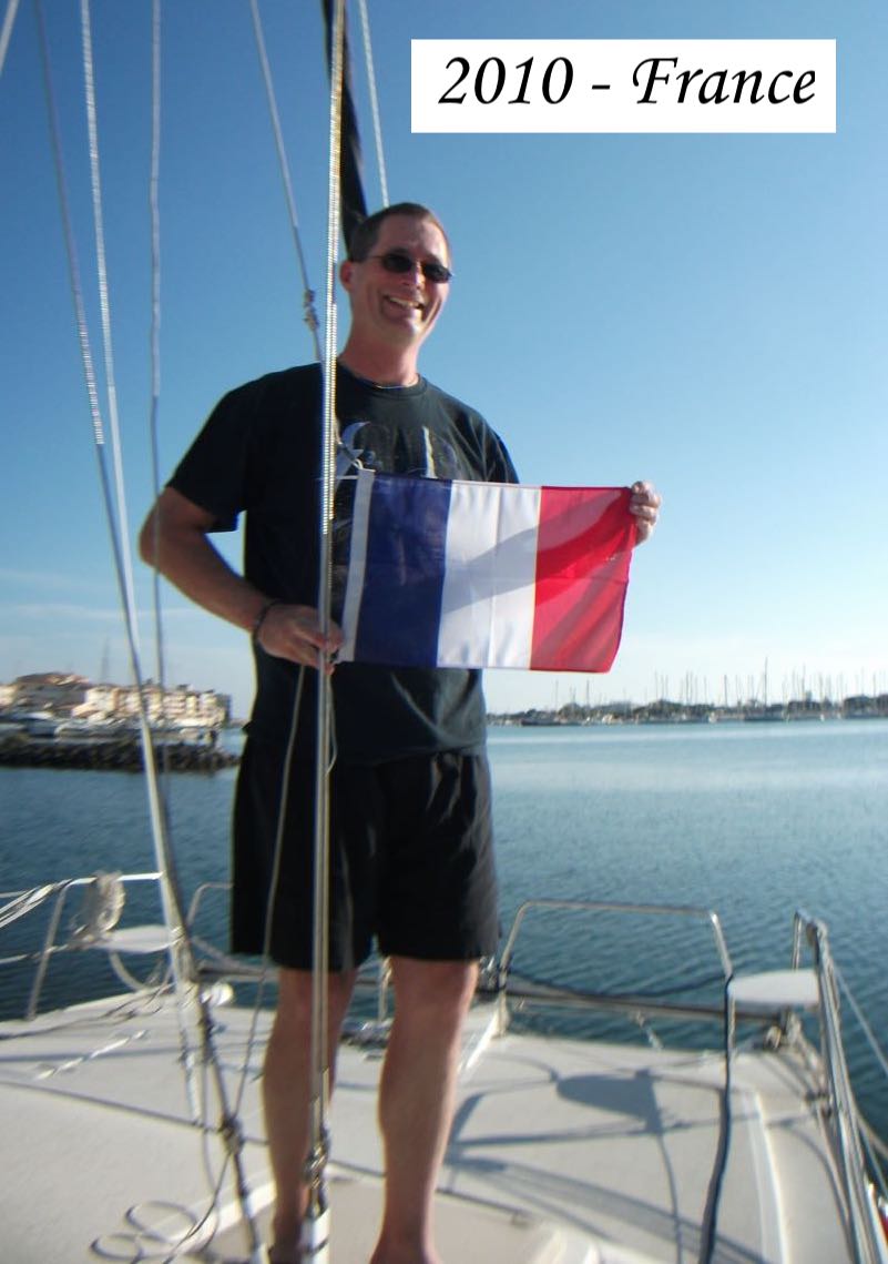


Courtesy flags hoisted on our Travels
1 comment:
Just one word!!! LEGENDS!!!!
Post a Comment