Sunday, May 25, 2025

Passage to the Tuamotus

[Kyle]Our passage from Nuku Hiva (in the Marquesas) to Tahanea (in the Tuamotus archipelago), was not expected to be a particularly good one. This was mainly because our course would need to be across the trade winds instead of with them. Strong winds and beam seas do not make for the most comfortable conditions.

The one thing we had going for us, though, was the distance. It was such that, if we aimed for a mid-morning arrival at the pass, we could either push the boat hard, or take an extra day and take it easy. We weren't in any hurry, so the latter seemed the more prudent option.

Since the forecast was for more wind than we would need along the entire distance, we put two reefs in the main, and then varied the size of the jib to maintain our target speed as we pointed a little windward of a direct line to hedge against wind shifts.

The lower speed made all the difference. Three-quarters of the speed is just over half the impact force every time we hit a wave. Flying off the tops of waves at nine knots and then slamming into the next one is jarring. Doing it at five-and-a-half is much easier on both us and the boat. Even though it cost us a day, and possibly some bragging rights with the monohulls, our passage felt like it would have had we been pointing forty degrees farther downwind. This was made even more so by our hedge, which curved us further and further downwind as we approached Tahanea.

The morning we arrived at the pass, the wind was just starting to ramp up again into "enhanced trades". We entered at the last of the ebb on a rising tide, opting for sails instead of motors for propulsion. Motors can reliably push us any direction, but sailing is faster. The angle was such that, even with the current messing with us, we were never in danger of approaching the edge of the envelope for sailing.

Once inside, we let out the sheets slightly and had a fast sail across the lagoon to the “7” anchorage, so named because it is behind a sandspit that looks like a seven in satellite photos. There's not much there, and it's not the best protected anchorage in the atoll, but for us, that was the point.

The entire atoll at Tahanea is a Marine Protected Zone, and there is no permanent settlement. There are no cellular towers here, no wifi, no stores, no nuttin'. My plan, which Maryanne was kind enough to go along with, was to linger for a while. We would have time to catch up on our photos and the blog. We could turn off our alarms, go to bed and wake up whenever we feel like. We could spend our days as our whims dictate, without the pressure of trying to do everything in a couple days.


Scenes from our passage; from the towering Marquesas to the very different low-lying Tuamotus. The fruit is a green (unripe) papaya which we used in salads, and curries (it was huge)


And safely at anchor in yet another version of paradise!


Anchorage location >> On google maps

Tuesday, May 20, 2025

Hakatea (via a return to Taiohae), Nuka Hiva

[Kyle]My next planned stop was Hakatea (also known as Daniel's Bay). We hadn't originally intended to return to Taiohae. Maryanne pointed out that, since it was on the way, we could pop in easily enough. That way, we could top off our fuel, get some fresh produce, and load up on relatively fast internet. She said we may even have enough time left over to go get another pizza. In my head, all I heard was, "Blah, blah, blah...blah, blah, blah...Pizza!"

Okay, we can divert.

The unfortunate thing was that we only had a small window with no rain, so when we got there from Taipivai, we had to hit the ground running and stay that way until pizza.

We were at home the next day, making the most of our data plan, when a boat full of uniformed officers approached us.

Just a few minutes before, we received a message about tomorrow's championship va'a (outrigger) race. We assumed that since many of the participants had been coming close to us during practice runs, that they were here to tell us we were in the race course and needed to re-anchor.

That turned out not to be the case. They were doing the rounds of the anchorage, checking that all foreign boats had cleared in. They were very courteous and, after passing our paperwork and passports back and forth, told us there would be no need for us to be boarded.


A quick stop for chores in Taiohae also included an inspection of our paperwork (all good)

Having accomplished everything we wanted on our second Taiohae stop, we were now ready to move on to Hakatea.

In the morning, instead of leaving too early, we delayed our departure so that we could have a better view of the va'a (outrigger canoe) race. We knew they would likely be faster than Begonia, so we timed our departure so that we would be able to see them on both the outbound and inbound legs of the circuit.

As the appointed start time came, not only were there no racers in sight, but we couldn't even see any boats in the water in the starting area. We continued on, figuring they would catch up to us. Once we made the turn out of the protection of Taiohae Harbor, another thought came to mind.

The wind was high and the seas were very rough. It looked like a miserable place to be in a small single-seat outrigger, even one operated by an expert. There was no chatter on the radio, but it seems likely that the race was probably postponed until the weather calmed down.

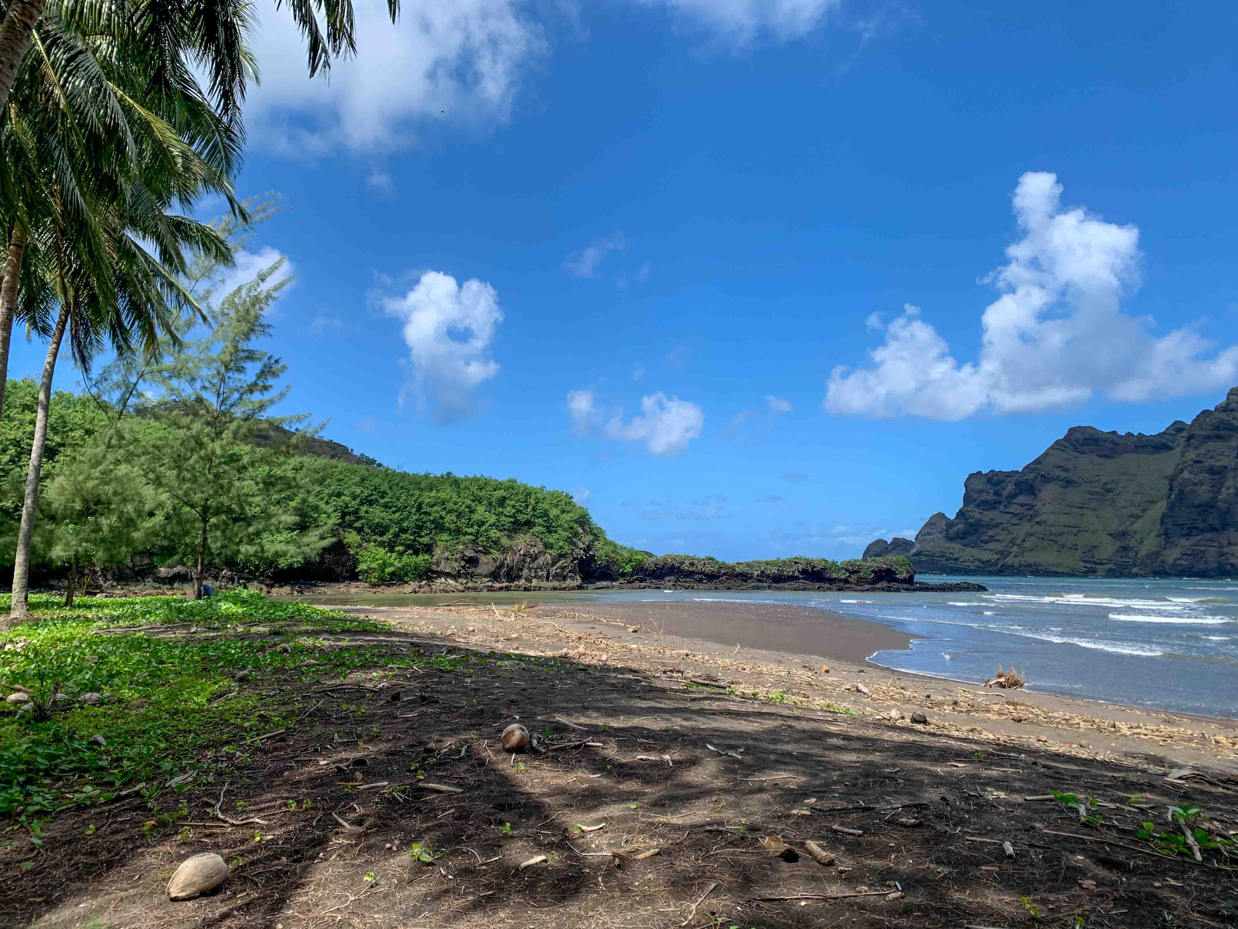
Our short leg was easy. After shutting down the engines, we made five knots or so under bare poles. We didn't even need to configure the boat for sailing. After half an hour, we were close enough to our destination at Hakatea Bay to restart the engines for our arrival.

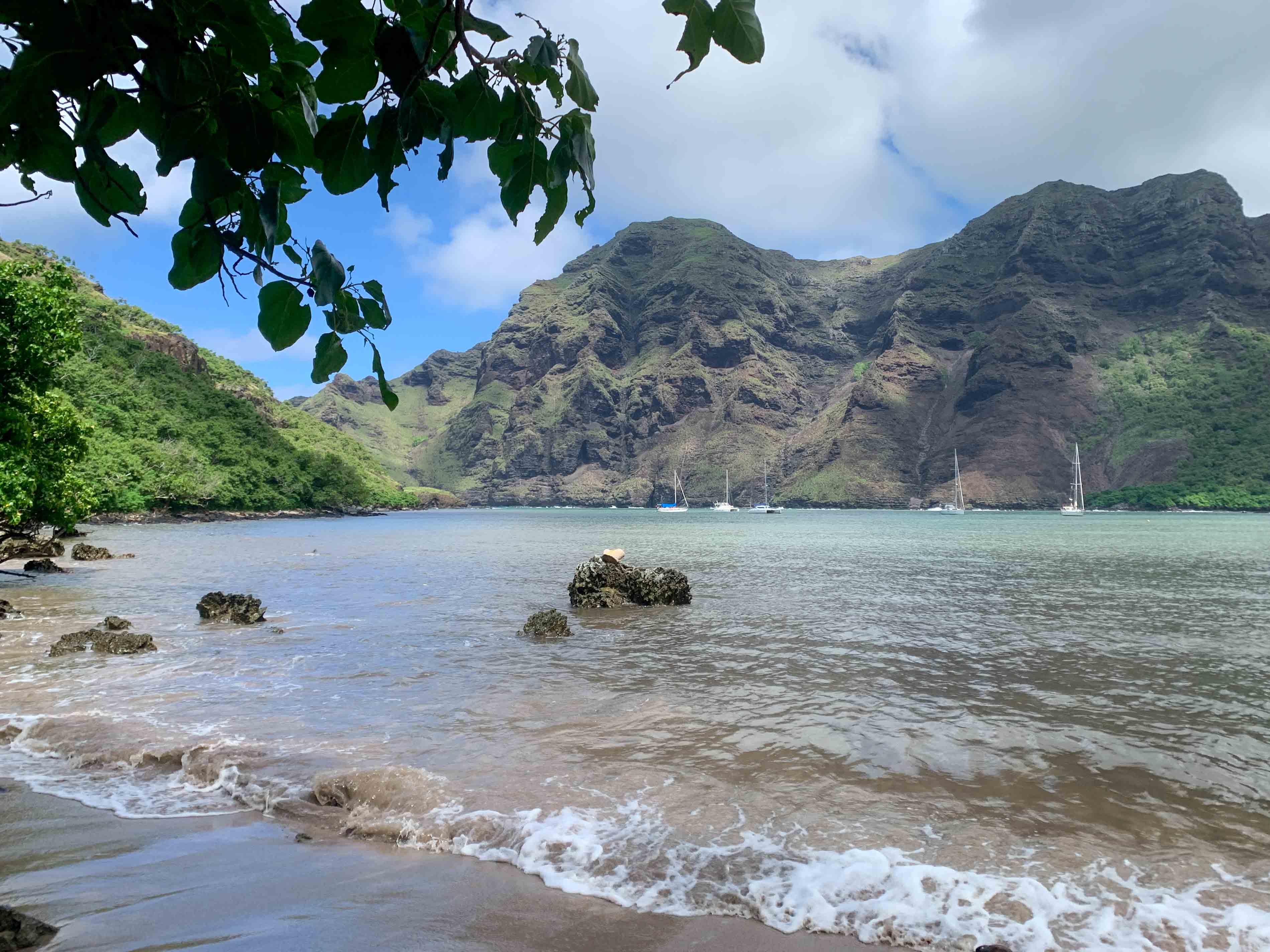
After rounding the headland, the sea flattened. The wind, however, was stronger than ever as it funneled its way through the saddle of the ridge above the bay. We found a spot amongst four other boats and then backed down hard on our anchor to be sure we stayed put.

The big attraction in this most southwestern indentation in Nuku Hiva's coast is the Viapō Waterfall, high up in the mountains of adjacent Hakau'i Bay. Viapō, with a single drop of 350m, is the highest waterfall in Polynesia outside of New Zealand or Hawaii, and the 199th highest in the world.

Since Hakaui Bay has big surf and poor holding, cruising boats anchor at Hakatea Bay. From there, it is possible to take a tender into the river at Hakau'i at high tide, or land at the beach at Hakatea and take a footpath about a kilometer to reach the village.


Scenes from the valley. We've no idea how the vehicles arrived, nor where they go when they get here (since there are no roads)!


The church, the main (royal) path through the village, and dining al-fresco

Maryanne and I had seen the Viapō Waterfall the last time we were here in 2017. Well, sort of. The base of the fall, reached after a 4km hike, is in such a narrow fissure that you can't see most of it from that vantage point. Also, by then, the water has been shredded into mist by the swirling winds, so the waterfall manifests itself as a lot of wet gusts amongst dripping cliffs. Additionally, to get to the last part, a perilous river crossing in fast, deep water must be made. Since we had done all of that before, and since we strongly suspected the recent heavy rains would make the last part impassable, we decided to give it a miss this time. The best way to see the falls would be by helicopter, but the island is too small to support a tour company. The only helicopter on the island is for medevac.

Instead, we took the kayak around the headland to Hakau'i Bay and went as far up the river as we could before grounding. We contented ourselves with an amble through the village and the lower part of the trail, as we watched other groups being led to their doom by local guides. Knowing that it is possible to have a meal prepared with a day's notice, our plan after our walk was to make the arrangements and come back tomorrow.

We met Ta'iki and his wife K'ua back in 2017, just after we had finished a meal with the other family in the valley. They were very nice and we promised that if we ever came back, we would give them our custom.

When we first mentioned that we had met them both before, they didn't seem too interested. They meet a lot of people. Most of the people they feed have just returned from the waterfall hike, with the meal as part of the tour package. When we showed them the photo we took the first time, when they were newlyweds who had just moved to Hakau'i, big smiles came over their faces. Ta'iki was especially amused by what his hair looked like back then.

Now they have a little boy, Pe'a'hē. He is quite gregarious. With no other children in the valley, he decided to make me and Maryanne his playmates, while we waited for our food. After teaching us to count to twenty in five languages, he then started a call and response game with various tongue-twisters. These things are fun for the first couple of repetitions, but quickly become tedious. Kids seem to have a boundless endurance for such things, and he never once seemed to tire of any game he made up for us to play with him. When another slightly standoffish tour group arrived, K'ua produced our meal and told Pe'ah'ē to stop bothering the nice people and go help your dad in the kitchen, which was really a preparation area surrounding an outdoor barbecue made from an oil drum.

Our meal was almost entirely breadfruit, prepared to different consistencies. On our plates, we had fries (breadfruit and yams), a salad of thinly sliced papaya and tomatoes, and a really sweet flambe-banana dessert side. I think Ku'a might have been at a bit of a loss to create a whole meal out of side dishes when we rejected any meat options.

Before we left them, we made a point of taking another photo, this time with little Pe'a'hē in the middle. These days, everybody has WhatsApp, so even though it might be a while, we promised to forward both photos to them the next time we had a signal.


Locals Ku'a and Ta'iki now have a son (Pe'a'he)

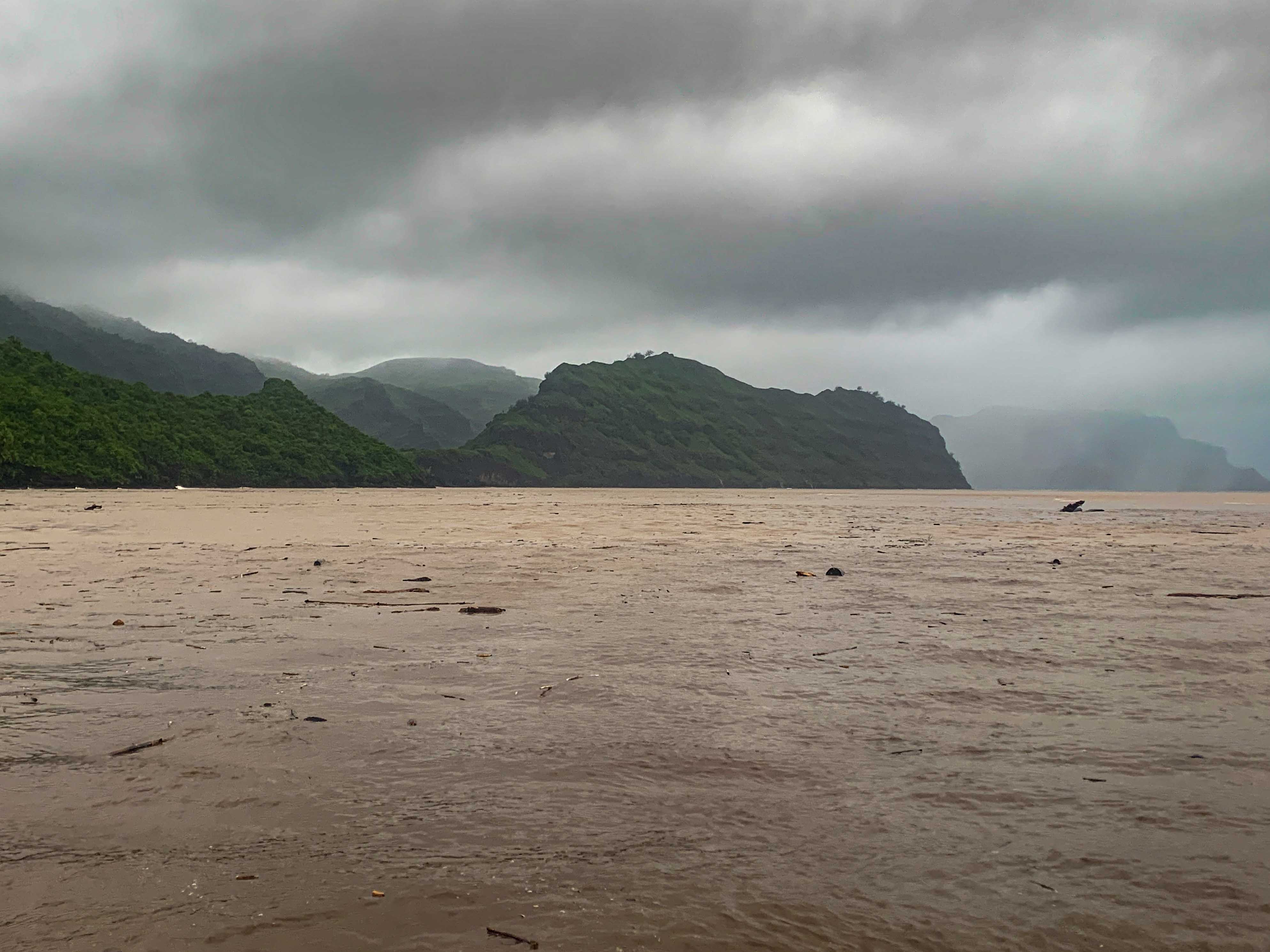
The next day, for some variety, we decided to take the trail from Hakatea to Hakau'i. It was a pleasant shoreside walk, but at the other side at Hakau'i, we found the river to be too fast and deep to cross. Tour groups brought from Taiohae were still doing it, but the operation required funding a big sturdy pole to brace against as you wade through chest-high water. Neither Maryanne nor I saw the point of doing it ourselves, since we had just spent the day before meandering through the village. We returned to Begonia to get ready to leave the Marquesas.


Anchorage location >> On google maps

Thursday, May 15, 2025

Controlleur's Bay, Nuku Hiva

[Kyle]After Hatihe'u, we battened down everything the best we could, and had another really rough sail along Nuku Hiva's east coast. This time, our destination was the first indentation at the southeastern corner of the island in Controlleur's Bay (also known as Hakaha'a Bay), and the village of Taipivai.

This part of Nuku Hiva has an interesting history. Since the island has such rugged terrain, each region is pretty well cut off from its neighbors. In the days before European contact, these discrete regions were home to different tribes that were often at war with one another. The Tai Pi valley, named after the main river, Tai Pi, was home to the Typee, who were generally regarded as the most fearsome and cannibalistic on the island. Such was their reputation that adjacent tribes would seldom even approach their territory. Later, in the Age of Exploration, ships that had first landed in other harbors learned of this fearsome reputation and went to great lengths to avoid Tai Pi. Word spread, and it became a place that almost no ships ever called. In August 1814, Thomas Staines took Nuku Hiva on behalf of the British Crown. He is said to have done this with the consent of the local tribes, with the notable exception of the Typees, who, presumably, everyone was afraid to ask.

Herman Melville's book, "Typee: A Peep at Polynesian Life" was based on his experience living for four months with the Typee in 1842 after deserting his whaling ship and its brutal captain.

Now, Taipivai is a sleepy little village centered around the Te A'itua Tohua ceremonial site.


Scenes from Taipivai

As it was a weekend and we no longer had the need to slog up the hill to the viewpoint for the Kueenui waterfall, we decided instead to visit a roulotte (food truck) perched on the high ridge to the west of the anchorage as a goal for a healthy climb.

Their menu is not exactly high on plant-based, healthy items. I ordered a Croque Monsieur that was basically two sticks of salted butter held together by a matrix of cheese and crusty bread. It was sooooo good! My left arm is going numb. The view from our table must surely be the best of any eating establishment on the island.


The Belle Vue food truck may not have the healthiest of dining options - but what a view! Also a bonus mural showing the legend of the two brothers who originally populated Nuka Hiva, and in particular the brother Taipinuiakavu (who settled in Taipivai)

Afterwards, our plan had been to descend back home, after possibly pottering around in a shop our two along the way. Suitably rejuvenated by our nine-thousand-calorie sandwich, we instead decided to continue climbing up the hill to a second viewpoint about the same distance farther up.

Sure enough, with absolutely nothing on the road between the roulotte and distant Taiohae, the second car that overtook us stopped, backed up, and asked if we wanted a ride. I wanted to say we had missed our airport shuttle, but then Maryanne jumped in and told them we were just headed to the next viewpoint a mile or so ahead.

Like at Hatihe'u, our new acquaintances, Tracy and Cindy, were cruisers with a boat in Taiohae who had rented a car for the day. They seemed to be on a more ambitious schedule than we were and the car seemed more efficient way to see Nuku Hiva for them than sailing around the island.

When we reached the viewpoint, we found it so overgrown that, instead of a look at Taipivai from a high perch, all we could see was the side of a thick stand of trees facing the road. Tracy and Cindy offered to take us somewhere else if we wanted, but we declined and bid them farewell. The leisurely downhill stroll back to where we landed the kayak seemed like a nice way to spend the afternoon.

Like it had at Hatihe'u, it rained in torrents for the next two days. The intensity was unusual, even for the Marquesas, and the local message boards were full of reports of mudslides, downed trees, power outages and river crossings too deep to ford.

The Tai Pi is the biggest river on Nuku Hiva. It didn't take long before runoff turned the blue water of the anchorage into shades of olive green, then dirty bathwater, then finally chocolate milk. A little while later, we started to hear thumps as coconuts and small branches bumped their way by us. When we finally saw a tree bigger than we are coming out of the river mouth towards us, we decided it was clearly time to relocate.


Heaving flooding caused chaos all over the island (scenes shared on the local facebook groups), and pushed all sorts of debris out into the bay

We got the engines started before the tree arrived and then picked a weaving course through the debris to the next indentation in the bay at Ho'oumi. The watershed above this village is small and thus had almost no runoff and the point protecting the bay diverted Tai Pi's debris right on by.

Maryanne and I had earlier been planning on walking from Taipivai to Ho'oumi. There was now only one decent weather day in the immediate forecast and we needed to use it to get back to Taipivai on Begonia. We got to anchor next to Ho'oumi, but we never got to see it.

The reason we needed to get back to Taipivai is that their water source, high up the Tai Pi, is the purest potable water on the island. It would likely be a couple more months before we can get potable water and after coming all the way from the Galápagos, we weren't going to be able to last that long without refilling.

This time, we anchored Begonia closer to the beach on the far side of the river outlet, where we were out of the flow of any debris. At this corner of the beach, one of the local artisans, who makes bamboo wall panels, has kindly set up a hose for cruisers that is long enough to reach the water, thus eliminating the need to lug jugs back and forth.

That's the good news. The bad news is that his particular part of the beach is exposed to the swell. That same swell eventually crushed the loading ramp that was previously at that location into a pile of slippery, ankle-breaking rubble. To get the drinking water, you have to jump onto an unknown surface at an unknown depth, stumble ashore over the boulders to set an anchor, so the dinghy doesn't float away, then stumble back with the end of the hose to fill the jugs. Then you have to hold the dinghy against the swell with one hand, fight with your legs to stay upright on the rocks, and fill the series of jugs with the other hand. Once they're full, the whole process with the anchor and the hose has to be repeated in reverse. Then you have to jump in the dinghy and get out of there before the swell puts you onto the rocks. The whole affair is equal parts exhausting and terrifying.

After figuring out I would need to do five round trips, I rowed Maryanne with me on the first so she would have time to walk to the village and make a pass through the shops, while I shuttle back and forth, decanting water into Begonia's tanks.

She was waiting for me at my third landing. We managed to get her and her haul into the dinghy safely, but just. There was no more room for water jugs.

After the fifth fill, I was dismayed to realize I would need to make a sixth trip to top up our supply. With an average of about eighty minutes per go, I got back to Begonia after dark. I was exhausted, but the dinghy still needed hoisting and with the next deluge imminent, I was sure I would be even less happy doing it later. Maryanne had a big dinner waiting for me on the table as soon as I dried off and came inside.


At his workshop on the beach, Mahinatea (a mastercraftsman in bamboo) shows his talents (see the traditional woven bamboo panels behind him), and generously welcomes cruising boats (offering food from his trees, and even use of a washing machine!)


Kyle filled water jugs, while Maryanne splashed through the muddy trails for one last pass through the village to get to the tiny store "just in case" any fresh produce had arrived (it hadn't)


Taipivai Anchorage location >> On google maps

Ho'oumi Anchorage location >> On google maps