Unlike diminutive Salt Pond Bay, Lameseur Bay is nice and roomy, with room for eleven widely-spaced moorings (anchoring is not permitted to protect the park seabed). It was also much less exposed to the swell wrapping in from the south, so it made for a much more comfortable stay for the few days when the trade winds swung south of east.
There was quite a bit of rain in the next day's forecast, so as soon as we were settled in, we headed ashore for a long walk. Just a few miles away, over the ridge separating Lameseur Bay from the next bay to the west, are a set of petroglyphs we were keen to see.


We didn't expect to see Mongoose on our walk(!), as we walked to Little Lameshur Bay and the start of the trail

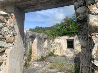


The first stop of interest is the old Lameshure Plantation (Ruins)
The walk wasn't too bad. It seems like the trail may have once been used by land owners on their horses going up and down the hill to the plantation houses higher up, so the gradient never got too punishing.
After descending into the next valley, we took a very steep side trail to a bricked-over ruin that was surrounded by overgrown flowering vines. When it came time to head back down the hill, Maryanne suggested we take an unmarked trail into the woods just to see where it goes.
We were going in the right general direction to meet up with the known trail system, so we carried on until encountering a whole cluster of ruins that may have been stables or possibly living quarters for workers.
When we were finished poking around the site, we were only about a hundred meters from the main trail system, but try as we might, we could not find a hoped-for connector trail to get there. In the end, rather than retrace our steps all the way back up the hill to the first ruin, we decided to find our way through the thick undergrowth without benefit of a trail.

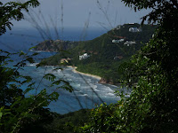


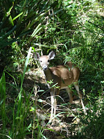
We climbed the trail, enjoying the views when possible up to Reef Bay Great House (gardens and ruins), and spotted a deer on the way (another surprise)
While the distance we had to cover wasn't great, the brambles separating us from the main trail were maddeningly difficult to penetrate. The worst of these was a delicate-looking vine that is covered with tiny thorns as sharp as hypodermic needles.
Getting pricked by the thorns wasn't so bad. The worst thing was that we generally didn't notice at the time. Then, after walking another step or so, the ridiculously strong vine comes taught and pulls the thorns ninety degrees to the direction of entry, shredding clothing and skin alike. By the time we stepped onto the nice, wide main trail, our clothes were covered with permanent snags and stained with blood from the trails running down from the deep scratches on our arms and legs.
A few short minutes later, we had finally climbed the short trail to the petroglyphs. In the state we were in, you could imagine how pleased we were to find the site was at a stream, complete with waterfalls and pools big enough for a cool, refreshing dip.


We took some time at the Petroglyph site, to also enjoy the waterfall and a nice cool pool to dunk in.
As to the petroglyphs, we could make out three of them, which are supposed to date from 800-1,400 years ago and contain the same art themes that can be found on other items, particularly pottery, from the same era.
Refreshed from our dip, we were able to have a little bit of a spring in our step for the first half of the way home, which got us over the main ridge.
On the other side, eager to collect the whole set, we took each side trail that we came upon. We had the same experience at each, where the trail started out nice and wide, but by the far end, we were again scrambling through brambles while trying to chase the thinnest hint of what may or may not be a trail.

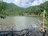


On the way back town to Begonia, we took all the possible side trails
This all meant that by the time we finally made it back to the dinghy, it was a huge relief to take a load off by plunking our weary bones onto the hard seat for the short row back to Begonia.
The next day, we decided to take a break from hiking and just swim around a bit instead. That's how it starts. Maryanne says something like, "Let's go see if there is any coral over by those rocks."
Once we're there, of course, the next set of rocks/coral isn't too much further, and so on. By the time we both finally agree that we've had enough and are ready to make our way home, we are a couple of miles away, have probably swum around a headland or two and are not even within sight of the boat.
On this particular swim, we saw pretty much the same marine life that is typical around here. There was one spot where there was an above average concentration of the pretty purple fan corals, which was nice. Also, a lot of the areas below cliffs had some really interesting topography with canyons, caves and giant boulders from rockfalls. The biological find of the day was while we were transiting the grassy, murky, "boring" bit between rocky areas. I spotted a cowrie shell, which is somewhat unusual. As I was admiring it, I spotted an eel under the adjacent small coral head. They are pretty unusual as well. After getting Maryanne's attention to come have a look, I noticed the eel I had seen wasn't an eel at all, but one arm of an octopus that was trying hard to look like half eel/half chunk of coral.


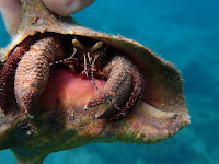

Snorkelling in the adjacent bays and points provided plenty to explore and enjoy
Anchorage location >> On google maps

No comments:
Post a Comment