Our first try took us along some interesting rocks along the shore, but any attempt to climb away from the beach was stopped by impenetrable brambles. We got back into the dinghy and headed further around the cove.
As we were making our way, another dinghy arrived and zoomed over to meet us. On board, there were a couple of young guys, one an Australian living in Holland, one from Germany. They were out for a short holiday from Hobart consisting of two day’s sailing each way, plus three in Bathurst.
This seemed like a regular thing for the boat. We asked about the trail to the top of Mt Rugby. They said they had just returned and that it wasn’t nearly as bad as the various guides implied. Instead of the five to six hour return, they said it was about an hour and a half up, one hour down. The German guy was wearing shorts and his legs were a tapestry of crisscrossing scratches. They suggested that if we go, we wear durable, long-legged trousers.
Our next attempt at a hike in Frog Hollow was the same as the previous one, so we took the dinghy around to the next cove over, Clytie Cove, where we found three boats anchored. Directly on the course we were taking we spotted two guys sitting in the cockpit of one of those three boats, so we stopped by to introduce ourselves.
They were two brothers originally from Romania, Andre and Adrian. They were bundled up against the cold, each holding a beer. They seemed very happy to be on holiday together and very happy to meet us. When they came to the rail to meet us, we could hear the crunchy clanging of other empty beer cans under their shuffling feet. They had just arrived in the gale we had been rushing to avoid and were celebrating their safe arrival. Their plan was to start exploring tomorrow. We bid them farewell and headed to the beach.
There, we found a trail up through the trees to the tundra above. We followed it, thinking it would eventually join with the main one in the distance that we had seen from Frog Hollow. It got to the edge of a thickly wooded bog and then skirted around the edge, paralleling our desired trail. After a while, it became apparent that the two were never going to meet. We retraced our steps back to the dinghy and headed further along to the far side of the cove.
There, as we passed by the day before, we saw a boat landing. Starting just south of here is, the Port Davey track, a trans-Tasmanian trail that crosses Bathurst Narrows at the landing. This southern spur was the ridge trail that we had been eyeing from Begonia. The Park Service has provided two rowboats for hikers to make the crossing to the north side. They were hauled out there.
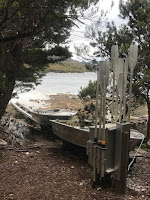


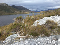
Exploring the Port Davey Track
We joined the trail and after a short climb, were rewarded with views of Port Davey and the western part of the Bathurst channel. We had hoped to get as far as the crest at the far ridge, but it was starting to get too late in the day to make the round trip before nightfall. We set a turnaround time to make sure we didn’t get caught out.

This place is really wild and beautiful. In the distance are huge, rocky mountains that look like they spend most of their time enveloped in clouds. Up close, the tough scrub sprouts thousands of tiny, intricate flowers in all colors.
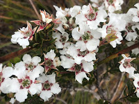


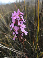
Flowers in the wilderness
Ten minutes before our turnaround, we could just see the top of Begonia’s mast poking above the ridge. We could also see that we had no hope of gaining any more altitude in the time remaining, so we called that good enough and turned for home. It’s good to have a goal.
The dinghy ride was horrible. The wind had kicked up a chop and we had to bash right into it. We had expected this and were wearing waterproofs, but our faces and hands got soaked with much colder seawater than we had had up north. We were shivering by the time we made it to the boat. Fortunately, Begonia has a heater, which had us comfy cozy in no time. It was the first time we had needed it for a while. We were glad everything worked as planned when we started it. We are the only people I know of who seem to save our heater to use in the Summer.
In the morning, we were up with the sun for the hike up to the top of Mt. Rugby. It was the only blue sky, light wind day in the forecast. We took the dinghy across the Bathurst Channel and landed at the beach by the trailhead. Then we started the march upward.
The trail doesn’t bother with switchbacks, but just heads straight to the ridge top above the trees at the beach. We were immediately rewarded with stunning views both directions down the channel.
The trail was a bit hard going. A groove had been worn down in the middle that was one foot-width wide, requiring us to put one foot in front of the other as we walked, instead of slightly to each side. This sounds straightforward enough, but it means that if you get off balance, there’s nowhere to the side to put a foot. In a lot of places, the trench was so deep that we couldn’t get a foot above the wall before tripping and falling into the brambles on either side.

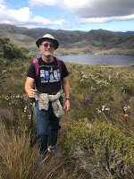

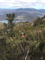


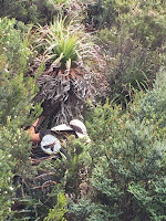
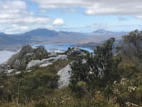


Mt Rugby was a killer for us! Peak is only 771m, but it is a steep hike and a poor trail
We got some relief along the ridgeline, but then the trail took an unexpected plunge into the forest. There, the hole we walked through was maybe five feet high and six inches wide. To get through, we had to push our way through hardwood trees whose finger-sized branches did not want to bend out of the way and were more than strong enough to stop us cold on occasion. The shorter ones had a tendency to stab, which also stopped us moving forward and left lots and lots of bruises. It was exhausting. Not only were we trudging straight up a hill using steps that were thigh-high, we were also being held back by all of the undergrowth and having to constantly strain to keep from being tripped by roots and the ever-present trail groove.
The trail’s twists and turns meant that we immediately lost sight of each other. We kept track of each other by the sounds of our moanings and our cries of alarm as we tripped into the unknown. Every time I landed face first into a thick bush, I kept hoping that southern Tasmania was too cold to have any of Australia’s venomous snakes or spiders.


More wild plants (along with the views) helped keep us going
In fact, apart from very few birds and a couple of skinks, we saw very little wildlife. There was supposed to be wombats in the area, but we had yet to see one.
I assumed it was because of the lack of office buildings. Wombats, or Whomp-bats, are supposedly named after the thudding noise they make when they accidentally fly into high-walled structures. How the beaver-sized critters get up there with no wings is a real mystery.
Our trail emerged from the forest long enough to cross a saddle from our initial ridge to the foot of Mt. Rugby proper. We got more amazing views for our effort and I sincerely hoped the worst was behind us.
Oh, it wasn’t. The trail resumed it’s upward push, only this time, steeper and through thicker growth. Farther along, as we neared the top, it went nearly vertical and required lots of dependence on branches and tree roots to keep our feet stuck to the surface.
Occasionally, a big boulder would break the monotony of the canopy and reveal a little patch of blue sky. We would step out onto it for a rest and be rewarded with even better views than before over a drop so precipitous that we could not see the bottom. At a particularly difficult spot, I left Maryanne behind and tried to scout a way up.
Someone had mentioned that for the last thirty vertical meters, it was a bit difficult to find the trail. The suggestion was to bring some marking material to help find your way back down among the myriad drop offs and dead-ends. People had apparently taken this advice to heart, because it seemed that nearly every tree was sporting a piece of colored tape. There seemed to be no discernible pattern. Did the people who left the tape have the presence of mind to remove it again if they found they had gone the wrong way? Did I put my trust in the blue tape or the red tape or the orange tape?
In the end, I did what everybody else must have done and scrambled in a vaguely upward direction along any route that didn’t seem as dangerous as the ones adjacent. Some places required holding onto half finger or toe-length ledges for support or making careful leaps over big drops onto the next boulder. The first two tries emerged at the top of the wrong boulder pile from the summit, which required undoing the acrobatics of the last ten minutes to traverse.
The three hundred and sixty degree views from the correct summit were amazing. I took the requisite photos and tried to make time to enjoy the vantage point. It was hard to care, though. The climb had turned my legs to jello. The dexterity lost was giving me a halting, wobbly gait. I was worried I would stagger too far and end up sliding off of the side of the boulder into the one farther below, or worse. I just wanted to get off of that rock pile and descend to the relative safety of that horrible trail. I was glad Maryanne had stayed behind. I would have been too worried about her.
Going down took slightly less effort, but was even more arduous than going up. The undergrowth made it impossible to see the surface, so each step was a surprise surface reached after a surprise drop. Whatever it was, it was never level and we twisted our ankles thousands of times on the way down. Or our feet would touch briefly before falling to the following step. At a few of the bigger drops, the hand and footholds were too far apart for Maryanne, so we had little other option except get me into position under her, where I would brace and then let her fall on me.
As we went further, just like on the way up, each segment of the trail was worse than the one before. We were getting more and more tired and limping more and more from the contusions and the strained ligaments. By the time we finally made it to the beach, I especially was just tripping from one fall to the other and being bounced back onto the trail by the shrubbery. Maryanne was a little more under control, but just a little. We both agreed that the Mt. Rugby trail is the most unpleasant stretch of trail we have ever hiked, that includes the 14,000 foot stuff with the boulders and the heavy packs. {Maryanne: We later learned that the park management are now discouraging hikers from this trail until they can re-route it sometime (somehow)}
We took hundreds of photos, as usual. Maryanne made the unwelcome, but not untrue comment that by the time we cull the mediocre ones and edit the rest, it is likely that all we will have to show for our effort is five really nice pictures. Maybe, but it’s also nice knowing that whatever we eat for dinner will be guilt free.
Oh, and our total: Four and a half hours up, four hours back.
We weren’t much in the mood for any big trails the next day. It looked like the next storm coming through would give us a few days of enforced rest. Before it hit, though, we took a quick trip to Clayton’s Cove. There, preserved for posterity by the Park Service is the small home of a fisherman and his wife who settled here after WWII.
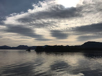

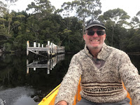


Clayton's Corner on a calm morning
and the views from the nearby hill
Their home was unexpectedly spartan, complete with wood stove and “toilet bucket”. They had a T.V., though, which I can’t imagine could pick up more than one channel. Maryanne and I passed on the big walk up to nearby Mt Beattie, and instead opted for the much shorter trip up TV Hill, where the Clayton’s antenna was placed. It offered good views all around. We didn’t feel like the longer trip was necessary.
Besides, we had to move. The Big Storm was coming, with a forecast for torrential rains and forty-five knot gusts. We needed to get somewhere where we could safely wait it out.
We opted for Rowitta Harbour, at the northern end of the larger Bathurst Harbour. It is protected behind a screen of tall trees, but is far enough from Mt. Rugby to be safe from any gusty katabatic winds roaring down the mountainside, known here as “bullets”.
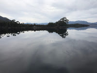

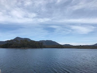

The calm before the storm(s) as we moved to Rowitta Harbour
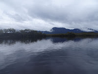

There are supposed to be large flocks of black swans there. We only saw them from a distance or flying quickly while heading for shelter.
Mostly, the wildlife did what we did over the next few days, which was to lay low and wait out the weather. The rain slashed at us and the wind howled. Sometimes, it felt like the gusts were going to pick us up and fly us from our anchor like a big kite.
We passed the time catching up on little jobs that we had put off too long. Maryanne was eager to get caught up on a bunch of sewing projects that had been piling up. It seemed like an ideal time to do it since our wind turbine would be producing enough power to run the machine all day.
Well, there’s no such thing as a five-minute job. Her day of sewing turned into two full days for both of us. She would sew until the machine went “Clunk!”, then it would be my job to fix whatever went wrong with it.
For some reason, the jackass who designed our sewing machine did so in such a manner as to require its complete disassembly and reassembly for every minor adjustment. Oh, how nice it would be to have a little adjustment screw that is in plain sight, instead of buried in the bowels of the thing behind all of the other machinery.
The good thing, I suppose, is that I now know its every cog and spindle and can do a complete overhaul in under an hour. I did six. We like our machine because it’s old and made of real metal and it can easily punch a needle through three layers of leather wrapped in four layers of denim (or eight layers of sail cloth), but it is very temperamental and I really don’t want Maryanne to do any more sewing projects for a while.
The weather improved slightly, so we used the opportunity to move Begonia across Bathurst Harbour to Moulter’s Inlet, where we hoped to at least take the dinghy ashore for an amble on the beach.


Moulter's Inlet - with a few brief spells of sunshine
Moulter’s has a very narrow, shallow entrance that keeps most of the monohulls anchored outside. The wind was way too bad for that, but it was protected from the chop on the inside.
We dropped our anchor in the deep (2.3m) spot right in the middle. Again, we were all alone in what looked like a lake surrounded by steep mountains that plunged right down to the shore.
There were obviously no trails around, but we were keen to get the dinghy down and look about. That was until more wind brought in more sheets of rain. We waited and waited, peering out the widows for a break in the weather that never came.
The next morning’s weather downloads predicted weather at least as bad for the foreseeable future. We knew the trails in the Bathurst area would be downright dangerous after all of that rain. They are bad enough when dry. We decided we didn’t want to burn through all of our Tasmania time waiting for decent weather in Bathurst. Instead, we would take the first not-too-terrible window to the east coast, where it tends to be drier, calmer and warmer.
To get into position, we motored the dozen miles from Moulter’s to Bramble Cove, just at the entrance to the Bathurst Channel. It was supposed to be clearing and calming as the day wore on, but instead, we had heavy rains and cold, thirty-knot headwinds.


Relocating to Brambles Cove - thank goodness it is summer time!
Mounting an expedition in slashing rain to squish up a muddy trail to an obscured view didn’t seem like as much fun as it sounds, so we gave up on that idea as well. We had to settle for a nice view of Mt. Stokes looming over the anchorage during a brief parting of the clouds before sunset.

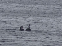

Mt Stokes, and a brief glimpse of the black swans between downpours
Five-plus meter seas and forty-five knot gusts along Tasmania’s southern coast kept us pinned in at Bramble Cove for a second night. Conditions in the anchorage were slightly better, but even going out into the cockpit was a miserable experience best done in only short bursts. The wind and waves are supposed to be only two-thirds as bad in the morning, so we’re hoping that will be good enough to get us around to the more protected eastern side of Tasmania.
