

Our forecasts were for winds between twenty and twenty-five knots, with gusts eight to ten knots higher. I timed our passage across the convergence zone just after high tide. That should be when the currents are spreading apart and not too strong. Then we could ride the last of the flood going west.
The transit wasn’t so bad for us. When the seas started building, our wind was about twenty-three, gusting to twenty-eight. We opted to sail the extra few miles it would take to stay in water deeper than sixty meters and I think that helped. We ended up with about forty minutes of uncomfortable medium washing machine before things calmed down again.
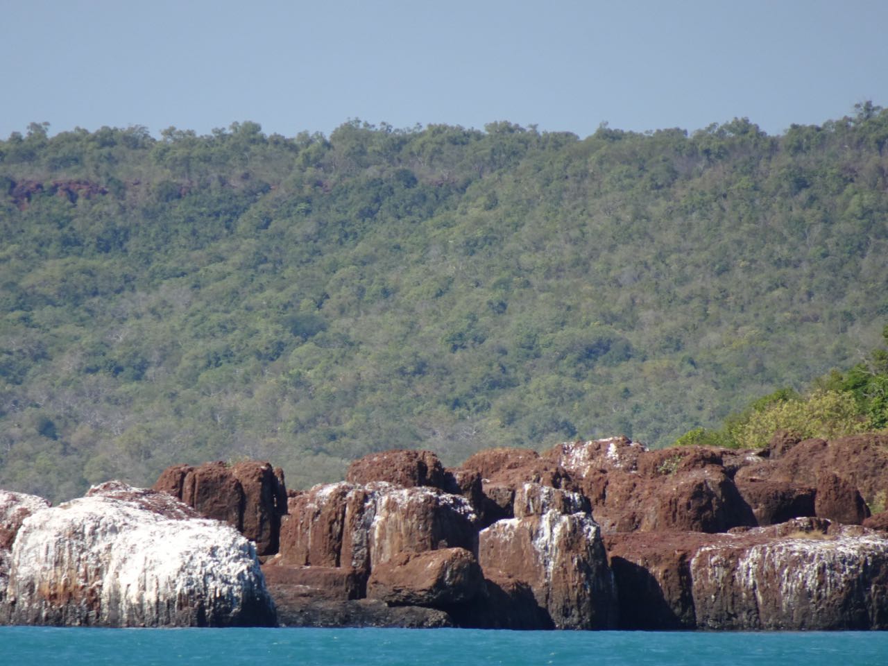
West of Cape Londonderry, the tides get bigger the farther west you go. All of that water swirling in and out of those bays and around the islands make for some strong currents. There were times when our day’s run was helped by a five-knot boost.


Sailing West - to Cape Talbot - we often had to double check if things on the water were logs, crocs or rocks.


Sailing West - Sunsets, sunrises and the occasional infrastructure mark the passage (this is a support center for the even more remote oil rigs

Sailing West - to Parry Harbour


Sailing West - to Krait Bay (Admiralty Gulf)


Sailing West - into South Montague Sound
On the fourth day, we finally arrived at South Montague Sound. There, the tide range is about seven meters and there are whole huge areas of the charts that are blank and marked ‘Unsurveyed’. This is a bit unnerving, so we tried our best to not stray too far from the recommended routes in our guides. Tacking from one side of the sound to the other to have a look at the scenery is out. That’s what the dinghy is for.
We set the anchor a quarter of a mile east of the unnamed islet south of Palm Island, near the junction of the unofficially named Four-man Creek.


We used the dinghy to circumnavigate the small unnamed island we were anchored near, and Maryanne explored ashore at low tide too - one of many such places around the bay


This Tawny Nurse Shark visited at the boat regularly


Sunsets make for a lovely end of the day
The nearby 'Four-man Creek' is navigable by dinghy for four miles and has lots of Bradshaw paintings, most notably a painting of four people in a canoe just a short walk past the head of navigation (hence the unofficial name). There are also two other sites in the creek where it is possible to see large paintings of animals without even having to leave the dinghy. At one point, we even saw a real animal as we turned into a tributary to see where it led. There, we saw two tree trunks sliding against each other. Then we realized it was only one tree trunk. The second was the tail of the croc behind, heading into the water. Perhaps we’ll give that one a miss.


The Kangaroo Rock art (at Four Man Creek) can be seen from the dinghy


We took it slowly up (and back along) Four Man Creek, enjoying all the inlets along the way. We saw one other boat exploring, and were 'chased' by a shark for a stretch (thankfully on the way home). Kyle's convinced it was a Hammer Head, but I only saw the tail thrashing to keep in our wake. I like to think he was just enjoying the tubulance and meant us no harm (since he could have easily caught up to us with our slow motor).
Farther down the creek, I was checking behind us for any suspicious wakes, when I spotted a fin tailing us. As long as it wasn’t a tail with two rows of scales or a pair of eyeballs. Barramundi do this pretty regularly, but this one was too big for that. It got closer and I could see it was a two-meter shark. We had a gorgeous Tawny Nurse Shark circling around and under Begonia for a couple of hours the night before. I thought it might be the same fish, but this one looked whiter. As it came closer, I could see the distinctive hammerhead. I’ve never seen one of those in the wild. I stopped the motor to get a better veiw, but then it lost interest and dove away.


At the naviable head of the creek, we found the '4 men in a boat' and a host of other rock art at this beauitful site


Another side arm of 'Four Men Creek' offered yet more rock art
After Four-man creek, we had just enough time left in the day to head to Five-man Creek, where a painting of, you guessed it, five people in a canoe can be seen only a short hike from the water. Five-man has slightly less art, but is by far the more stunning of the two for beautiful scenery of the surrounding area. We had needed to work the tides to get up and down Four-man Creek. That left us with not nearly enough time in beautiful Five-man to explore and gaze at the vistas. We knew sunset was coming and all of the area’s crocs would be waking up to hunt soon. We reluctantly returned to the dinghy and sped home.


And before the sun faded for the day, we rushed to see 'Five Men in a boat' at a diffent creek (also beautiful to explore)
In the morning, we moved Begonia further up the bay to what the cruisers have dubbed ‘Cave Beach’. We had no idea what to expect, other than it was supposed to be a nice beach with some interesting rock features.
Uh, Wow! There are some really nice structures of wind-sculpted sandstone bookending the beach, which is not sand, but almost entirely made up of shells. As we approached the cliffs at the northern end, we could see several passageways leading further into the hill. Further exploration revealed the whole headland to be a porous labyrinth of crisscrossing passageways. Oh, what an amazing place to play Hide and Seek! Maryanne and I tried, but we always found each other.


We LOVED exploring the sculpted rocks (and passageways) at 'Cave Beach'
The south end of the beach had the same type of erosion as the north end, but at an earlier stage, with the passageways all being too small to fit through. Behind the beach between the two ends lay a central jumble of boulders, which made for some challenging scrambling. Maryanne was the first to notice that we were on the remains of a section that had collapsed in upon itself. The whole place was endless fun to explore.
After the tide started rising, we moved Begonia a few miles north to the eastern end of unsurveyed Wollaston Bay. Again, we were chasing a tip from Michael about some art near there. We headed to the small beach nearest to the location he had given us. After some poking around, we spotted the well-worn trail into the interior.


More Rock Art and beautiful scenery at Woolaston Bay
After about a hundred meters or so, we came to two different caves with lots and lots of Bradshaw art. Most notably, there were several 'mouthless' paintings of human figures with halos. These are believed to be either shamans or spirits. Some of these were even painted in rarer yellow pigments. Each surface was so busy that we kept spotting new things everywhere we looked.
As we were studying the ceiling, a tour group arrived from a small ship that had anchored a little farther out than Begonia. Like us, they were all smiles at both the quantity of art and at the privilege of even being here in such a beautiful and remote place to see it in the first place. We sighed at thoughts of the spread to which they would be returning (ice cream!). When they all hastily loaded up and returned to the main boat, we realized the beauty of our budget cruise was that we get to set our own pace. After they left, we lingered on the beach for over an hour, just because we could. There was lots of beautiful and interesting stuff here that they just didn’t have time to see. Plus, there’s always a chance the big boat will send over some ice cream before they haul anchor...


Exploring a different beach at Woolaston Bay (there are wasp nests under many of the overhangs in the Kimberley)


Such beauty
Next, we hauled our own anchor and headed west to the unnamed island north of Winyalkan Island. The draw there was supposed to be a cave in a gully behind the main beach. This was not the case for the guests of a posh cruise ship anchored around the corner at Palm Island. They had been taking helicopter tours of the area all afternoon. While they did that, several of the ship’s tenders arrived and started disgorging supplies onto the beach for what was clearly looking like sunset bonfire party.


Some boats arrive with more toys than others, but we all get to see the same views (at least from the boat)
The main ship arrived shortly thereafter and anchored behind Begonia. Then passengers were shuttled over to the waiting line of chairs on the beach. Before the actual sunset came, most of them dutifully sat in their chairs facing the glaring sun, squinting and shielding their eyes until it became low enough to be bearable. About half an hour before it set, the fire was lit and the drinks were served.
Once it was dark, we noticed a fire dancer, like the ones we had seen in Fiji, putting on a show for them. I guess being near the water in croc territory at sunset is less dangerous if there is a large group making lots of commotion to scare them off. Their MO is to go for the one that strays too far from the group. It looked like a nice place to enjoy the sunset, but I can’t see just Maryanne and I attempting it alone in our little dinghy.


Ashore at 'sunset beach'
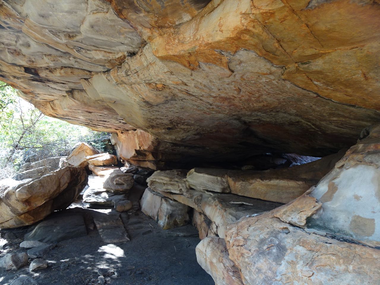
The cave was okay. It’s less of a cave than a big crevasse with a few boulders wedged in to act as a ceiling. As such, it was well-lit and airy, although not a place you to which you could retreat to escape a rain shower. After five minutes of poking around, we had pretty much seen it, so we headed back to the beach. I thought we were on our way home after a refreshingly short day when Maryanne started scaling the boulders on the south end of the beach. Well, maybe one more thing.
She eventually reached what was a dead end for her, but not necessarily for me. I pushed on, just to see if there was anything worth seeing. When I got to where I could see over the ridge, I found a gorgeous set of tidal pools backed by orange cliffs. I decided to add one more thing to the day by seeing if I could get Maryanne there in the dinghy.


The lovely site we 'discovered' and called '3 lagoon inlet'. As the tide falls these pretty pools remain (it was tempting but we were not certain how croc safe they would be)
Once we had done that, Maryanne started a series of, “Let’s just go a little bit further to the next cove.” pleadings that eventually led us on a pretty comprehensive tour of the whole anchorage area coastlines. Everywhere we stopped was beautiful and each was different from any of the others. It turned out to be a lot longer day than we had planned, but we were happy at what we had seen.


Winyalken Inlet


'Beachcombers Beach'


And lots of unnamed island exploring
[Maryanne]Thinking of visiting the Kimberley with your own boat? – Check out our Kimberley Tips