Tuesday, November 27, 2018

On to Whangarei

[Kyle]The frontal rains of the last few days finally moved off into the ocean to the east, taking the associated winds with them. From Tutukaka, we had a slow sail all of the way down the coast to Whangarei Harbour, arriving at the entrance just as the ebb shifted to a helpful flood. We went up the Hatea River to the very last anchorage and dropped our hook for the night before heading to the marina in the town center the following morning. We were right by Norsand Boatyard, where we did our refit a year ago before heading off to Chile. We’ll be back soon and hopefully our list will be a lot shorter than it was then.


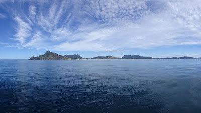
Views from our Tutukaka-Whangarei sail

In the meantime, we headed up to the marina and were assigned exactly the same slip we had been in the year before. The place was the same as we remembered it, but most of the surrounding boats were different. It was a little surreal. We were immediately welcomed by people from boats we've met through the year - it felt good.

We were in less of a hurry than last time, so we made a point of heading off immediately to walk the pretty waterfront paths and carve out a little time for some fun. We knew we would be busy enough when we were hauled out, so we stopped ourselves whenever we felt like we were getting too bogged down in haulout related planning and took a break for a walk and some time to appreciate our surroundings.

We also carved out time to spend both evenings with our South African friends Rob and Muzzi from Lalamanzi, who we had first met in Suwarrow and liked immediately. Ever since then, if we know they’re around, we always look forward to seeing them. We pretty much came to the marina before haulout because we knew they were there and they were about to leave to go explore the South Island by road. We didn’t want to miss them. Each night, we got to be on the boat from which peals of laughter rolled across the harbor. (Coincidentally, we were moored right behind another South African boat the year before: Jadean)

The time flew by far too quickly, though, and before we knew it, we were anchored in front of Norsand again, ready for the next day’s lift. The cool, clear morning turned into thunderstorms and a whole afternoon of rain in sheets. Maryanne prepared a big batch of “Anniversary Soup” to keep us warm (a recipe we got from a pub in Scotland on our seventh anniversary), and we spent the rest of the day getting ready for what is to come.

Friday, November 23, 2018

Tutukaka for Thanksgiving

[Kyle]From Whangaruru, we sailed down the coast to the epicenter of North Island sport fishing, Tutukakaka. We had plenty of wind and depending on whether it was being blocked by a hill or funneled by a valley, we alternated between a nice sedate sail (crawl) and a fast romp, kicking up rooster tails in our wake.


Views from the sail between Whangaruru and Tutakaka
There were very few boats, but plenty of wild fish activity with large patches of ocean suddenly splashing with activity.

When we finally got there, the narrow entrance was hidden behind the giant boulder of Tutukaka Head. We knew it was there, though, because every now and then a fishing boat would suddenly appear from out of the cliffs as if by magic.

We made our entrance by passing a few boat widths from the cliffs, heading directly at some nasty looking rocks and then making a ninety-degree turn through the narrow entrance just before we hit them. Inside, perfectly protected from the conditions outside, were several placid little coves dotted with boats swinging on their moorings or at their anchors. We placed ours between the edge of the moored boats and the channel to the marina. What a beautiful spot! We were surrounded by tree covered rocks and beaches of red and yellow sand.

We were just getting ready to go out and explore when the skies opened up and drove us back into our dry cabin. Never mind that plan. Maybe it’s an indoor kind of day.

Ten minutes later, bright sunlight cast crisp shadows through the cabin windows and it started to rain even harder, making everything seem very sparkly. What the hell‽ Ten minutes after that, the rain stopped and the sky turned a brilliant blue. We decided to launch the dinghy before it began to snow.

It never did. We had a nice leisurely row to the dinghy dock at the marina, making a point of tracing our way along the convoluted coastline. Once we were ashore, we poked around a little until we found the path to the light on Tutukaka Head. It started as a stroll down a quiet street through some very lovely homes, all with amazing views along the coast. Then it turned into an easy walk across the grassy pastures at the ridgeline. Along the way, there were plenty of benches on which to pause for a moment and enjoy each particular vantage point.

After a while, the meadow ended and the trail turned into an unbroken set of hundreds of stairs that plunged down to the beach below. There, at low water, a thin strip of land crosses over to Tutukaka Head, passing several tiny coves on both the ocean and the harbor sides.

At the far side of the beach, the trail starts up steeply again and wraps its way around the little island as it climbs. There are regular gaps in the trees, which always caused us to stop in our tracks and gasp at the beauty before us. This place is REALLY nice!

Finally, the trail made one last steep ascent before emerging at the navigation light on top of the hill to 360 degree views of the whole coast. Wow! The coast to the north is beautiful. The coast to the south is beautiful. The harbor with all of its picture perfect coves is beautiful. Even the ocean, which should look like any old ocean, was beautiful because there were a bunch of sublimely rocky islands in the middle distance. What a place! We were so glad the rain had stopped.

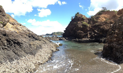
Sunny skies for a beautiful trail

We retraced our route back, amazed at how pretty all of the same stuff was from the new angles and with a different light. We weren’t feeling ready to call it a day just yet, so we popped into the Fishing Club for a beer and a game of pool. The Fishing Club serves as the Yacht Club, since most of the boats in the area are sport fishing boats. The walls were adorned with GIANT mounted trophies and pictures of proud fishermen being dwarfed by their catches as they hang from the crane along the wharf. There were more examples than we could count of fish that were twice as long or twice as heavy as their captors. One surprisingly skinny little guy caught a 325kg (715lb) Marlin that was 5.3m (18’) long!

We just made it back to Begonia before the rain returned, creating the perfect cozy atmosphere for a traditional warm Thanksgiving dinner.

Wednesday, November 21, 2018

Whangaruru Harbor

[Maryanne]Yes, Whangaruru, and I know, the previous post was Whangamumu; fun isn't it? It helps once you know that Whanga means 'harbour' in the Maori language. Ruru means shelter or refuge, and mumu has several meanings that may be relevant here: Warrier, beetle, or rough winds! And all this I know becuase of an online Maori dictionary and app. Specifically we anchored in Oakura bay within the harbor. If you believe the internet The Maori word Oakura is said by the local Maori Elders to refer to the phenomenon of the "AO-A-KURA" which means "the light - that comes with - the red sky" as experienced at sunrise and sunset. Once Anyway... back to Kyle.


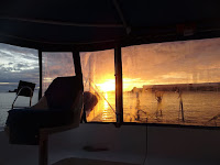
Oakura is famed for its sunsets!
[Kyle]We had another early departure to another Whanga. I think it must be like Mill Creeks in the Chesapeake – they’re everywhere.

Our sail started off nicely enough. We had a leisurely downwind course past the rocks and cliffs of the coast. The rain beat us to the anchorage this time, though, and we spent a significant stretch of it hiding from it under the cockpit enclosure and bundled into our proper foul weather gear. We were lucky enough to get a break just long enough to set the anchor at Oakura Bay before it started up again.

This area is very pretty. Unlike unpopulated Whangamumu, Whangaruru has lots of little coves edged by crescents of tan-colored beach. Behind the beaches, clusters of baches climb up the hillsides like vines looking for the best light. (Baches ,pronounced 'batches', are what Kiwis call their vacation cottages, traditionally very basic, but sometimes very grand indeed!) With the green hills in the background and the big rocks out to sea, I imagine this is kind of what Sausalito must have looked like fifty years ago.

{Maryanne: with the rain and the forecast, we didn't take the time to go ashore here, but hunkered down and relaxed, and enjoyed the views.}

Tuesday, November 20, 2018

Whangamumu Harbour

[Kyle]After Oruruhoe Bay, we went all of two miles all of the way to the corresponding spot on the other side of the Cape Brett Peninsula. To get there, though, we had to sail all of the way around the thing. We did the same as before, just unrolling enough jib to keep us moving, but not enough to block our views. We sailed close under the cliffs, alternately thinking it looked like we were in Northern Ireland or Scotland or Maine or Northern California. In truth, I guess it looks like New Zealand. Either way, we couldn’t help marveling at it.


An early start for rounding Cape Brett

As we passed the lighthouse and the keeper’s cottage at Cape Brett, we got the answer to one of the questions that had been bugging us: How did they build a road there?

They didn’t. There are a few long hiking trails to get there, but the light itself is serviced by helicopter. Since there’s no flat spot to land, the helipad sits out on an enormous platform that probably took more stone to build than the lighthouse and the cottage combined. A bridge then connects the platform to the 60 degree cliff alongside. The cottage is built into a flat spot that has been blasted out of the hillside and a long path zigzags to the lighthouse itself high above.

In spite all of this obvious effort, Cape Brett lighthouse still has a less than perfect view of the sea below. Several sectors are obscured, including a very large one in the direction of vessels approaching perpendicular to the island from offshore. That sector is blocked by a very large rock pierced by a very large archway known colloquially as “The Hole in the Rock”. If you visit the Bay of Islands, you can choose from lots of tours that include being sped through on a boat, snorkeling, diving or even landing on top in a helicopter. We were trying to beat the rain, so our early morning departure got us there before the crowds arrived.

Whangamumu appeared as a small indentation in the coastline. After s-turning our way in, we anchored in the middle of a completely calm bay with only a sliver of open ocean visible through the gap. A New York realtor would bill it as a complete view of the WHOLE Ocean.

The bowl of the bay was lined with a layer of mature deciduous forest separated by meadows of grass and ferns. We were keen to climb all over the place.


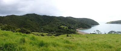
Blue skies (for a short while!)

The very moment we got the dinghy into the water, the skies opened up and it started pouring. We cancelled our hiking plan and hoisted it back into its nook in the transom. I changed out of my wet clothes and the moment I put on my last dry item, the sun came out and shone brilliantly. Of course… We put the dinghy back in the water again.

We rowed over to the remains of the old whaling station and poked around the ruins for a bit before reboarding the dinghy and heading to the beach at the head of the bay. We found the trail leading up to the ridgeline and started climbing through tall grass with the goal of seeing over to the Bay of Islands on the other side.


Exploring the old Whale Station which once processed 50 whales a year (all herded into the bay for capture)

No sooner had we entered the forest at the top of the clearing than it started raining again. This rain was not Tropical, meteorologically speaking, but Temperate. Tropical rain forms when water droplets at altitude bump into each other and coalesce until they are too heavy to remain suspended. It is wet. Temperate rain forms when frost forms on other frost until it becomes too heavy to remain suspended. It melts on the way down, but just. It is wet AND cold. We decided that was enough of an outing for the day and headed back home.


Kyle could not resist the view from atop a hill before the next wave of rain!

We had just finished changing out of our second set of wet clothes when the rain hitting the cabin top started to get louder and louder. The rain changed to gravel-sized hail. Hail! – little frozen pea-size ball-bearings of water! I knew that rain was cold.

Monday, November 19, 2018

Oruruhoe Bay (Bay of Islands)

[Kyle]From Russell, we had a very pleasant sail through the Bay of Islands to Oruruhoe Bay, just across the channel from Urupukapuka Island, where we had so recently enjoyed our evening with the Cruiser’s Festival. We were enjoying the views so much along the way that we deliberately slowed to a crawl so we would have more time to enjoy them. We anchored in the small bay amidst clusters of rocks that encircled it and protected it from any swell whatsoever.

The views were almost too pretty to bear. From our spot, we could see almost the whole Bay of Islands. The craggy rocks in the foreground were backed by small islets covered in tufts of trees. Beyond them across the water were rolling hills of green pastureland dotted with big shade trees fanning their boughs over wide shadows. Looking further still, the mountains in the distance rose up to sharp peaks capped with a layer of thick conifers. The whole place smelled of pine and eucalyptus. It was a lovely anchorage to just sit and watch the sun set.


A little too overcast for the photos to do this area justice

Sunday, November 18, 2018

Visiting the town of Russell

[Kyle]Our first stop after leaving Opua was Russell, known previously to the Mauri as Kororareka or “sweet penguin”. They have penguins here. We haven’t seen any yet.


We anchored in the bay of Matauwi - just a short walk around the corner from Russell

Russell was the site of first European contact with Aotearoa (New Zealand) and briefly served as New Zealand’s Capital before it was relocated to Auckland and then to Wellington. The town’s history has passed through several phases as a rough and lawless whaling port and the site of several important skirmishes in various Mauri/European wars. Now it has settled down as a quiet and quaint tourist stop that can be taken in completely in half a day of ambling around. We found it to be very charming.


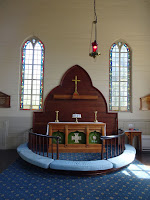
Christ Church looks very basic, but embedded in the stained-glass window borders are quaint features of whales, penguins, ships, etc.

We went to the museum and the other one and made a point of stopping in for a drink at New Zealand’s very first pub, located in the Duke of Marlborough Hotel. To some the Marlborough is also considered the oldest pub in New Zealand - that is if you ignore that it has burned down four times in since it opened in 1827. Russell also has the countries oldest church (one that Darwin actually contributed to the building fund of).


We were the only tourists for our tour of the Pompallier mission house (with printing press and tannery, and beautiful gardens)
Not the case at the Duke of Marlborough Pub - that was much busier!

Mostly, we just enjoyed strolling around under the shade of big, leafy trees, looking out at the beautiful seaside scenery. This is, of course, an activity that is best appreciated with an ice cream in one hand.

{Maryanne: It is so nice to be a tourist again. After the rush of activity on arrival, we now have a short window of dedicated 'fun' before our scheduled haul out. I'm loving it!}

Saturday, November 17, 2018

Opua (Bay of Islands)

[Kyle]We splashed out and stayed at the Bay of Islands Marina in Opua for four nights after our arrival. I LOVE Opua! The marina is nice and modern, the staff are all super nice and everything you could possibly need or want for a boat is right there. There are canvas shops, electricians, diesel mechanics, outboard mechanics, riggers, sail makers and chandleries all within walking distance from the docks. {Maryanne: And laundry facilities, and a shuttle to the nearby supermarket}. In addition, they have pubs, restaurants, fish & chip shops and a respectable-sized grocery store, all of it with the hilly, tree-covered backdrop of the Bay of Islands.

It was so nice to be able to blast through our pent-up shopping list of boat supplies after months in the islands. Here’s an example of one of Maryanne’s experiences:

Maryanne (at an electrical shop), “Hello, I’m looking for some tiny little electrical spade connectors for the sensor wires on Raymarine instruments, would you have something like that?”

After looking in the back, the guy returns and says, “Nope, we don’t have any. Try the guy two doors down.”

Two Doors {Maryanne: Kyle has become enamoured with the punctuation mark 'Interrobang' - a combination of the exclamation mark and a question mark... Sigh!}

She goes two doors down, repeats her request to the new guy. He does the same thing; goes to the back and returns to say he doesn’t have any, BUT he can have some in by tomorrow morning at 8:00. Eight o’clock…the NEXT morning! Not, “Maybe on the next freighter in three months, except that you would have needed to order them a week ago. They’re $100 each. In the meantime, try aluminum foil.” Brilliant!

Each day, when we got done with our day’s boat jobs, we made a point of going out to attend the BOI Cruiser’s Festival event of the evening. Our favorite was a high speed tour boat ride through the islands (where the captain pointed out interesting anchorages for future exploration) and out to a dinner at Otehei Bay on Urupukapuka Island. The scenery along the way was amazing. We had a nice meal with interesting people and even had enough daylight to hike to a viewpoint atop the island for views of the bay at sunset.


Evening Cruise through the Bay to Otehei Bay on Urupukapuka Island

We finished our time off at Opua with a long coastal walk from the nearby town of Paihia and Quiz Night at the Boat Club. Even though our group of two had the smallest number of brains to call upon, we shot WAY ahead on the first round: Science, getting every question right, plus the double score bonus. We peaked too early. After that, we slid back further and further through the pop music round, one on New Zealand Political minutiae, one on Obscure New Zealand historical events and an incomprehensible one about acronyms used by various New Zealand government departments. The Kiwis thought that one was easy. What the hell is the NMTPRQ? By the end we had slipped to dead middle, which was at least not dead last.


Visit to Paihai (local tourist hub)

.. and views from the trail back to Opua