Saturday, October 09, 2021

Happy Bay, Long Island

[Kyle]We had heard good things about Happy Bay. There is the defunct Long Island Resort, from which several easy to medium trails began. They also have good cellular service for our ongoing cooperation with my brother Darren in handling Mom’s estate.

The sail from Cid Island was so short that we were already pulling around the corner at Happy Bay by the time the engines were warmed up. We crossed the intervening channel with a three-knot beam current, allowing us to sail on a broad reach even though we were tracking dead downwind,

There were a handful of boats already in the anchorage, all squeezed in the first shallow band of sand clear of the coral protecting the beach. We got as close as we dared and dropped the hook. By dinnertime, the population of boats in the bay tripled.


We row ashore to the Long Island Resort (long closed to new guests)

In the morning, we went ashore to find the trails. The problem is that they all start from behind the resort, which is liberally sprinkled with ‘Private Property’ and ‘No Trespassing’ signs. We even saw one that said simply, ‘Get Out’. There isn’t really a good way to skirt the resort, so we tiptoed through, trying our hardest to appear respectful and non-threatening for the reputed security cameras.


Our first trail was the 3.5km Whitsunday Circuit, to the north of the resort, it circuit takes you across to the east side of the island (its a rather skinny island). We were hoping for some lovely views from both sides of Long Island, but they never appeared. The trail was instead a rather dull walk through a uniform forest/jungle. We went into a green tunnel and emerged an hour later feeling like, apart from putting in some distance for the exercise, we hadn’t really seen much.


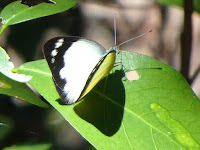
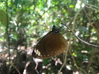
The walk was made quite magical by the clouds of butterflies that we walked through (mostly the brown ones)

As a consolation, we tried another loop trail to the south (the Round Hill circuit), but despite being a national park trail it was too overgrown, we had to abandon the idea. We then headed to Humpy Point, one of the prominences bookending the anchorage. The trail went to the summit, which was in the middle of the hill and surrounded by trees, so there were no views to enjoy there either. At least we got to say we summited something.

Oh, well. We returned to Begonia for a refreshing dip and some of that great internet. We also had long views of the sunset.

Friday, October 08, 2021

Cid Harbor - Retake

[Kyle]The last time we were at Cid Harbor, delays and my screwed-up back kept us from hiking the trail to the top of Whitsunday Peak (the highest point in the island group); we decided to return to rectify the oversight and grab some serious exercise.

We were up bright and early (a 7am start in an attempt to beat the heat) and managed to get all of the way to the top and back before seeing anybody else. Then, as a bonus, we walked the much flatter one-kilometer trail from Sawmill Beach to Dugong Beach.


Plenty to distract us (or an excuse to take a break) while going up to the top of Whitsunday Peak (437m/1430' altitude, 2.5km each way, allow 3 hours return)

The trail to the top was relentless in its gradient, but had helpful rock steps and wasn't overly steep. We both arrived at the summit feeling like that wasn’t nearly as hard as we had expected. The views from up there were well worth the effort, with the only minor disappointment being that we had tucked Begonia in too close to shore to be seen from up top.


Rewarded with some great views (and a phone signal)

We ate a snack of granola bars and fruit and used the opportunity of a phone signal to make a few estate-related calls while we could. Then it was time for the easy, downhill amble back to the beach. This is when Maryanne goes from panting to being literally chirpy as she attempts to carry on a conversation with the local birdlife.


And back to Sawmill beach eventually

We were both so sweaty and grubby that we really wanted to go in for a refreshing swim to cool off. Cid Harbor is riddled with buoys advising against it due to a few local overly aggressive sharks. To rectify this, we moved a couple of miles to the other side of Cid Island, where we were able to have our cooling baths in peace. The only trouble there is the current, so you don’t jump in without keeping hold of something to stay connected to the boat.


Relocate to the west side of Cid Island for sunset and a swim/bathe

Wednesday, October 06, 2021

Chance Bay (with a stroll to Whitehaven Beach)

[Kyle]We wrapped up our Internet stuff a little earlier than anticipated and so decided to head east to Chance Bay, at the southeastern tip of triangular Whitsunday Island. We were both itching to go for a hike. Mahana had just been there and told us about the trail from Chance Bay to Whitehaven Beach, where we could take in the show.


Moving home again, and the sun came out to play (although some of the hills were still capped with cloud)

Whitehaven Beach is by far the most popular spot in the Whitsundays. If you have ever seen a travel brochure or one of those posters they put in jetways featuring the Whitsundays, you have likely seen this beach. We think it’s funny because it gives a skewed view of the area.

Most people, when they think of what is typically Whitsundays, think of pearl-white beaches and azure-blue water. In fact, as we have said before, most of the Whitsundays is made up of steep granite islands topped with forests that go right down to rocky shorelines. It looks like Maine or the Pacific Northwest or Scotland. Whitehaven Beach is pretty much the only place that doesn’t look like that, but it’s the one everybody knows.

As such, it gets a lot of attention. Every helicopter and boat tour leaving out of Hamilton Island makes a beeline for Whitehaven as their first and sometimes only stop. Boatloads of people are landed for a day of splashing, picnicking and baking in the sun.

{Maryanne: Whitehaven beach is beautiful, with shallow swirling sands extending from the inlets and channels at each end of a 7km long white-sand beach. The sand is really special too in that no other beaches in the area have this especially white sand, and it has the quirk of not getting hot in the sun, so is easy (no pleasantly cool) to walk on whatever the baking sun has to throw at you. All this is best viewed from on high of course, and thankfully the national parks provide trails with viewpoints to do just that. Unfortunately we wouldn't make it to the northerly end of the beach (Hill Inlet), which is the one on all the brochures, but we would still be able to at least visit the beach and get a viewpoint from the southern end.}

Chance Bay, on the opposite side of the south-east corner, is much more diminutive and sedate. It offers better protection from the prevailing winds and, of course, still allows access to Whitehaven Beach via a modest trail between the two.

When we arrived, there were a handful of other boats anchored in Chance bay. Most were clearly charterers who were making brief stops to break up their trips to and from Whitehaven, probably waiting out the change of tide to have the current in their favor through the narrow gap between Whitsunday Island and Haslewood Island (The Solway Passage).

We landed the dinghy and joined the trail and were surprised not to see another person until we got to the junction between it and a smaller loop trail that runs from Whitehaven to a few viewpoints and then back down to the sand. We noticed that even more people than usual were climbing barefoot, as you see pretty regularly in Australia. Almost all of this same contingent were clad in swimming gear and clearly were more setup for walking on soft sand than rocks and twigs.


Parking the dinghy and hitting the trails...

It was at this point that we also came across a handful of goannas (lace monitor lizards) ambling up or across the trail with no apparent worry about us. The biggest one was maybe just over a meter long and seemed quite happy to fall in step with us.

At the viewpoints, we got high views of the craggy inlets of both Whitsunday and adjacent Haslewood Islands. We also got our first views of the broad sweep of 7km (four-mile-long) Whitehaven Beach. It really is a very nice beach. Almost the whole length of the bay there was filled with boats more densely packed than back at Chance Bay. Most were tour boats, followed by charterers and then private vessels. There was even a mega-yacht there with a three-story water slide running from the top deck. It was a bit of a madhouse, but since the beach is so long, there was plenty of real estate that wasn’t being taken up by beach blankets.


Enjoying the views, and braving the beach crowds!

We went down to the water just long enough to say that we had been there and then retreated to the relative peace and quiet of Chance Bay.


Returning to peaceful Chance Bay


Here is a cracker of a view of the northern end of Whitehaven Beach (Hill Inlet), you can see what everyone gets excited about. It wasn't taken by us, but you can purchase this online at Salty Wings

Tuesday, October 05, 2021

Gulnare Inlet

[Kyle]After two whole days with no internet, we sailed south to Gulnare Inlet, on the south side of Whitsunday Island. Our main reason for doing this was to intercept our friends Caitlin and Nick on Mahana. Caitlin works from the boat and both she and Nick are trying very hard to get flights to their home country of New Zealand. Their main problem is getting one of the very limited slots for quarantine when they get there. They are allocated via lottery and the online queues take hours. Thus, Mahana REALLY wanted to be where there is good internet. Gulnare Inlet looks out on Hamilton Island, with its posh resorts and good 4G, so it may be just about the best spot around for this.

Now poor Maryanne has something to do. She can dig back into her lists and hopefully stop keeping herself up at night worrying about not being able to help with Mom’s estate. She couldn’t seriously have thought Darren had finished everything and needed more to do, but she does want to be helpful.


Kyle hoisting the main so we can go sailing

The sail to Gulnare from Butterfly Bay was a good mix of just about everything. We had strong winds, no wind, fast currents with us, fast currents against us. All of this was while weaving our way through a gorgeous landscape of pine-topped islands indented with secluded little bays. We both agreed that this area reminds us very much of the Maine coast, only a lot warmer.

We stowed the sails just as we rounded the corner into twenty-five knot gusts funneling down the valley. There were several boats tucked way in, but we stopped early, where we and Mahana would have line-of-sight to Hamilton Island. It seems that as soon as we were secure, all of the other boats saw us and decided we must be where the anchorage is. Within half an hour we were surrounded. Mahana was on the way and we were hoping our out-of-the-way spot would make it easy for them to anchor close. Now it looked like they were going to be three or four layers back.

Luckily for both of us, the guy on the racing boat who took the spot I had wanted for them started dragging anchor as they were stowing their sails. They weren’t looking at us and they were too far to shout to over the wind noise. Since they had plenty of safe space to drag along into we just watched them make the slow trip downwind to Hamilton wondering when they'd work it out, and with a plan to call them on the radio if it wasn't soon. Mahana approached, passed them, warned by Maryanne that they were dragging, and took their old spot. Brilliant!

Once they had dragged about 1/4 mile, the racers figured out what happened and tried another unsuccessful attempt at anchoring on the other side of Mahana. When that didn’t work, they just put up their sails and left the area altogether.

Mahana had offered to make a dinner of comfort food for us, but our fridge was so overfull that we convinced them to let us do the cooking. They offered to supply nibbles, drinks and ice cream, which sounded like a pretty good deal to me. We started with a champagne toast to Mom and then spent the evening with a good mix of talking about her and talking about other things to distract us before Maryanne and I got too weepy. It was just what our hearts needed.

Mahana left in the morning just as we were thinking about stirring. We asked how the quarantine slots went and Nick shouted back that they had made it to #11,000 in the queue (for 3,000 rooms) before the window closed, and hadn't won in the lottery this try. We wish them better luck next week!

Monday, October 04, 2021

Butterfly Bay, Hook Island

[Kyle]There wasn’t a hint of wind when we left the Coral Sea Marina for more affordable locales. Three seconds of reverse was all we needed to glide straight back out of our slip without even brushing the fenders. Once out of the exit channel, the wind slowly filled in. We started off too slow to even register on our instruments, but we were soon enough keeping up with all of the other boats that were inexplicably motoring on such a fine sailing day.
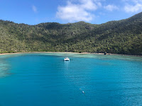
As we neared the northwestern tip of Hook Island, the wind shifted against us and we started tacking. This was one of those times that tacking was rather pleasant. There are a cluster of small islands and reefs here and tacking was a nice way to see stuff that the other boats motoring through on the shortest path were missing.

We got to Narrow Passage, between Hook and Hayman Islands, about an hour before low tide. I was hoping we would be able to catch the last of the ebb through, but our first couple of tacks quickly revealed that the south-going flood had started. Each tack was putting us just behind the one before. Okay, fire up an engine.


Sailing towards the north end of Hook Island

That held us in place for a while until it was warmed up and we could use more power. There was a lot of traffic going back and forth through the passage. It was becoming clear that this was on a lot of day-tour itineraries.

We rounded the corner into Butterfly Bay, the biggest inlet on the farthest side of Hook Island from the mainland, and discovered a mix of about 3/4 charter boats, both power and sail, and 1/4 private powerboats. These were all scattered amongst a generous collection of free government moorings, which are placed to protect the coral. We picked an empty one and tied up for the show.

As we bobbed at our mooring, a whole procession of boats came and went. The occupants of the chartered monohull that arrived three minutes before we did all went for a swim. They were headed back out of the bay thirty minutes after they arrived. I guess if you rent a boat and want to go see a good chunk of the Whitsundays, you don’t have time to savor. Most of the other boats stayed an hour or two, with the guided tours on the strictest schedule. About an hour before sunset, most of the power boats unhooked and sped off to their marinas, presumably to get back by dark.

A strong wind was in the forecast for the following night. It wasn’t here yet, so the sun broiled us all as we swam or cowered under our awnings. Maryanne couldn’t take it anymore and went for a swim herself. I really wanted to join her, but I spotted something suspicious at the top of one of our shrouds on my post-sail rig inspection. It kinda looked like a broken strand, but it also kinda didn’t. It was probably nothing, but I knew it would be bugging me until I knew for sure. It was also as calm as the bay was going to be during our stay, so there was no better time than the present.

Up I went. It was nothing, just a few encrusted salt crystals that needed to be brushed away. We could really use a good rainstorm. By the time I was back down on deck, I was so overheated that I briefly considered foregoing my usual snorkel prep and just jumping overboard fully clothed. Maryanne wanted me to join her on her exploration of the surrounding reef, which is why all of those boats come here after all, so I wouldn’t have been a good snorkel buddy without fins and all.


Kyle had to go up the mast - so managed to take a couple of 'aerial' photos (one day we might actually invest in a drone).

The water was not cold, but I was so hot that it felt that way to me for the first few seconds. Aaahhh! It’s amazing how a quick dip can instantly reverse hours of heat buildup.

The snorkeling was okay. The visibility wasn’t the best and there was a lot of silt buildup. The interesting thing about the area is that it’s almost completely made up of varieties of soft coral waving in the current and it goes on for the whole perimeter of the bay. We swam until we realized sunset was not far off, and returned to Begonia feeling fresh and new.


All the reef was very silted over with only rare patches of life, and most of the life was soft corals. The west side of the bay being much better populated than the east.

We stayed another whole day at Butterfly Bay, watching the charter boat turnover. I went for a short swim, mostly to cool off. Maryanne skipped it. She felt like she had seen it and her hair can be a bit of a pain to deal with, so she stayed behind.

There is no cellular service in Butterfly Bay, so poor Maryanne found herself with no jobs to do (and feeling guilty). She was a bit fidgety the first hour or so after getting out of bed, but it didn’t take her long to rediscover the joys of leisure. She spent the balance of her day sat in the cockpit reading a book. She’s still an overachiever. She finished the whole thing in a day and started on the next. It will take a long time to get her to where she can just look out and admire the clouds for an afternoon…