Saturday, May 05, 2018

An “Easy” Day - Easter Island Part 5

[Kyle]Two days after getting rained out at Rano Raraku, we returned to present ourselves to the now familiar faces of the staff, gave them our line about needing a little more time and were readmitted. We meandered around, enjoying the strange atmosphere of a nice grassy park that seemed to be sprouting giant, friendly statuary waiting for the right moment to be harvested.

After a while, a couple of tour busses disgorged their contents and the serene morning took on too much of a Disneyland feel for our tastes. There’s something tragic about these great constructions of humanity surviving for hundreds of years only to end up as a background in some yob’s selfie as he flashes some made up gang sign he saw in a boy band video. Watch out Facebook, here comes a bunch of posts: “Bro, Kickin’ it with the E.I. Heads!” Groan.

We walked back to Tongariki, where we were able to sit in the grass of the big square and reverently admire their magnificence in relative peace. The sun tracked across the sky and the changing shadows slowly highlighted previously hidden features. We gazed up at them and imagined out loud to each other what it must have been like when this square was full of people who had dressed in their finest tapa and feathers to attend some grand ceremony where yet another moai was unveiled for the world to see. What a magnificent time that must have been, when a fertile land gave rise to people of such great stature. We looked up at them again and couldn’t help but wonder: If the people were so large, how enormous must have been their bunnies?

{Photos to follow}

Thursday, May 03, 2018

More Hitch-hiking Craziness - Easter Island Part 4

[Kyle]I had it in my mind that we would spend the day at Rano Raraku, now that we had our tickets, and finish off with some quality time spent at Tongariki, sitting in the grass of the great square and taking the time to properly soak up its magnificence. The tourist office unwittingly messed up my plans when they gave Maryanne a map.


Anakena Moai(s) & the wild horses on route

From her map, Maryanne was able to determine that we were just across the island from some other good stuff that, now that she knew it was there, she was not about to miss.

So, at first light, we walked past Tongariki and joined the road as it looped toward Anakena. Unlike the previous morning, there was no traffic whatsoever going in that direction. We walked over the saddle of the island to the north side, where we could see the whole coast laid out before us. After an hour or so, we came across a family of horses who eyed us suspiciously as we ambled past. A curious foal kept being frustrated in his attempts to introduce himself to us by his nervous mother, who kept blocking his path.

A little while later, we met what appeared to be a German endurance athlete doing his morning lap. We figure the only other person we had seen for hours would stop for a brief chat, but he didn’t seem to want to interrupt his workout. I was a little hurt, but then I have been that guy myself. Don’t want to let the heart rate go below 150. This would actually be a lovely place for a long run; lots of scenery, mild grades and no traffic.

As we were approaching the coast on the other side of the island, we spotted our first car: a subcompact full of Asian tourists – no room there. The next car was a big pickup with four seats and only the driver. He blasted past us going twice the speed limit and seemed to deliberately not leave more than a few inches, which seemed rather unnecessary, considering the lack of other traffic. The exceptions to my subsequent curse were if he actually had to deliver a baby or put out a fire. If he wasn’t engaged in hurriedly getting to either of those two activities, he is going to get the most tenacious and embarrassing burning itchy rash.

Two cars later, just when the blisters were starting to get painful, we were picked up by a nice Chilean couple, who promised to take us to Anakena if we didn’t mind stopping at Ahu Paro along the way. Of course we wouldn’t! Ahu Paro is on our map!

Paro is the last of Easter Island’s Moai ever to be transported to and erected at an ahu. Now lying unceremoniously face down in the dirt after being toppled, Paro was the tallest moai ever successfully transported and erected. He is currently beyond the capacity of the island’s largest crane to erect.

Also at the site is Te Pito Kura, a series of stones known as the Navel of the World. Oral histories say the center stone, which is 75cm in diameter, was brought to the island by the first group of settlers. It is also said to focus energy, Sedona-style, to assist in the movement of Ahu stones and Moai. Subsequent geological testing showed the stone to be of local origin, so it’s looking more like they were all just big and strong.

Once we’d all had our fill, the four of us jumped in the car and within a few mere minutes, we were being dropped off at the beach at Anakena. That really does beat walking!

Anakena is the largest and most accessible by sea of Easter’s two beaches. Evidence indicates that it was likely the place where landfall was first made and where the first settlements were established. It is a lovely crescent of white sand fronted by swaying palms. The water is shallow in most of the little bay, so it is the perfect spot for families to spend the day splashing around and sitting on big towels. It could be anywhere tropical but for the two Ahu rising above the sand in the background.

The largest, Ahu Nau Nau, holds four Moai, each about half of the size of those at Tongariki. The Ahu is built upon the ruins of several earlier Ahu. This and the level of refinement in the details of the Moai has led archaeologists to believe the current Ahu was constructed during the very latest stages of the Moai period.

Since we were unsure how much of the trek back to Hotuiti we would have to do on foot, we decided to fortify ourselves with lunch at one of the many attractive cabana cafes overlooking the beach.

Most of the normal entrées caused a bit of sticker shock but, as almost everywhere, the empanadas were quite reasonable. We went for one each and and balanced them out by splurging on smoothies to drink.

Wow! Our meal was magnificent! Not only was the view the view that it was, the smoothies were about a liter each and were explosions of tropical sweetness and the empanadas were by far the best we had ever had.

Empanadas, like their cousins the Cornish Pasty, are mostly meant as a quick and portable lunch you can hold in one hand. As such, they are ubiquitous in bakeries and gas stations all over Latin America. They are generally built so as to be able to tolerate many hours under a heat lamp before being consumed. This gives their crust a texture that varies between crunchy and chewy. The ones laid before us now were made when we ordered them. They covered the whole plate and were so light and flaky that at the first hint of pressure from a bite, they dissolved and flowed over our tongues. Inside was not the usual gravy-colored, uniform filling, but real food – crunchy vegetables and delectable sauces making a kaleidoscope of wonderful flavors. We liked them so much, we would have ordered another, but we were already full from the ones we had.

After that marvelous experience, we rolled out of our chairs and decided to burn a few calories by walking at least part of the way back before sticking out our thumbs again. We took a shore trail from just behind the beach at Anakena over rolling hills to the next cove over at La Perouse. The trail was not that long, but made up for it with a surprising amount of up and down. Along the way, we got great, long views of the north coast as well as some nearer ones of the many wild horses grazing along the way. They all looked like they didn’t see too many walkers on this part of the island.

Cresting the last ridge, we got a high altitude view of the cove at La Perouse. Anchored inside on a tiny patch of sand was Nemo, now the only other sailboat at Easter. The group of three other boats had left Anakena the day before and were now heading for Pitcairn Island. Nemo was just a bit too far away for shouting and waving, so we admired them for a bit, wishing our anchorage was as calm, and continued on.

We were only on the road for a mile or so before we were picked up by an innkeeper giving one of his guests a quick orientation tour in which he was kind enough to include us.

He was an interesting guy. In the 1960s, he was an aerospace engineer who decided to give up the rat race, learn Tahitian dancing and move to Easter. He claimed to be the first Caucasian permanent resident. He married a Rapa Nui woman and has lived on the island ever since. He knew so much about the Island and its history and it was very generous of him to let us tag along.

As we approached Hotuiti and he got ready to drop us off, we mentioned that we were going to walk to Rano Raraku and he offered to take us with him. There, he gave us a good tip: Park tickets are only supposed to be good for one entry at Rano Raraku, but if you don’t get to see all you want or the weather is bad, you can come back a day or two later, point out your name in the book, and they will let you back in.

That turned out to be good advice for us. Almost as soon as we entered the site, it started to drizzle. That turned into rain, which increased further until it was slashing down in sheets. Undaunted, we walked the whole site anyway as all of the other visitors save one headed for their cars. He was an Asian man who had clearly come a long way to see this and wasn’t going to miss it for anything. He became our Easter Island friend. We never spoke, but over the next few days, we would see him here and there, often sitting on a bench admiring the view. As we passed by, there always came a moment when he would recognize us, and then he would give a little wave and break into a knowing smile.

The rain was really rather unpleasant. We kept a nervous eye on Begonia, rolling over the swell in the bay as we scoped out photo angles for what we hoped would be a return on a sunny day. Rano Raraku is in a way like a photograph itself. Work at the quarry seems to have stopped everywhere all at once in the same thin moment of time. Statues in various stages from rough-cut blocks still attached to the parent rock to completed ones being lowered down the slope to begin their journeys to their distant Ahus have remained in their same locations for hundreds of years, slowly being swallowed by the ground beneath them. One statue, its features just taking shape as it lies supine in the rock would, had it been completed, have been by far the largest ever made. Its final mass is estimated to have been 240 tons. The next heaviest, at Tongariki, is 86 tons. It is widely agreed among geologists that had an attempt been made to separate it from the mountain and raise it to vertical, it would have collapsed under its own weight.

We left right at closing time, with the staff following behind us at a respectful distance to close behind. As we were splashing through the puddles on the access road, a van stopped. It was the same woman who had given us a ride the previous afternoon, only this time her van was filled with the same staff we had just left. We made broken small talk as best we could for the five-minute drive and they seemed simultaneously impressed and concerned that we were anchored in rolly Hotuiti.

We squished our way to the dinghy and launched it, but not before someone ran out and gifted us another piece of fish as a thanks for the box of cherry cordials we had left at the empty house that morning. Once back at Begonia, I did the whole reverse wrestling match to get the pudgy safely out of the water into the davits. We achily peeled off all of our soaking wet clothes and hung them in the cockpit, not so much to get them dry, as the next day was supposed to be even wetter, but to keep from dripping all over everything inside. A change of dry clothes and a hot meal later, we were snug and looking forward to a rest day of not having to leave the boat, even if it was bouncing around like we were on passage.

Wednesday, May 02, 2018

A Busy Day - Easter Island Part 3

[Kyle]We were up very early, hoping to make the most of the daylight. Launching the dinghy was like trying to wrestle an unbroken horse. For a while, it seemed like it was a race between getting us both aboard and pulling both arms out of their sockets. They’re still in.

We rode the surf to a tiny fishing harbor tucked in behind the point, where two quick ninety-degree turns put us in water that was only heaving up and down ever so gently. As Maryanne and I were pulling the Pudgy up the ramp, two young fishermen came to help. I thought they were going to grab a lifeline each and help us pull the dinghy on its wheel. Instead, they just picked the whole back end up. The sudden decrease in drag made me almost fall forward onto my face.

Fronting the harbor was a small house. We exchanged “Buenas Dias’s” and “Ia Orana’s” and they promised to look after our little yellow Pudgy for us.


Tongariki Ahu and Moais - Wow!

Our first stop was the big obvious thing next door: Tongariki. Tongariki was the greatest site of Easter Island’s moais, constructed during the apex of the moai period. Fifteen of them stand side by side on the largest Ahu ever constructed – 220m long and many times more mass than the statues themselves. In the early morning sun, orange light cast long shadows of their profiles on the green grass of the square. Here we were again. This was unmistakably Easter Island and nowhere else. It was amazing to think that Tongariki was to be beginning of the end of an era. Kings in a constant battle to one-up each other with ever more impressive constructions finally reached the point where there were no more trees to fell for logs to roll the statues from their quarry to their resting places, or for scaffolding to erect them. After that, Rapa Nui society declined into internecine warfare where the focus turned from boasting to violence and destruction. During that time, every moai on the island was toppled – most in a manner meant to break their necks and show disrespect to the ancestors they were supposed to represent. Most of Tongariki’s moai have been re-erected and now are able to stand proudly again as they did so long ago. It is humbling to stand in their shadows as they gaze timelessly into the distance.

From Tongariki, we walked down a dirt shortcut to the quarry at Rano Raraku, the volcano where most of the Island’s moai were carved. We got as far as the ticket booth, where the woman there told us there would be no entry unless we bought a ticket, which we could only get in Hanga Roa (We fully inteded to purchase the ticket, but when we'd tried in town previously we'd just missed the opening hours at the park office). She seemed to think we had a car and we could just pop over and get them. When Maryanne explained that we walked from our boat, just over there, she still wouldn’t budge. We had a quick lunch at the café to regroup, then came up with another plan: we would hitchhike to town.

We started by walking to the road via a path that followed one of the Moai delivery tracks toward the western side of the island. It would have been a lovely nature walk anywhere as it meandered through farms and pasture land, but here, we would occasionally come across a prone moai, stopped in its tracks hundreds of years ago on its way to becoming something awesome and regal. Instead, it has spent all of that time with its nose in the dirt.

When we got to the road, we stuck out our thumbs and got a ride from the first vehicle that approached. Our driver was Benny, a fisherman who just finished for the day. He saw our dinghy at the little harbor and figured it must be ours seeing as how we were the only people on this half of the island who got there with no wheels. He drove us the whole way to Hanga Roa while we alternated between attempting to converse in Spanish and just hanging our heads out of the window to smell the fragrant grass of the rolling hills like we were puppies on our first car ride.

He dropped us off near the airport and we meandered our way into Hanga Roa along the main road. What a nice little settlement Hanga Roa is. For what we had expected would be one of the world’s most remote outposts, is had a surprisingly energetic bustle. There were lots of the expected t-shirt and souvenir shops, but there were also more really nice looking pubs and restaurants than we would ever have time or money to patronize as well as more than a few cafes that looked like the perfect place to watch the world go by. There were also grocery stores, mini-marts and hardware stores. Most of the people milling about did not seem to be tourists, but residents running errands.

We paid for our park tickets and made a point of going through a feria (craft market) along one section of sidewalk. There was a lot of stuff there that would have been cool had we owned a house. Even so, it was hard to pass by so many mementos of our time here and settle for the photos.

At one stall, one of the women there asked where we were from. I guess we don’t pass for Rapa Nui people. Maryanne answered that she was English and I was American. At this point, she narrowed her eyes on Maryanne and said, “You have one of our statues! We want it back.”

In 1869, the HMS Topaze removed/stole a moai called Hoa Hakanani’a and took it to England, where it now resides in the British Museum. Maryanne tried to lightly explain that it wasn’t actually her that took the statue and acknowledged that Britain has had some less than proud moments in the past. The woman then broke into a superficial smile and said, “I know. I’m on your side.” , but she said it the same style as the big scary guy in all prison movies who introduces himself to the new guy by threatening to rip his limbs off and feed them to him, before smiling and saying, “Aw, I’m just messin’ with you, Man.” Spoiler Alert; He was NOT.

Maryanne said she hoped the statue would be returned soon, to which the woman snapped, while still beaming a saccharin smile, “WE can’t take it back! We have nowhere to put it. YOU have it in a nice climate controlled environment.” It was clear she thought Maryanne should have known that.

The conversation went on like that for several minutes with the woman using verbal ninja moves to turn everything Maryanne said right back on her, even after Maryanne agreed whole heartedly with her last point. I think the only thing that would have appeased her was to say we had it on the boat, but just couldn’t figure out how to balance it on the dinghy. It will be here tomorrow. When we were finally able to pull ourselves away, she wished us a good trip. Her mouth smiled, but her eyes said, “I’ll be watching you!”

We picked up a few things at the store, simultaneously giving our backpack enough heft to make it feel like bringing it was justified and making sure every step felt like three.

As we passed the airport, we began sticking out our thumbs with quite the opposite effect of the morning. Loads of cars went zinging past. We would just be thinking, “What the hell”, when they would turn off onto the next driveway. Okay, fair enough.

It then started to rain. At first, it wasn’t so bad, but then it started to rain onto the first rain and we were soon splashing up rivers of red mud that ran along the edge of the pavement.

A truck slowed down, buoying our hopes, but then the woman in the passenger seat rolled down her window to say she was so sorry, but they were full. They really were full. Our only chance would have been to ride on the hood, action movie-style. At least they apologized. That was nice.

It wasn’t until several miles later, when we reached the junction where the road splits for Tongariki that we were finally picked up by a mother and daughter who let us ride in the bed of their truck. They took us as far as the Aka Hanga archeological site – maybe half way. We thanked them and had barely made it past the parking lot when we were picked up by a woman leaving in a van. She turned out to be the ‘bus’ for the youths working at the various sites. She dropped them in the morning and picked them up when their shift was done. During the day, she delivered water and lunches. We had a slow drive as the road was clogged with wild horses. She explained that every time it rains, the horses come to the road to drink from the puddles that collect on the paved road. Most of the island’s volcanic soil is so porous that standing water is rare in the fields where they graze.

She dropped us off where the road splits to go to Rano Raraku and we walked along the coast back to the harbor at Hotuiti. As we arrived, we stopped at the house to say hi and were invited to coffee with Anna, the matriarch.

She talked and talked and seemed not to care if we could understand her. I was getting the gist, but Maryanne seemed to be doing much better. She later told me she wasn’t. She was just smiling when Anna smiled and looking upset when Anna looked upset. The one thing we both picked up on was that she didn’t like Chileans being on her island. We understand that nobody is likely to appreciate their occupiers, but we’ve hardly met any Chileans we didn’t like, so it made for a squirmy hour or so before we were able to use the setting sun as our excuse to get home. Before we left, she gifted us a giant piece of fish caught by her husband that day. It looks like fish curry for dinner.

Monday, April 30, 2018

The Other Side of Easter (Easter Island Part 2)

[Kyle]After leaving Hanga Roa and moving around the Easter Island to a more protected anchorage, the wind increased as predicted during the night. We were protected from it by the cliffs at Vinapu, but the incoming swell was wrapping all around the island and pushing us to the shore end of our tether. This is disconcerting at best, but when combined with the sound of surf hitting the rocks just astern and then exploding into spray, made for a very fitful night of half sleep, half panic.

It was worse for the other boats, who had elected to stay at Hanga Roa. Even before first light we could hear bits of conversation breaking through the squelch on the radio. Every one of them had had a miserable night and the talk was all about getting the hell out of there and going to the other side of the island.

By the time we weighed anchor, two of the others were already zinging around the point. By the time we had our sails up and pulling, they were half a mile ahead of us and a third boat was on our heels. Nemo, the fourth boat, elected to go the other way around the island and have a look at Anakena.

Damn! There was only one other anchorage on the protected side of the island, called Hotuiti, and too many boats were all racing for it. Our “Head start” didn’t count on the rest having their anchors up at the first hint of light. Depths there were also supposed to be 24m, which meant putting out all of our ground tackle, which would give us a swinging circle with a diameter of 350m. The info we had indicated that there was nowhere near enough real estate for four boats to do that simultaneously.

To complicate matters, the other boats were going back and forth on the radio with the Armada about what to do. When they announced their plans to go to Hotuiti, the Armada came back and said it wasn’t safe. The conversation was broken, but after several tries, we heard the Armada say,”The charted position at Hotuiti is unsafe now because of rocks.” Rocks are bad because, a: an anchor can get wedged in a gap and be irretrievable at 24m without SCUBA gear, and 2: chain can wrap around them as the boat swings. This can reduce or eliminate the sag of the caternary and thus the chain’s ability to absorb shock, making it more likely to snap or rip the bow roller out of the deck. They recommended Anakena on the third side of the triangular island. Anakena was protected from the long swell arriving from the south, but not from the strong north winds. Since all four of us had to sail past Hotuiti to get to Anakena, the other boats explained they would have a look at it anyway as they went by. The Armada stopped short of outright prohibiting them to do so, although it sounded like they really wanted to. They just kept saying in an authoritative voice that. “Hotuiti is unsafe. Recommend Anakena.”

I keep saying “they” because we could never reach the Armada on the radio ourselves. We had started under the cliffs at Vinapu and were sailing closer to shore than the others, so our antenna may have been blocked by terrain. By the time we were all halfway to Hotuiti, the Armada said they would lose us all because their coverage was bad on the eastern side of the island.

Since we couldn’t get them by radio, we sent them an email via satellite. Technically, we were supposed to request a reposition before we left, but Vinapu was deteriorating, so we left first and then asked. The Armada here is pretty cool and we were sure they would understand. One of the three other boats on our side of the island considered stopping at Vinapu and we talked them out of it, explaining that we were bailing out. There was subsequent talk about “another catamaran” and “a fourth boat”, so we figured the Armada was in the loop.

An hour or so later, we received a short email reply saying, “Reposition Hotuiti approved.” Great!

As the four of us approached the anchorage there, it looked like a huge mess. A big swell was rolling in and turning into great big surf crashing onto the rocky shore. The group of three had been spooked by rock problems in Hanga Roa and didn’t even alter course toward the anchorage. They just sailed on by and pretty soon were disappearing around the island. The Three went to Anakena. Nemo ended up at La Perouse, in the next bay over from them.

We decided to have a look at Hotuit anyway for a couple of reasons. First was that the bay had an outcrop of rock on one side. We have been a few places where that is all that is needed to diffuse the swell and create a milder patch inside that is not apparent from further out. Second, we had the list of anchor positions for each of the island’s five anchorages, but we also had found another obscure source of info that told of a triangle (like Bermuda, only a lot smaller) of coral-free sand at a slightly different location in the bay. I was really hoping it was true.

Fortunately, the water at Easter is so clear that it’s easy to see the bottom way down at 24m. I stopped the boat in the middle of the triangle and it was indeed good, clean sand. We were outside of the surf in long 2m swell. We dropped the anchor and then let out everything we had. Up at the surface, it still felt like we were on a pretty rough sail. We had 72m of chain out, with its caternary, plus 90m of nylon rode, which can stretch another 36m before reaching 50% load, plus two high load bungees on each leg of our bridle. The idea is that we can heave up and down and sway and surge a few boat lengths each way without the anchor having to know about any of it because the shock has all been absorbed by then.

This, of course was all dependent on us not getting it all wrapped around a rock or coral head. While Maryanne wrote the Armada telling them we were safely anchored, I went for a long reconnaissance swim to check things out. I first swam to the anchor, which I couldn’t see. I saw our trip line emerging from the sand and about 15m behind it, the anchor chain appeared along the sea floor. It was good and buried and the first half wasn’t even moving. Excellent! I then swam a big spiral around the boat to find where the sand ended and to make note of any obstructions we might get wrapped around. To my surprise, the triangle was all sand and everything out of it was mostly coral heads and rock. I swam a long way and could not find another spot with a large enough patch of sand to lay out our chain. We had the one spot in the bay. It was uncomfortable on board, but we weren’t going anywhere.

When I climbed back aboard, Maryanne said, “We got an email from the Armada. You’re not going to like it.”

She was right. It was clearly translated using software. It was pretty incomprehensible, but it did not sound good. Here is the text in its entirety:

GOOD AFTERNOON CAPITAN
I HOPE YOU ARE GOOD, YOUR YACHT MUST STAY FUNDED IN HOTUITI RECEPTION IT WILL BE CARRIED OUT ONCE YOU SURRENDER IN THE HAGUE ROA BAY FOR ALL THE AUTHORITIES INVOLVED
IT IS FORBIDDEN TO DROP TO EARTH AND TO LEAVE THE YACHT

What!? I read it over and over and couldn’t figure it out. The one part that did seem pretty clear was the last line. In Spanish, ‘Earth’ and ’Land’ are the same word. ‘Drop to land’ is an expression meaning ‘to land’ or, ‘make a landing’. What was the point of coming to Hotuiti to escape the next six days of north winds if we couldn’t go ashore? Was it because they thought Hotuiti was too dangerous? Or were we being punished for not contacting them before we left Vinapu?

We were sure there was some kind of misunderstanding, but the only way to clear it up was to ask for clarification, which would mean acknowledging that we got their email. If we did that, we would lose the ability to make the argument, thin as it was, that we never got their message and didn’t know we couldn’t go ashore, which we really wanted to do because that’s why we sailed all the way here in the first place.

We took a deep dive into the rest of the email. ‘Funded’ was a misspelling of one of their common words for ‘anchored’. In Spanish, the word for ‘surrender’ is also used for report (as in to report) and deliver. That made it sound slightly less ominous, but still almost as confusing.

It was cleared up when we got a call from the Armada on the radio. I told the guy I was surprised to hear from him because I thought they said they had no signal here. He told me he was in a truck doing a lap around the island to check on all of the yachts. He flashed his headlights so we could see. He then started peppering us with questions about our last port, next port, crew aboard, etc., as if we hadn’t already told them all of that in Hanga Roa. That’s when it dawned on us that he thought we were a new international arrival that hadn’t cleared in yet. In that context, the email makes perfect (or at least more) sense: Don’t go ashore until you have reported at Hanga Roa for clearance. When we explained what happened to him, he asked us if we felt we were safely anchored where we were. We said yes and he then said to have a nice time on the island. The ride on the emotional roller coaster was over almost as quickly as it started – just like regular roller coasters.

It was getting dark already, so we were relieved to give ourselves permission to call it a day. Sitting in the cockpit, looking ashore, we decided we had the best view of any anchorage on the island. From where Begonia rolled and swayed, we could see no rusty oil tanks, only rolling hills of gold and green and blue surf crashing into white spray on volcanic rocks. Beyond, the fifteen moais of Tongariki stood perfectly centered and facing the Rano Raraku volcano from which they were created.

Sunday, April 29, 2018

First Impressions: Easter Island

[Kyle]After having spent twenty days to get there, our next challenge was getting ashore. There is much written about how treacherous the approach to the main harbor at Hanga Roa can be. Most of the people we have met that have actually been there insisted the only way to get in was with an inflatable equipped with a powerful enough motor to get it to plane. The entrance often has surf breaking across it and it is critical to shoot in quickly during a gap.

Our Portland Pudgy/Torqueedo combo is marvelously efficient and durable, but it’s not fast. It was suggested that our best option would be to either flag down a local fisherman in a panga or hope another boat is in the anchorage who wouldn’t mind letting us tag along.

There were four other sailboats anchored off Hanga Roa when we arrived. Three of them seemed to be a sealed unit of friends that had been sailing together since at least mainland Ecuador. The fourth, called Nemo, were deep into a tricky engine repair and hadn’t even had the time to start thinking about inflating their dinghy yet. The officials who came out to perform our agricultural clearance were vague about it, but said something to the effect that they didn’t think the pangas did pickups any more.

Luckily for us, it was unusually calm and the swells were not too bad, so we decided to give the Pudgy a try. It turned out to be completely doable for us. Thinking about it later after a few round trips, I realized the “You MUST have a dinghy capable of going twenty knots” advice suffered from a kind of confirmation bias. People with dinghies that fast use them to go fast and have probably never tried a low-speed entry. It was hairy for them, so they incorrectly assumed their speed was the only thing that saved them. The pangas do it, too, probably because that’s how they were originally taught and how they’ve done it ever since.

Plus, it IS faster. They bounce stories off of each other and in short order, everyone agrees a fifty horsepower engine is the minimum needed and then it enters into common knowledge.

Now, I’m not arguing that there aren’t times when that is completely true, but the proportion of those times to the total has probably been artificially inflated, the way some people think a mile is too far to walk because they always hop into their car if they have to go that far.

We essentially used the same technique they did of timing the waves and using strategic bursts of speed to minimize their impact. We just had to go through three waves each time instead of one, which is also exactly what the surfers and va’as (outrigger canoes) did. When arriving, we would match our speed to the breaker and surf in. Leaving, as one approached, we would stop, let it break under us and then speed to the next one.


Some of the sights on route from the harbor to the crater

Setting foot ashore for the first time, we were not given any sort of a buffer as we wandered in search of the real Easter Island. Looming over the harbor was our first Moai, gazing beneficently over the green hills with a look of proud peace. The rest of the adjacent area had the pleasant air of a laid back tourist town. There were dive shops, souvenir stores, backpackers hospedajes and several surprisingly appealing restaurants, but they were all support structure that seemed superfluous to the real thing; the Moai. Nothing is more archetypal to Easter than these enormous ancient statues. Standing in its shadow, one cannot feel like they are anywhere else. After a lifetime of seeing it on documentaries portrayed as an amazing and remote place, we were finally here. It certainly made it feel like many of the compromises we had made over the years had ultimately been worth it, even though it was often hard to tell at the time. The kid deep within me was thrilled. We had made it to the ancestral home of the Easter Bunny.

After the requisite visit to the Armada to confirm our presence out their window, we started to explore the local area. This started as a brief familiarization with the village of Hanga Roa but, in the way these things do, it quickly morphed into much more.

Much of the blame was on the weather. The wind was forecast to shift in the middle of the night and Hanga Roa was not going to be safe. We needed to move to the leeward side of the island and we needed to do it today. I calculated backwards from the latest time I wanted to be dropping the anchor and came up with something like six hours for us to explore. This meant we had to make some hard choices to delay seeing some of the things we wanted until a later day, which carried the risk of turning into never if the weather didn’t cooperate. The thing we decided we just had to try to see was the ‘Orongo volcano. From the harbor, we could see a trail snaking its way up the flank to the rim. We decided we should at least try to get to the top.

It was a bit of a slog. The slope was about forty degrees, which gets a little tedious very quickly. This is not helped by the fact that Easter is still a low tree environment (the island was deforested during the Moai era). The morning sun was just about perpendicular to the slope and we were baking in a big solar oven. Stopping eased the muscle burn, but did not allow us to cool off.

Helping to keep us going were our companions. Like in Robinson Crusoe, we were adopted by not one, but two dogs who were determined to accompany us to the top. Not having our ability to perspire, they dealt with the heat by panting. They never gave up, though, and once even tried unsuccessfully to clear a small herd of cattle out of our path. By the time we were closing on the rim, Maryanne remarked that it sounded like we were being accompanied by two steam locomotives.

We were starting to doubt the wisdom of the whole enterprise ourselves when we crested the rim and saw the expanse of the Rano Kau crater. Filled with rain water, the 1km wide lake is Easter’s largest endemic flora reserve. The rim gave us a 360 degree view of the whole island.

We had intended to see the view and get back, but the trail continued just a little further (and up) the rim to what looked like some more cool stuff. We looked at our watches and decided we could probably just make it. Our locomotives wandered off to find other people to help and we felt strangely abandoned for two people who didn’t even have pets an hour and a half earlier. At the end of the trail was the ‘Orongo ceremonial village. Built of circular walls of stone, the village was the residence of the Island’s supreme ruler – the Bird Man, where he would spend the year in monastic isolation until replaced by the next Bird Man. The village was amazingly well preserved and quite extensive, having over 60 different buildings that were very robustly built to a very high standard. None of them were apparently ever occupied by anyone other than the Bird Man except briefly for ceremonies. It reminded us of other Neolithic sites we have seen in the Orkneys and Shetlands in the British Isles.

The Bird Man thing is nuts. It is essentially an athletic and daredevil competition that was held every year to pick the leader. It started at the village. Competitors then ran down the loose and steep slope of the volcano to the sea, where they would then swim to Motu Nui through treacherous currents. Once there, they would wait, sometimes for days if necessary, for the return of the Sooty Terns. The first one to gather an egg, swim back, climb the volcano and present their egg unbroken was declared Bird Man, whose prize was to spend the next year ruling while having as little contact with others as possible. Apparently, they still have the event every year and they still have a regular supply of competitors who think of the Ironman and the Eco Challenge as cute little warm-up events.


Crater and some of the village buildings and carvings

We lingered at the village just a little past our turn-around time and had to make a point of Bird Manning it down the trail to the harbor. When we got there, we ran into trouble with the dinghy. Because of the surge, the harbor is crisscrossed with heavy ropes. Boats tie a line to the wall and another to the ropes to keep from banging into the wall. We did the same, but in our absence, the tide fell about a meter. My knot around the big rope was too high for me to reach. It would be too late to leave in daylight if we waited for the tide to come back up, so I had to figure out how to get to our line. I thought about shimmying out, but then I realized I have probably reached an age where I only think I can do that. I eventually ended up climbing up on the bow of a panga and leaning way out to untie our line with my fingertips. I noticed people were starting to gather and I knew it was because they were hoping to see me fall in. If I had been a betting man, I would have sided with them. If asked, I would have given myself about a 30% chance of success. In a way, I was almost hoping I would go in. Losing my battle to stay dry and maintain my dignity would have freed me up to do a larger range of stupid things to get our line back, thus improving my odds. To everyone’s surprise, I was able to get our line untied and after a few long, wobbly seconds, managed to fall back into the panga, instead of over the rail.

Back at Begonia, we made quick work of getting the dinghy up and getting the anchor raised. Our route took us around the ‘Orongo volcano and past the Motu Iti and Motu Nui. I scanned the slope looking for some route down that was not obvious from the top, but all I could see was steep, loose scree all of the way from the top down to the water. It is the kind of terrain where if you slip, you won’t stop sliding until your body splashes into the sea.

We came around the corner and anchored at Vinapu, just off the opposite end of the island’s enormous runway from Hanga Roa. We had chosen it because it was only one subway stop from downtown, but it turns out the subway was still in the very early planning stages, so we got no help there. The anchorage was small and deep, requiring a huge kerfuffle of trip lines and chain floats. The swell broke over the rocks all around us and we could see no safe way to land the dinghy. In addition, our view of the island was dominated by two large, rusty oil tanks, which ruined the atmosphere of the place as ancient and unspoiled. We decided our Vinapu stop would be one night only.

Passage to Easter Island

[Kyle]When Bahia Tierra Blanca began to get sloppy again with swell coming in from an approaching front, we knew it was time to leave.

The wind shift from N to SSW was to be in the middle of the night, so we left in headwinds, leaving enough daylight to clear the island and find deep water.

We reefed everything down, but were still bashing our way into thirty knot gusts and big seas. Our only consolation was that it was to be short-lived. It took a little longer than we thought, because our speed was slowing the relative overtake of the front behind us. Just after an exhausted Maryanne handed the watch over to me at midnight, the headwind dropped to almost nothing and then sprang up from astern. Three hours later, I had the spinnaker up and we were tearing a groove in a calming sea.

A squall came through a little while later and the wind built to almost twenty. That's way more than I like while the spinnaker is up, but getting it down alone is a huge ordeal in those winds, so I just steered dead downwind for a bit to lessen its intensity and held on for a fifteen-minute gallop until the cell passed and the wind dropped back into comfortable single digits.


Birds and other boats were rare sights for much of the trip
Unlike sunsets and our own ship

When I woke Maryanne, all had been reduced to a gentle swaying downwind ride with the background hiss of our fast wake. That's the stuff! As we were doing weather/breakfast/emails, another shower arrived and the wind started to pick up again. I went on deck and studied it for a bit before assuring myself it was isolated and not part of a bigger system. I decided to do the same as that morning and turn downwind to ride it out. The wind got up to 22 knots and the boat to 13 before things started to calm down again. We were just sitting down to breakfast when there was a slow boom (if you can imagine such a thing). I looked at the spinnaker and saw only a triangle of sky framed by the sail's flapping hems. The main fabric had peeled away like a banana and fallen into the sea ahead of us like a big tongue. Damn!

It took us a while to wrestle the remains out of the water and stuff it into its bag. Now all we had left was normal sails. How boring.

Boring wasn't really the problem. Our normal working sails are great, but on deep downwind courses in anything other than flat seas, it's almost impossible to get them to set without banging back and forth as the mast swings around, whereas the spinnaker just sways gently from side to side. Former spinnaker, that is. Well, it is what it is, so we used every sail trimming trick we know to try to keep them calm while trying our best to tune out any remaining racket.

The direct course to Easter Island was WNW, but there was a huge area of headwinds that way, so our only choice was to sail almost due north for several hundred miles to reach the trade winds, where we could find easterlies to push us West. It was disheartening to know Easter was to our left, while each new forecast told us the best course was to keep going ìsidewaysî to the north, putting us few miles closer. Adding to the stress was that since I had left and reentered the country to get parts, a limiting factor for us was the number of days Maryanne had left that she was allowed to stay n Chile. Going the wrong way was making our stay in Easter looking like it was going to be shorter and shorter.

It was a week before we were finally able to curve west, making a long arc around remote Felix and Ambrosia Islands. I had the light on Ambrosia for company at night and the top could be seen receding the next morning. It was still not quite the right direction, but it was closer. Easter was now WSW of us.

That day, Maryanne caught a fish. She's always so disappointed every time she tries, but this time, it happened like it does to other people; she decided she wanted a fish, she put in a line, and a few minutes later, she caught a fish - a yellowfin tuna just the right size for two or three meals. When she pulled it out of the water, I noticed its buddy swimming alongside. Are we about to callously eat half of a couple? I prefer food where I don't have to look their mate in the eye before ending their life. Anyway, I did my best to put it out of my mind. Maryanne is a wonderful cook and that fish WAS fresh.

We then had days and days of tailwinds weaker than forecast and mostly cloudy skies where what little sun we got was invariably on the opposite side of the sails from the solar panels. Our batteries suffered and we had to run a motor for a few hours every day or so to keep them from dying. We ran them more than we had cumulatively in the past six months. The forecasts kept saying not to turn left yet. No wind, slatting sails, lots of motoring, and we still aren't going the right way. When will this trip end?

The only event of other note to mention came on Day 9. We spotted not one, but two fishing vessels traveling the same course about ten miles apart. The second one looked to be coming quite close. He did not seem to be trailing any gear and was showing no day signal for fishing, so he seemed to be just a big power boat at the moment, making him the give way vessel. Maryanne called them to verify this and was told they were expecting us to stand on (maintain course and speed). They would give way. She then had a longish chat with them. They were a Spanish crew on an Ecuadoran boat that spent three months at a time fishing.

As they approached, they seemed to be distinctly not altering course. Every time a change in wind would change our speed, they seemed to alter course TOWARDS us. Maryanne called again and was told quite vehemently to stand on. She was worried about making a change that would block his impending course change, so she kept standing on. He WAS on a course to pass ahead of us, but only by about fifty feet. When he got too close, Maryanne disconnected the autopilot, spun the helm to leeward and backed the sail. I emerged from bed just as his wake slammed into us. What the hell? I guess the lonely Spaniards wanted to get a close look at the cute English woman.

It was well after we should have already been there when a front passed to the south of us and changed the headwinds there to tailwinds. All we had to do was motor across a hundred miles of calm to get there. Fine.

We spent a day motoring in flat water, which was nice, but loud. We shut the engine down, bobbed around a bit and then gradually, the wind arrived. It was enough to keep us moving, but not enough to keep the sails from banging around in the building swell. The afternoon after that, the wind arrived in earnest and we were finally moving smartly. Twenty-four hours after wishing we could find some bloody wind, we were double reefed and careening down big swells and I was wishing it would start to die down, already. I like medium wind. At least we were ticking off the miles.

On day 20 of our 14-day passage, I awoke during Maryanne's day watch and decided to say hi. When I emerged, she pointed out a mound of red rock ahead topped with golden grass - Easter Island. Well, I'll be.

It took us most of the day to sail around to the main harbor at Hanga Roa, which was almost at the far extreme from our direction of approach. About halfway, we passed into the lee of the island. This had the welcome effect of calming the wind and seas, but also gave us our first smell of the island. It smells mostly of dry grass and dust, even though it's not particularly dry or dusty, with occasional areas of Eucalyptus and a few other fragrant herbs. It smells like a hot summer day when the fields have been freshly cut.

One other noticeable thing to us was the lack of birds. Everywhere else we have ever made landfall, the last two hundred miles or so has been marked by an increasing incidence of seabirds. Usually, we see more dolphins and fish as well.

Approaching Easter, we had none of that. We saw one lone Frigate bird before we saw the island itself. Easter is in an area with very little plankton. Without them, everything up the chain that feeds on them is also absent. This makes it pretty boring, marine biology-wise, but makes for some of the best underwater visibility in the world.

That visibility helped us when we dropped all of our ground tackle overboard onto a sand patch that we could clearly see from on deck. It was eighty feet below the water's surface. We could also see several moai from the boat already!

We had just shut off the engines when we were boarded by the authorities. With formalities complete, we tidied Begonia up and both got to have our first full night's sleep in weeks AND at the same time!


Finally Land Ho! and after another half day we were anchored in sight of some of the famous Easter Island Moais

Tuesday, April 10, 2018

Robinson Crusoe Island - Bahia Tierra Blanca

[Kyle]It was blowing hard from the south all day after our exploration of San Juan Bautista. We spent the time aboard getting ready to go to sea and just trying to hold on while the chop in Cumberland Bay threw Begonia around. Getting the Pudgy into lifeboat mode was like we had both been strapped to a mechanical bull. I wore nothing but swim trunks for the procedure, which turned out to be an unnecessary precaution, but only just.

Maryanne spent her time being teased by the internet, which is less exhausting, but at least as frustrating. She kept getting two bars just long enough to connect before losing the signal. After a day's work, I think all she was able to do is see that she had some emails, but not much more than the subject line.

By morning, the bay was flat and clear and calm. It seemed like a perfect morning to go ashore, but the dinghy was all trussed up with safety gear and lashed into her crook in the transom. It was a trick by the weather anyway, meant to lull us into a sense of security before the ambush.

We laboriously pulled up the anchor as well as all of the chain and rope we had deployed when we arrived and headed out to the other side of the island, where we would be protected from the fierce winds approaching from the North. There was no hint of them yet. We didn't even have enough to even consider trying to put up any sail.

After a few hours motoring, we arrived at Bahia Tierra Blanca and redeployed all of our ground tackle at the center of a semicircle of high cliffs to the North.


The sail around the Island was quite stunning

Along the way, we had imagined we would don snorkel gear and find a beach to which to swim. Looking at it now, we realized it was all folly. There was no beach, only steep cliffs. Every semi-accessible ledge was occupied by big fur seals vigorously competing for the best spots. The leftover 3m swell from strong South winds of the day before were slamming into the cliffs, exploding in great fireworks of spray and then sending the remainder reflecting back into the bay. The sea was a mess. The chop in the bay was from no discernible direction, other than all of them, but it was big. The bay looked like a giant ballroom full of square dancers all repeatedly stretching apart, grabbing the edge of the next group, and pulling back together. Yuck! At least we had the bay to ourselves.


The bay is a rookery(?) for Jaun Fernandez Fur Seals
It may be hard to see them on the photos but they are everywhere!

For a while, at least.

Just after sunset, the lights of three other boats arrived and began poking around for spots to anchor. Maryanne noted that the four of us had been the four biggest boats in Cumberland Bay that morning (the only boats not here were small open fishing boats). It was now us, a big steel fishing boat, a slightly smaller steel fishing boat, and the Armada's patrol boat. The wind was really starting to blow by then and they each took several tries to get their anchors to hold.

The offshore wind had the welcome effect of organizing the waves so they were all gong the same general direction and flattening them slightly, so we stopped bouncing around so much. Under the lee of the cliffs, the wind swirled into vortices that spun round the bay until they got far enough from shore to be flattened by the general blow. Forty knot gusts would have us pulling hard on our nylon rode and bridle, which we could see stretching under the strain. Then the wind would die to nothing and Begonia would spring forward. Before she could coast to a stop, another forty knot gust from a completely different quarter would veer us in another direction. Occasionally, the gust would come from behind and we'd pick up enough speed to be able to see eddies form in the wake of our hulls. When we got to the other side of our circle, Begonia would snap around to face the new wind before it died again. Times like this are why you don't skimp on ground tackle.

We had a fitful night of light sleep interrupted by frequent trips on deck with a floodlight to check on everything. There were no lights ashore and few stars visible, so it often took a few nervous minutes to verify that we were staying put. This wasn't helped by the other boats, who seemed to be in a new position every time we looked.

As the day broke, the wind was howling loudly enough that Maryanne and I had to shout any time we weren't sat right next to each other. The big fishing boat had moved way over to the other side of the bay and seemed to be holding okay. The smaller one (still bigger than us) was having a rough time. They were in yet another position. We watched them for a bit and after ten minutes or so, it was apparent that they were dragging. They would let it go another five until it was obvious their anchor wasn't resetting, and then they would pull it up, go find another spot and repeat. They had only a small anchor attached to what seemed like not nearly enough rope and no chain at all. We felt bad when we realized it had been like that for them the whole dark, stormy night.

After a while, they finally gave up and got out an anchor it looked like it took all three of them to lift and dropped it over the side before sprawling out on deck for a rest. That anchor held twice as long before they realized they were headed back into deep water. Rather than haul the thing up, the skipper would gun the engines and tow their anchor behind until he found another spot. We cringed and braced for a lurch when he circled ahead of us, waiting for his hook to catch our rode. The bay was deep and our anchor was WAY ahead of us. It didn't happen, but he seemed to really like the spot where it was. He would stop ahead of us, let the anchor fall, rest for twenty minutes until it was apparent he was getting a little too close to us, and then go back up for another try in the same spot. The chances we would both end up out at sea trying to untangle ourselves from each other's anchors increased each time.

The Armada was dragging as well, but they seemed less concerned. Somebody was always awake at the helm, so they would just start 'em up and re-anchor every hour or so.

We were getting ready for another stressful night, when we saw the men in the fishing boat ahead heave up their anchor and start steaming for the end of the island. The other one followed and then the Armada joined in. Before they left, the skipper called us and asked if we were going, too. We told them that since the wind was to be from the North for a few days, we would stay where we were. We had already arranged such at the office and they knew we would be leaving the island directly from Bahia Tierra Blanca.

He didn't seem to like this and started a difficult to understand argument about how the wind was going to come from the South and so we needed to leave. He seemed to be working from a forecast of the general area that he had printed before he left Bahia Cumberland. Our more specific forecast was for about six hours of ten knot winds from the South before switching back to the North again. There was no way our Spanish was up to explaining the nuance of this to him, so we just kept saying our anchor was secure and we would be safe. I was worried he was going to order us to leave, but he thankfully stopped short of that, saying something to the effect of, Okay, but you agree to assume all responsibility

Yes. Fine, fine. Gracias, Buenos Noches

We spent the next three days aboard in lovely weather. Apart from an occasional fishing boat in the distance during the day, it looked from Begonia like we had all of Robinson Crusoe Island all to ourselves.

Friday, April 06, 2018

Robinson Crusoe Island

[Maryanne]Robinson Crusoe Island is one of the islands on the Chilean Juan Fernandez Group. It is the island where Alexander Selkirk was alone for over 4 years and it is Selkirks story that is the inspiration for the (fictional) Daniel Defoe novel 'Robinson Crusoe'. It has a population of around 700-900 and a small runway so does have a smattering of tourists. It also has the best diving visibility in Chile (20m+) so scuba diving is a big draw. There is only one town on the island: town of San Juan Bautista at Cumberland Bay (where we anchored). In 2010 the main town was mostly wiped out by a tsunami so many of the buildings seen now are temporary (e.g. the post office is a shipping container) or newly and beautifully constructed from local wood. Note there is also a Robinson Crusoe Island near Fiji, but that isn't this one...


The island is also very special for its native species. According to the Island Conversation Organization "The islands host fifteen resident/breeding bird species, six of which are globally threatened, and 131 endemic plant species, of which 96 are globally threatened. More than 440 endemic invertebrate species, three endemic land-bird species, and the endemic Juan Fernández fur seal depend on these islands for their existence." It also has a little competitive edge with the Galapagos and regularly shares that "The islands are sixty-one times richer in endemic plant species per square kilometre and thirteen times greater in endemic bird richness than the Galápagos". Whatever the case, we know we are especially lucky to be visiting.


Two endemics:
The hummingbird: Juan Fernandez Firecrown
Feeding on the Cabbage Tree flower

[Kyle]Having arrived at the island around sunset, we landed the dinghy the following morning on the rocky beach and walked to the Armada to check in. The Armada in Chile is always friendly, but I’m getting a little weary of the process. Every time, instead of looking at our existing zarpe and checking us in on their computer system, we have to go through the whole procedure anew as if they have never seen us before, answering a zillion questions so they can prepare and print us a new zarpe, even though all of that information is already on the zarpe we just handed them. We always think we’ll just pop in for five minutes, but end up staying over an hour or more. {Maryanne: Poor Kyle remains 'surprised' every time it happens, but it isn't so terrible and the folks are always so nice..., we just have to learn to plan for the extra time.}.

During what was left of our day, we went to CONAF (the Chilean National Parks Department) and paid our fees to enter the park, which encompasses the whole island outside of the one town. There wasn’t time left to tackle any of the many long trails in the area, so we spent the rest of our day exploring everything within the town and adjacent, before rowing back for an early night. Among the highlights were the Caves of the Patriots (where Spanish patriots were exiled after Chilean independence), and the older fort wall, and plenty of WW2 war fortifications along with some much older cannons. There is also a beautifully built wooden walkway built into the hill with numerous gazebos from which to chill and enjoy the views, a perfect place for a stroll.


Rain was forecast the next afternoon, so we made a point of hitting the beach at first light to get on the trail to the Selkirk lookout before it got wet. As we were making our way up the hill on the town’s roads, we encountered lots of friendly dogs and cats, all looking for a scratch. At one hostel, a Very large (scary large) black dog that looked part German Shepard, part Rottweiler got up and came to the open gate to see us. The only threatening thing about him was his size, so I took a chance at giving him a pat on the head.


That was it. We were friends now. He was so excited because he knew where we were going and was going to show us the way, bounding ahead in full puppy mode. The climb was steep and we were going slowly, but he was always just ahead at the next bend, waiting for us.

When we made it to a gazebo at a viewpoint about three quarters of the way up, he plopped down in a corner like he owned the place. From high up, we could see the whole valley. A freighter had arrived as well as a giant cruise ship! We beat that crowd.

We continued further up to the top, where we were supposed to be able to see down the other side of the island. All we could see on that side was thick fog as the approaching weather rushed up the slope, broke through the saddle and tore into fragments as it headed down the Cumberland side.

We stopped for a break, sharing some of our snacks with our new friend. He was so gentle, we could hardly feel him taking his share from our hands.

When we started back down, he got a second wind and had a jolly old time diving into bushes and streams and digging for something he wanted to root out that we never could figure. At some point, Maryanne figured out he really liked the little red berries that were growing alongside the trail. Most of them at his height seemed to be gone for some reason, so she plucked a few high ones for him to his delight. Great! How are we supposed to fit him in the dinghy?

As we got to the edge of town, he tore off, chasing something or other. We thought he was gone, but then he returned a few minutes later wet and covered in another layer of mud. He was so clean when we met him. How were we going to explain this?

After running off a third time, at which time we were pretty sure he went home, a Conaf truck passed by and offered us a ride. The rain had already been late in arriving, so we took him up on it.

As soon as we started rolling, that big black dog came bounding out of the trees and started chasing the truck. He kept up for a while and then veered back into the trees. We came around a switchback and there he was again, sitting on the sidewalk. He made eye contact with me and gave me a look that cried, “Why?, why did you leave me?” I felt like such a traitor.

I had a pretty good mind to go back up to the hostel and pet him goodbye, but we needed to go to the Armada first to collect our papers. After that, we got swept up in a stream of cruise ship passengers headed the same way on their way to a party.

We chatted with one of them and found out the ship (the Oceania Sirena) was on a luxury around-the-world cruise. They had just arrived from Easter Island. It sounded like an amazing trip.


The other side of the mountain was totally cloaked in mist
The temporary post office (after a recent tsunami) remains
And the party is all ready to roll

At the party, we had to fend off the advances of the waiters holding trays of empanadas and Pisco Sours (they assumed we were from the cruise ship). In retrospect, maybe we shouldn’t have. They were just most likely going to throw the unused stuff away.

The party was just getting into full swing when we climbed into the dinghy. Right after that, the sky opened up and it rained hard for hours. By the time we were back at Begonia, our clothes were stuck to us and the music ashore had stopped. Several hours later, we heard the ship’s horn blast and were just able to see them disappear into thick fog and rain.

Leaving for Robinson Crusoe Island

{Maryanne: I'd really wanted to spend some time in the museums and more socializing generally, but we were suffering from a host of computer issues and knew we would soon be well away from internet of any speed - I felt compelled to try and 'fix' and update (and test) everything possible, even in our last minutes while Kyle was pushing to leave with the tide. Every '5-minute job' I was trying to complete turned into several hours... Eventually we just had to give up and go without.. Sigh.. But it also meant I sacrificed my expected Museum time on the darn technology.. Ugh! In the midst of all the pressured 'rush' our kind neighbours aboard Sea Rover cooked for us again which was both a wonderful pressure relief and another fantastic evening.}

[Kyle]Our new marina-friends came and waved us off as we left Valdivia for the sail to Robinson Crusoe Island. We had three days of strong winds and big seas, which were made a little less uncomfortable by both coming from way aft of the beam. I wouldn’t characterize it as pleasant sailing, though, and we were both glad that our good progress was making it look like a fourth night at sea wouldn’t be necessary. When the wind started to die off on the last day, we had to deploy the spinnaker to make it to the anchorage at Cumberland Bay by nightfall.


Farewell to the Chilean mainland
and 'Ata 'ata and Sea Rover II


Landfall...

Wednesday, March 28, 2018

Valdivia Area - Last Minute Sightseeing

[Maryanne]After and between all the chores to get Begonia ocean ready again, we also needed to do the final provisioning, check in with the Armada etc. I dragged Kyle out and about and where possible squeezed in a bit of sightseeing. At the same time our wonderful neighbours in the marina were also keeping us entertained. It was busy and we clearly were not going to have enough time to do everything, but some fun MUST be had! We struggled to do as much as we'd expected since so much was clearly off season or even closed, but we did our best!


The area is packed with 'craft breweries' we had to try at least one,
And when we went to try some crazy golf, we met these llamas instead!


The local fish market shares its home with some hungry Sea Lions

[Kyle]THE thing to do in Valdivia is get a boat tour of the river. All of the tourist guides we have seen for the area mention it in the first three items of must dos. There are several companies, but they all do pretty much the same: Go down the river, throw a wake at the marina on the way, stop at Corral for an hour or so of sightseeing, go back up the river, throw another wake and return to Valdivia. The going rate for these tours seems to be about 50,000 pesos per person, about $85USD or £70.

Not for us, thanks. We've seen the river and we can hardly throw a wake on ourselves. That just left Corral. We're practically locals now, so we just took the bus from the marina to the ferry terminal and bought a couple of tickets. Our way had the added benefit of allowing us to explore without being part of a mob.


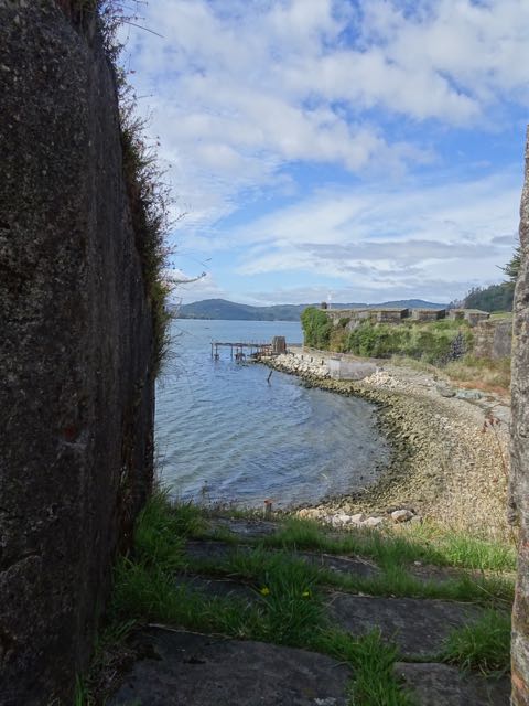
The old Spanish fort at Corral

We got off the ferry and strolled up to the big Fort. We paid 1,700 Chilean pesos (about $3) and immediately realized we could see 90% of it from the ticket counter. There were a few old cannons, but nothing else other than the walls themselves. We took it as slowly as we could, but we're still finished fifteen minutes after entering. Apparently, in season, they have re-enactments, which might make it seem less like throwing our precious sightseeing day in a hole. We couldn't help but notice the contrast with the well done (and free) Fort at Niebla.


And around Corral - on a quiet day

It felt a bit early to return, so we had a stroll around Corral to see what there was to see. It turns out it wasn't much. We followed the smell of fresh bread to a bakery, where we picked up some walkin' food to enjoy as we explored the remainder of the town. As soon as we left the bakery, we realized it would be smarter to slow to a saunter. Even after doing that, we were back at the ferry stop fifteen minutes later having exhausted the town's offerings.

Given it's high billing, I think we were expecting way more in the way of diversions in Corral. We thought about popping into a pub for lunch, but since the main view from their balcony was of a big plywood wall, we decided to pass and retrace our path home. We were a bit disappointed. It was nice to get out, but at least the day hadn't cost us 100,000CLP. We managed to get the whole day for 7,500 (about $12).

Next: The Valdivia Museums? Nope. Our last chance day was cold and rainy all morning and we never could get the motivation up to tear ourselves away from important but unglamorous indoor jobs to go out in it. We're going to lose fast internet when we leave the marina (most likely until we arrived in New Zealand again), so we wanted everything to be as updated as possible before we go. Unfortunately, sometimes you have to decide there's stuff you're just not going to get to do.

Between getting everything pretty much fixed to go, we did make some time to do some socializing. We have met some very nice people at the marina and it was always hard to pass up on opportunities to spend time with them in favor of some greasy job that will surely result in losing more skin off of my knuckles. Finally, all of the major work was done, so we planned an evening out at a nearby restaurant we have been trying for a while to patronize.

Every time we had tried to visit a highly reviewed local restaurant called K8, it has been closed – even on Saturdays. Maryanne finally found some mention on their U-face page about being open again after vacation. We invited the crowd, who were all willing to give it a try with us. Joining us were Rene, a lovely Swiss man on a long solo adventure in his boat Ata Ata, and Gary and Karina from Sea Rover II, who we had originally encountered in La Paz, Mexico just before we left for the Marquesas.

Dinner and the atmosphere at the restaurant were all that we could have hoped for. We all got along great. The stories were flying. We all like each other. That’s not the interesting part. The interesting part was the journey between the marina and the restaurant.

We had originally planned to walk the mile or so there and then get a bus back. As we left the marina, the two resident dogs, Sophia and Maxima, decided to join us for something to do. The first time Maryanne and I made the walk to K8, they had accompanied us maybe halfway and then gave up to go back home. This time, they were both in it for the duration.

Sophia is great. She seems to be mostly Border collie and she is sharp as a tack. Maxima is as sweet as a dog can be, albeit a little shy, but she is not the most savvy.

The problem is that the road to the restaurant is a main road with no path for walking other than a thin line of tramped down grass off the edge of the pavement. In the breaks between fast moving traffic, the road is by far the better quality surface. When traffic approached, we all dove into the grass to let it pass – all of us except Maxima, whose reaction to a huge vehicle barreling down on her is to cower in the middle of the road. Fortunately, each time, the drivers saw her and had time to hit the brakes, no doubt cursing us for “our” idiot dog’s behavior. Sophia has the sense to get out of the road and most of the time Maxima would follow her, but in the confusion of a sharp bend, a big truck and a lot of legs to dodge in the grass, she would occasionally get “stuck” in the road, looking terrified and confused as to what to do.

We had each had about six heart attacks each when we reached the bridge. The only way to cross it was to wait for a gap and time a quick dash across along the six-inch wide curb. We were all really hoping the dogs would give up there and head home, but they didn’t. Maxima was successfully skulking along in the gutter when an approaching bus from behind spooked her and she took a right turn in front of another bus. Both drivers had quick reflexes and she managed to avoid getting squished, but just barely. That was heart attack number seven.

Karina couldn’t take it anymore and found some rope, from which she planned to make two leashes to lead the dogs home. There was no way we were taking the bus back and leaving them to cross the bridge by themselves.

Sophia was fine with this, but when Karina went to put the rope around Maxima’s neck, she had a full freak out. Karina thinks she made have been caught one too many times by a dog catcher. I tried to help and we got the second leash on her only to have her flip out again and knock me into a thorn bush, some of which I am still digging out of my hands a week and a half later. About that time, Sophia chewed through her leash. We got them across the road one last time to the restaurant, which didn’t seem to mind letting them join us on the patio. They stayed under the table and kept our feet warm.

When we paid our bill and left, leaving plenty of daylight for the walk back to the marina, a third dog emerged. Sophia has a male doppelganger.

The eight of us made it back across the bridge okay. After another of Maxima’s scares, Karina took it upon her wonderfully kind self to run back to lessen the time they were near the road. New Dog stayed with us and looked very put out when we left the road for the marina. Everyone made it safely. Every time I see Maxima now, I have to give her a hug for being alive and have a little talk with her about staying away from the road.

Subsequent get-togethers were held at the marina.

** Note: this post was UPDATED 6-Apr-2018 - apparently it had been posted without all the appropriate information - communications failure.. :-) **